STS51A-45-118
| NASA Photo ID | STS51A-45-118 |
| Focal Length | 250mm |
| Date taken | 1984.11.__ |
| Time taken | GMT |
Cloud masks available for this image:
Spacecraft nadir point:
Photo center point: 26.5° N, 82.0° W
Photo center point by machine learning:
Photo center point: 26.5° N, 82.0° W
Photo center point by machine learning:
Nadir to Photo Center:
Spacecraft Altitude: nautical miles (0km)
Country or Geographic Name: | USA-FLORIDA |
Features: | FORT MYERS, SEDIMENT |
| Features Found Using Machine Learning: | |
Cloud Cover Percentage: | 0 (no clouds present) |
Sun Elevation Angle: | ° |
Sun Azimuth: | ° |
Camera: | Hasselblad |
Focal Length: | 250mm |
Camera Tilt: | |
Format: | 6017: Kodak Ektachrome 64, 220 Roll Format |
Film Exposure: | Normal |
| Additional Information | |
| Width | Height | Annotated | Cropped | Purpose | Links |
|---|---|---|---|---|---|
| 3851 pixels | 3904 pixels | No | No | Earth From Space collection | Download Image |
| 631 pixels | 639 pixels | No | No | Earth From Space collection | Download Image |
| 640 pixels | 480 pixels | No | No | Download Image |
Download Packaged File
Download a Google Earth KML for this Image
View photo footprint information
Download a GeoTIFF for this photo
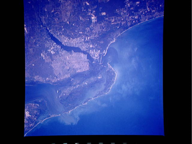
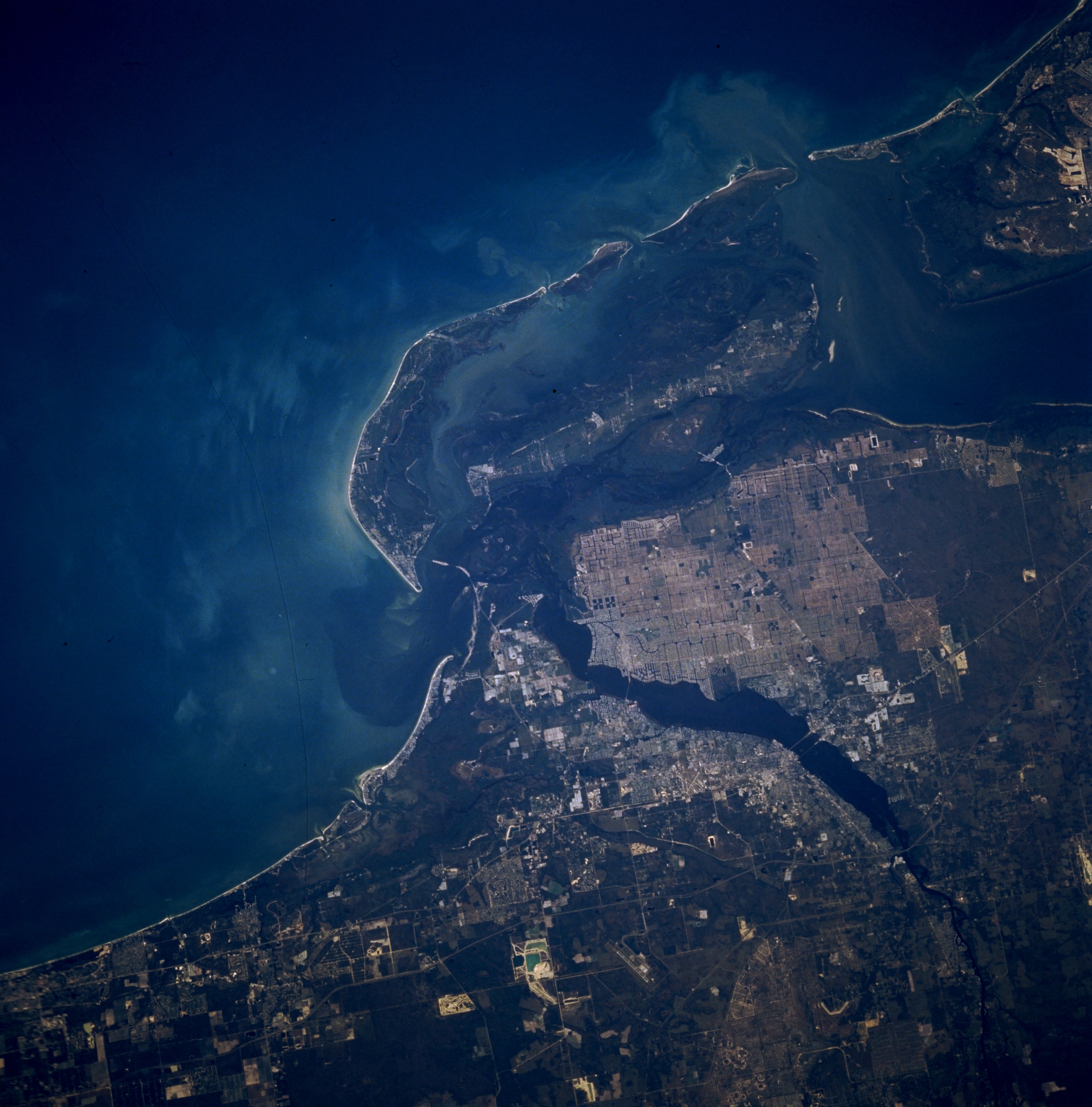
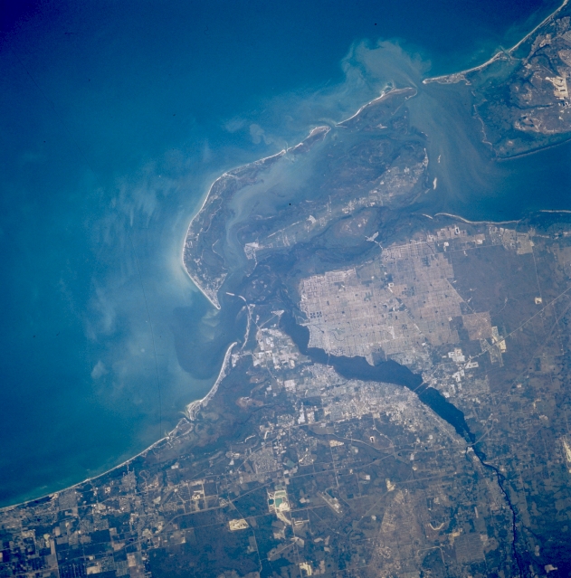
Image Caption: STS51A-045-0118 Fort Myers, Florida, U.S.A. November 1985
This photograph of Fort Myers covers a comparable geographic area as photographs STS069-718-053 and STS070-712-063; however, features are more easily discernible in this photograph's sediment plume from Charlotte Harbor (upper right) into the Gulf of Mexico; gridded street patterns within the urban area; the size and shape of Sanibel and Pine Islands; and bridges that cross the Caloosahatchee River connecting Fort Myers, North Fort Myers, and Cape Coral.
This photograph of Fort Myers covers a comparable geographic area as photographs STS069-718-053 and STS070-712-063; however, features are more easily discernible in this photograph's sediment plume from Charlotte Harbor (upper right) into the Gulf of Mexico; gridded street patterns within the urban area; the size and shape of Sanibel and Pine Islands; and bridges that cross the Caloosahatchee River connecting Fort Myers, North Fort Myers, and Cape Coral.
