STS41G-37-84
| NASA Photo ID | STS41G-37-84 |
| Focal Length | 100mm |
| Date taken | 1984.10.07 |
| Time taken | 10:31:37 GMT |
Resolutions offered for this image:
5266 x 5266 pixels 639 x 639 pixels 5700 x 5900 pixels 500 x 518 pixels 640 x 480 pixels
5266 x 5266 pixels 639 x 639 pixels 5700 x 5900 pixels 500 x 518 pixels 640 x 480 pixels


Cloud masks available for this image:
Spacecraft nadir point: 38.5° N, 46.1° E
Photo center point: 38.0° N, 45.5° E
Photo center point by machine learning:
Photo center point: 38.0° N, 45.5° E
Photo center point by machine learning:
Nadir to Photo Center: Southwest
Spacecraft Altitude: 143 nautical miles (265km)
Country or Geographic Name: | IRAN |
Features: | LAKE ORUMIYEH |
| Features Found Using Machine Learning: | |
Cloud Cover Percentage: | 5 (1-10)% |
Sun Elevation Angle: | 39° |
Sun Azimuth: | 136° |
Camera: | Hasselblad |
Focal Length: | 100mm |
Camera Tilt: | 18 degrees |
Format: | 6017: Kodak Ektachrome 64, 220 Roll Format |
Film Exposure: | Normal |
| Additional Information | |
| Width | Height | Annotated | Cropped | Purpose | Links |
|---|---|---|---|---|---|
| 5266 pixels | 5266 pixels | No | No | Earth From Space collection | Download Image |
| 639 pixels | 639 pixels | No | No | Earth From Space collection | Download Image |
| 5700 pixels | 5900 pixels | No | No | Download Image | |
| 500 pixels | 518 pixels | No | No | Download Image | |
| 640 pixels | 480 pixels | No | No | Download Image |
Download Packaged File
Download a Google Earth KML for this Image
View photo footprint information
Download a GeoTIFF for this photo
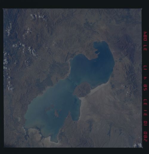
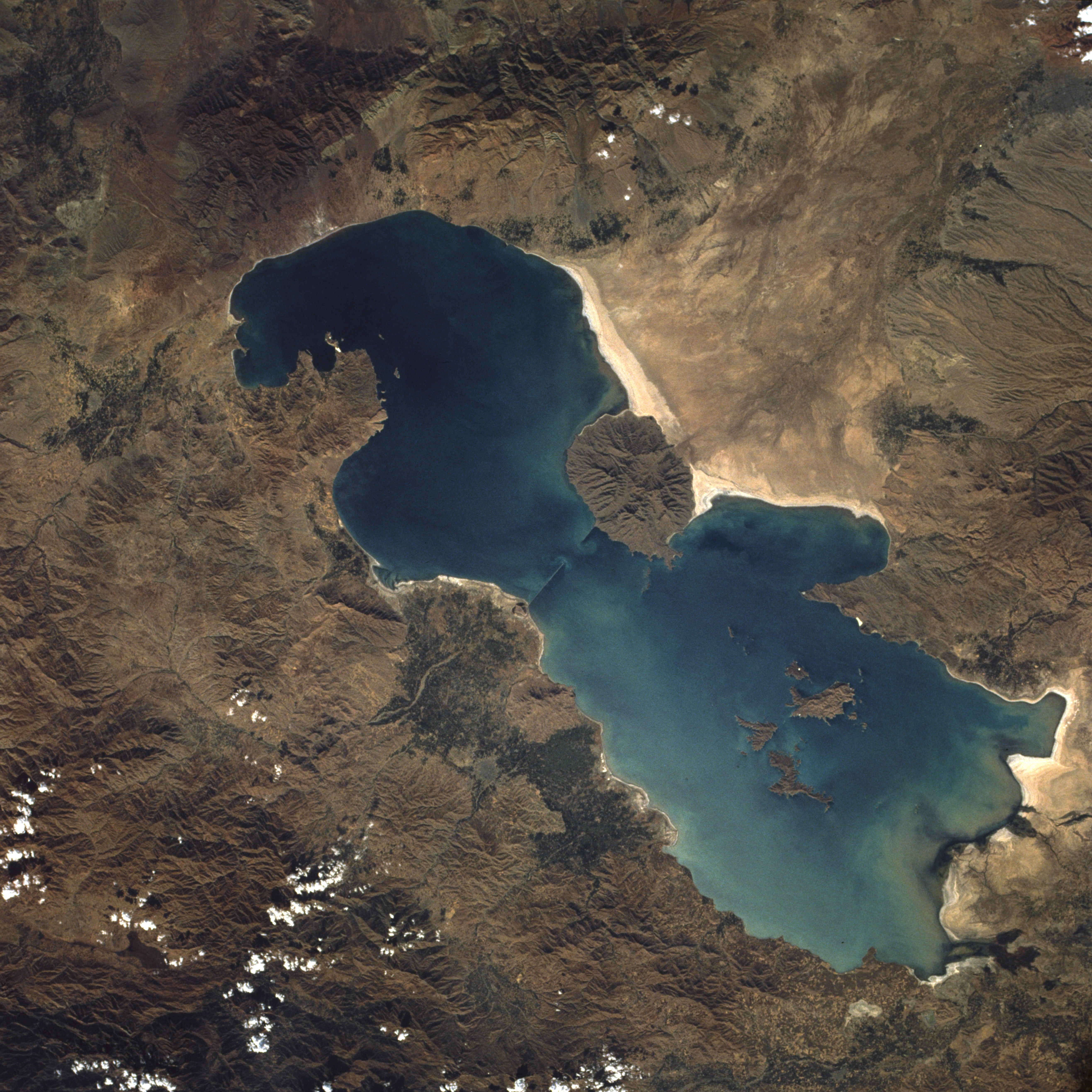
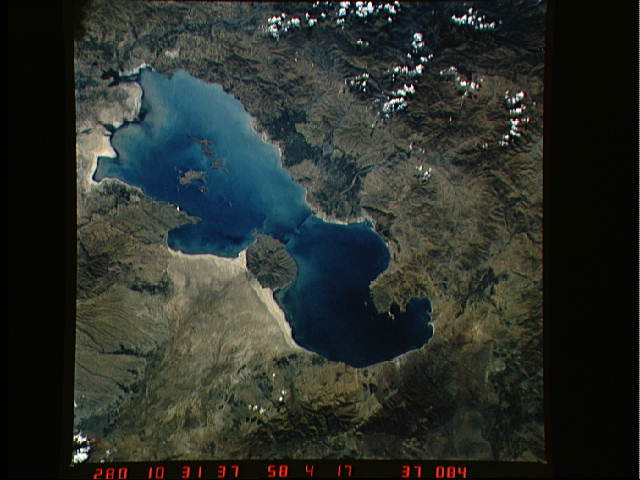
Image Caption: STS41G-037-0084 Lake Urmia, Iran October 1984
Lake Urmia is an isolated lake in Azerbaijan Province in northwest Iran. The total area of the lake is 1815 square miles (4700 square kilometers), and the north-south length is about 90 miles (145 kilometers). The maximum depth of the shallow, saline lake is approximately 50 feet (15 meters). Climatically, the lake region is located in a semiarid, almost desert environment, with general precipitation averaging 12 inches (30 centimeters) per year. Topographically, the entire region is either plateau or mountain. The surface of the lake is approximately 4100 feet (1250 meters) above sea level with several of the individual volcanic peaks reaching more than 7000 feet (2134 meters) above sea level. The massive, rugged mountain range west of the lake has ridges that exceed 11 000 feet (3353 meters) above sea level. Agricultural patterns are visible in several delta areas around the lake (darker signatures). Sediment patterns can be seen along the southern end of the lake near the salt flats and the delta areas. The highly reflective area along the eastern shore of the lake appears to be either the development of salt deposits along the shoreline or the receding water level in the lake, which exposes more shoreline. The narrow linear features jutting into the lake from opposing shorelines (toward the middle of the lake) could not be identified, but appear to be manmade.
Lake Urmia is an isolated lake in Azerbaijan Province in northwest Iran. The total area of the lake is 1815 square miles (4700 square kilometers), and the north-south length is about 90 miles (145 kilometers). The maximum depth of the shallow, saline lake is approximately 50 feet (15 meters). Climatically, the lake region is located in a semiarid, almost desert environment, with general precipitation averaging 12 inches (30 centimeters) per year. Topographically, the entire region is either plateau or mountain. The surface of the lake is approximately 4100 feet (1250 meters) above sea level with several of the individual volcanic peaks reaching more than 7000 feet (2134 meters) above sea level. The massive, rugged mountain range west of the lake has ridges that exceed 11 000 feet (3353 meters) above sea level. Agricultural patterns are visible in several delta areas around the lake (darker signatures). Sediment patterns can be seen along the southern end of the lake near the salt flats and the delta areas. The highly reflective area along the eastern shore of the lake appears to be either the development of salt deposits along the shoreline or the receding water level in the lake, which exposes more shoreline. The narrow linear features jutting into the lake from opposing shorelines (toward the middle of the lake) could not be identified, but appear to be manmade.
