STS41C-39-2030

| NASA Photo ID | STS41C-39-2030 |
| Focal Length | 250mm |
| Date taken | 1984.04.__ |
| Time taken | GMT |
Cloud masks available for this image:
Spacecraft nadir point:
Photo center point: 12.5° S, 13.5° E
Photo center point by machine learning:
Photo center point: 12.5° S, 13.5° E
Photo center point by machine learning:
Nadir to Photo Center:
Spacecraft Altitude: nautical miles (0km)
Country or Geographic Name: | ANGOLA |
Features: | LOBITO |
| Features Found Using Machine Learning: | |
Cloud Cover Percentage: | 30 (26-50)% |
Sun Elevation Angle: | ° |
Sun Azimuth: | ° |
Camera: | Hasselblad |
Focal Length: | 250mm |
Camera Tilt: | Near Vertical |
Format: | 6017: Kodak Ektachrome 64, 220 Roll Format |
Film Exposure: | Normal |
| Additional Information | |
| Width | Height | Annotated | Cropped | Purpose | Links |
|---|---|---|---|---|---|
| 4410 pixels | 4600 pixels | No | No | Download Image | |
| 479 pixels | 500 pixels | No | No | Download Image | |
| 640 pixels | 480 pixels | No | No | Download Image |
Download Packaged File
Download a Google Earth KML for this Image
View photo footprint information
Download a GeoTIFF for this photo
Image Caption:
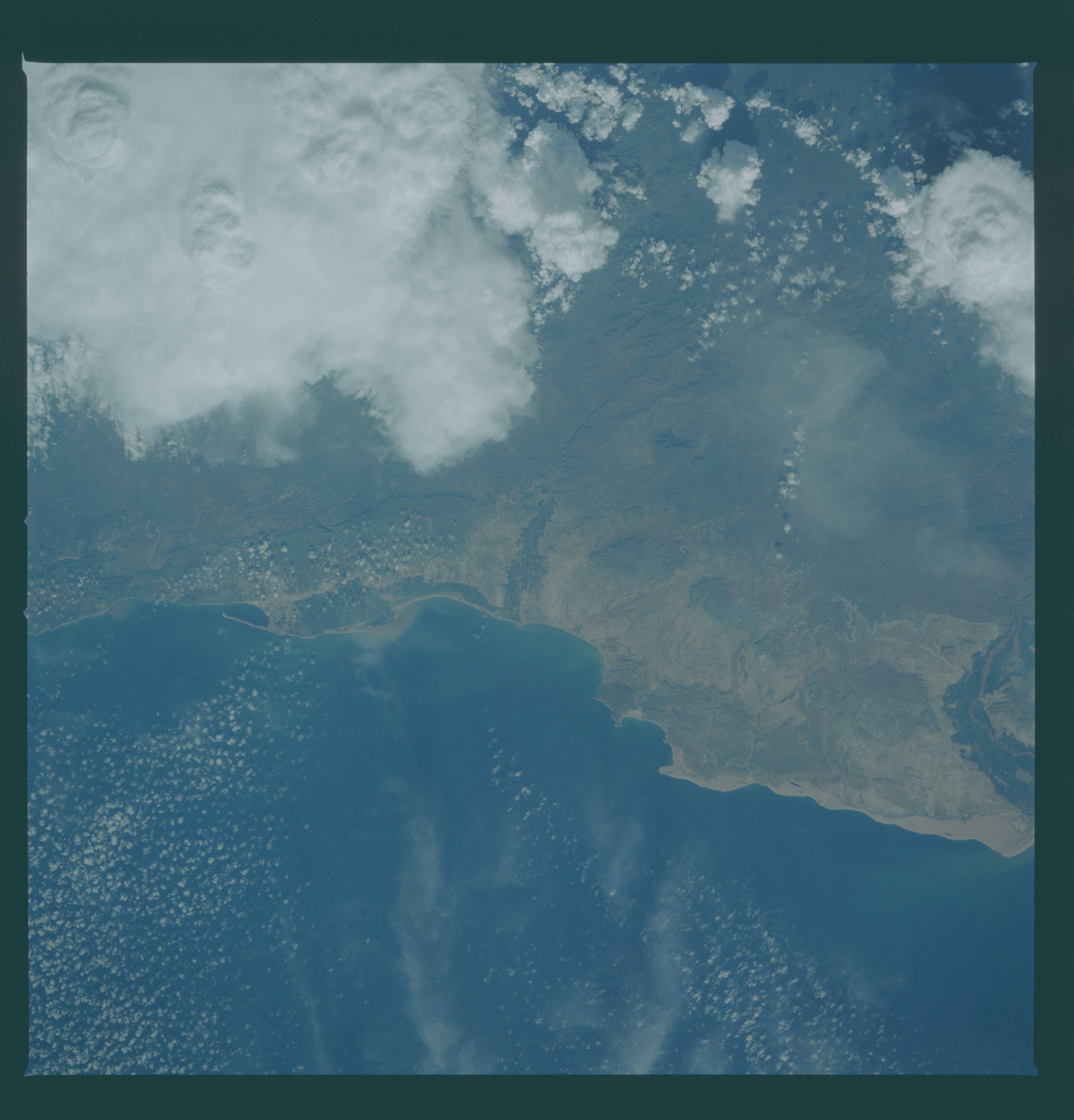
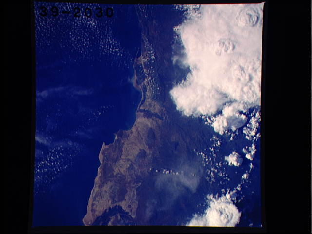
Towns on an Arid Coast T44
The southern half of Angola's long Atlantic coastline is an in-
hospitable desert, an extension of the Namib desert to the south.
Two of tthe desert's four small coastal town appear on this mosa-
ic. A small sand spit (top) protects the harbor of Angola's
second port city, Lobito (1). The town of Benguela (2) is locat-
ed 25 km (15 mi) to the south at the mouth of a river which sup-
plies needed water for irrigation on this arid coast. The green
strip of vegetation along the lowest few km of the valley (3) is
irrigated, as is the strong growth of vegetation between Lobito
and Benguela. A similar situation can be seen 60 km (35 mi)
south of Benguela where the large Coporola River delta is well
vegetated and makes a good visual coastal landmark in conjunction
with the Cape of Ponta da Salinas (4). Sediment plumes can be
seen to the north and south of the river mouth. Connected by
rail to the center of Angola and surrounding countries, Lobito
has acted intermittently as the export point for copper ore from
Zambia's Copper Belt. The civil war between Angola's central
government and UNITA rebels (based in Southern Angola) has
prevented such exports for years. (41C-39-2029, 2030)
