STS113-347-28
| NASA Photo ID | STS113-347-28 |
| Focal Length | mm |
| Date taken | 2002.12.06 |
| Time taken | 20:24:22 GMT |
Resolutions offered for this image:
1200 x 798 pixels 1024 x 768 pixels 1024 x 768 pixels 540 x 405 pixels 540 x 540 pixels 1000 x 1143 pixels 3070 x 2044 pixels 515 x 342 pixels
1200 x 798 pixels 1024 x 768 pixels 1024 x 768 pixels 540 x 405 pixels 540 x 540 pixels 1000 x 1143 pixels 3070 x 2044 pixels 515 x 342 pixels


Cloud masks available for this image:
Spacecraft nadir point: 40.0° N, 74.1° W
Photo center point: 39.5° N, 76.5° W
Photo center point by machine learning:
Photo center point: 39.5° N, 76.5° W
Photo center point by machine learning:
Nadir to Photo Center: West
Spacecraft Altitude: 212 nautical miles (393km)
Camera: | Hasselblad |
Focal Length: | mm |
Camera Tilt: | 35 degrees |
Format: | 5069: Kodak Elite 100S, E6 Reversal, Replaces Lumiere, Warmer in tone vs. Lumiere |
Film Exposure: | |
| Additional Information | |
| Width | Height | Annotated | Cropped | Purpose | Links |
|---|---|---|---|---|---|
| 1200 pixels | 798 pixels | No | No | Photographic Highlights | Download Image |
| 1024 pixels | 768 pixels | Photographic Highlights | Download Image | ||
| 1024 pixels | 768 pixels | Photographic Highlights | Download Image | ||
| 540 pixels | 405 pixels | Photographic Highlights | Download Image | ||
| 540 pixels | 540 pixels | Yes | Yes | Earth From Space collection | Download Image |
| 1000 pixels | 1143 pixels | No | No | NASA's Earth Observatory web site | Download Image |
| 3070 pixels | 2044 pixels | No | No | Download Image | |
| 515 pixels | 342 pixels | No | No | Download Image |
Download Packaged File
Download a Google Earth KML for this Image
View photo footprint information
Download a GeoTIFF for this photo
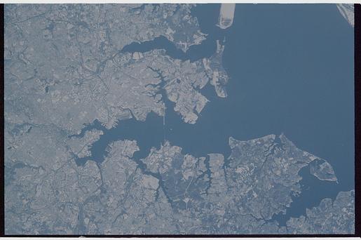
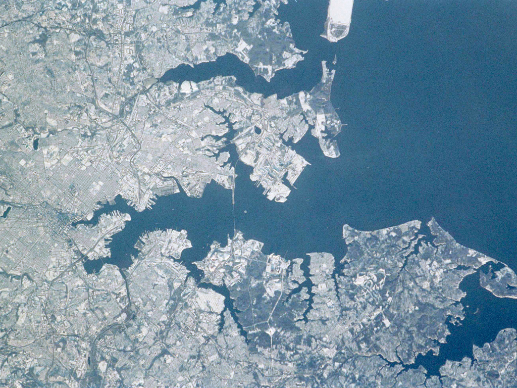
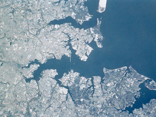
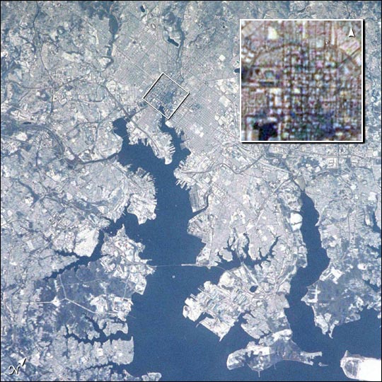
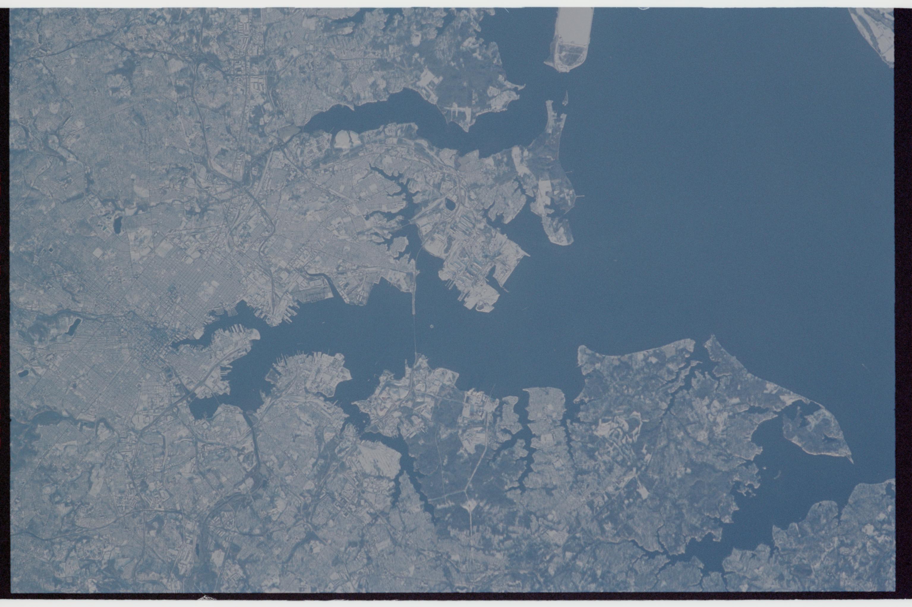
Image Caption: STS113-347-28 Baltimore, Maryland, USA December 2002
While traveling to the International Space Station aboard the Space Shuttle Endeavor, astronauts photographed the northeastern United States blanketed in fresh snow. This image, taken in early December 2002, shows the city of Baltimore, and the surrounding area. An inset shows the center of the city (rotated so north points up--see Earth Observatory image posting.
Astronauts routinely track weather phenomena on Earth, and use their onboard cameras to document their observations. Ground support in the Earth Observations Lab at the Johnson Space Center also track weather events world wide as part of the image planning activities, and alert the crews to significant events such as winter storm systems.
