STS111-371-3
| NASA Photo ID | STS111-371-3 |
| Focal Length | mm |
| Date taken | 2002.06.15 |
| Time taken | 22:01:31 GMT |
Resolutions offered for this image:
3070 x 2044 pixels 1200 x 798 pixels 1024 x 768 pixels 540 x 405 pixels 540 x 405 pixels 1000 x 750 pixels 3070 x 2044 pixels 515 x 342 pixels 2960 x 1964 pixels 640 x 424 pixels
3070 x 2044 pixels 1200 x 798 pixels 1024 x 768 pixels 540 x 405 pixels 540 x 405 pixels 1000 x 750 pixels 3070 x 2044 pixels 515 x 342 pixels 2960 x 1964 pixels 640 x 424 pixels


Cloud masks available for this image:
Spacecraft nadir point: 44.4° N, 124.8° W
Photo center point: 46.5° N, 122.0° W
Photo center point by machine learning:
Photo center point: 46.5° N, 122.0° W
Photo center point by machine learning:
Nadir to Photo Center: Northeast
Spacecraft Altitude: 190 nautical miles (352km)
Country or Geographic Name: | USA-WASHINGTON |
Features: | MOUNT ST. HELENS, SPIRIT LAKE |
| Features Found Using Machine Learning: | |
Cloud Cover Percentage: | 10 (1-10)% |
Sun Elevation Angle: | 61° |
Sun Azimuth: | 233° |
Camera: | Nikon 35mm film camera |
Focal Length: | mm |
Camera Tilt: | 48 degrees |
Format: | 5069: Kodak Elite 100S, E6 Reversal, Replaces Lumiere, Warmer in tone vs. Lumiere |
Film Exposure: | |
| Additional Information | |
| Width | Height | Annotated | Cropped | Purpose | Links |
|---|---|---|---|---|---|
| 3070 pixels | 2044 pixels | No | No | Photographic Highlights | Download Image |
| 1200 pixels | 798 pixels | No | No | Photographic Highlights | Download Image |
| 1024 pixels | 768 pixels | Photographic Highlights | Download Image | ||
| 540 pixels | 405 pixels | Photographic Highlights | Download Image | ||
| 540 pixels | 405 pixels | Yes | Yes | Earth From Space collection | Download Image |
| 1000 pixels | 750 pixels | No | No | NASA's Earth Observatory web site | Download Image |
| 3070 pixels | 2044 pixels | No | No | Download Image | |
| 515 pixels | 342 pixels | No | No | Download Image | |
| 2960 pixels | 1964 pixels | No | No | Public Affairs Office (PAO) | Download Image |
| 640 pixels | 424 pixels | No | No | Public Affairs Office (PAO) | Download Image |
Download Packaged File
Download a Google Earth KML for this Image
View photo footprint information
Download a GeoTIFF for this photo
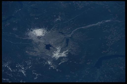
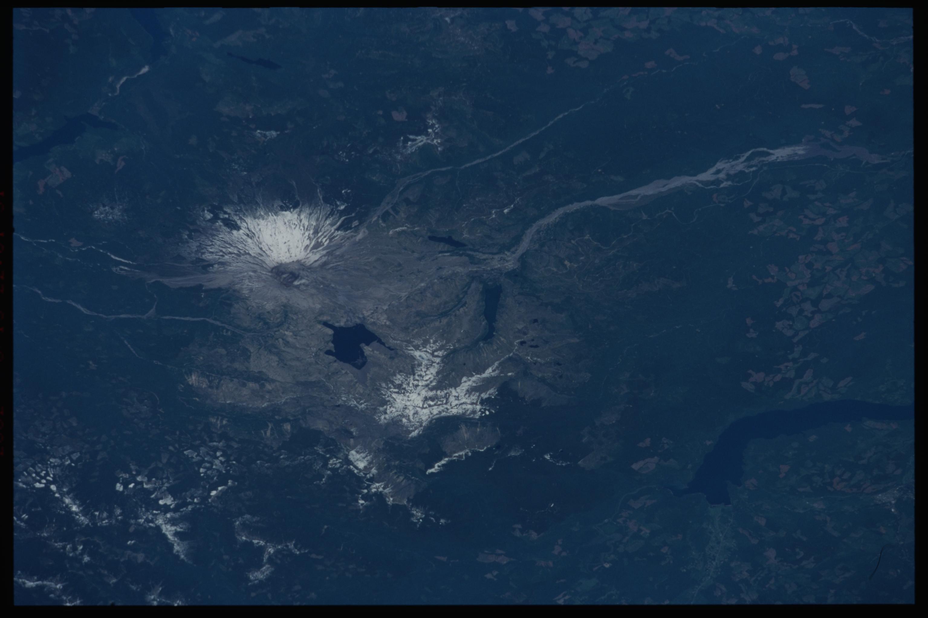
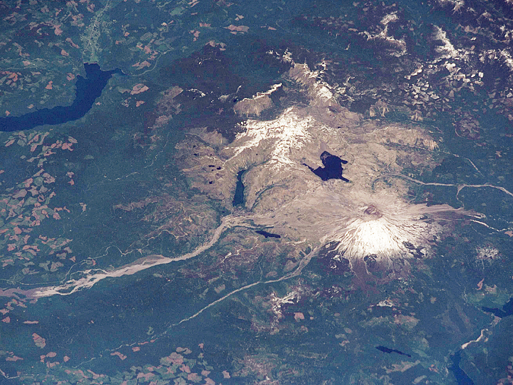
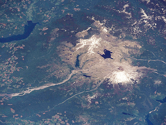
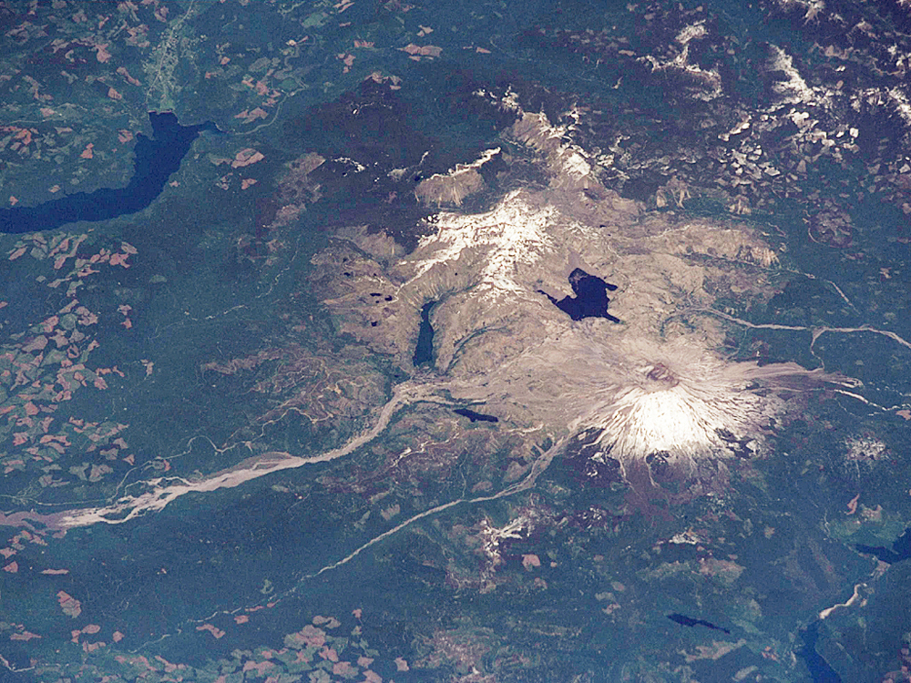
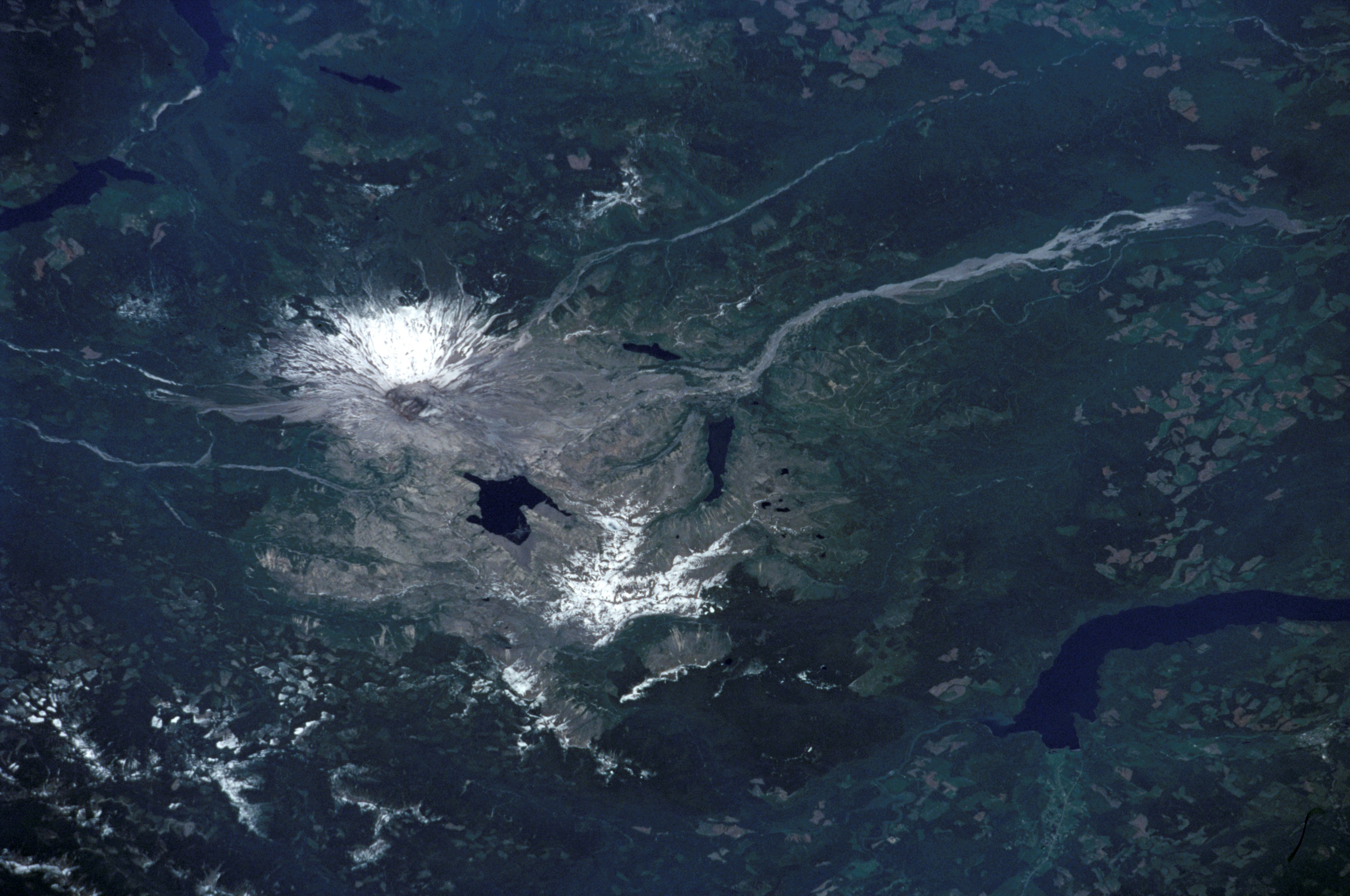
Image Caption: STS111-371-3 Mt. St. Helens, Spirit Lake, Washington, USA June 2002
Snow still covered the peaks of the Cascade Ranges in mid-June when the STS-111 crew photographed Mt. St. Helens from the Space Shuttle Endeavour. From their vantage point, the crew observed blast zone from the 1980 eruption of the volcano, the mud-choked North Fork of the Toutle River, and fallen timber that still floats in rafts of logs on Spirit Lake. Continued imagery of the region will document the slow regrowth of the forests. Today, the volcano and surrounding region comprise the Mt. St. Helens National Volcanic Monument which is dedicated to research, education and recreation.
Snow still covered the peaks of the Cascade Ranges in mid-June when the STS-111 crew photographed Mt. St. Helens from the Space Shuttle Endeavour. From their vantage point, the crew observed blast zone from the 1980 eruption of the volcano, the mud-choked North Fork of the Toutle River, and fallen timber that still floats in rafts of logs on Spirit Lake. Continued imagery of the region will document the slow regrowth of the forests. Today, the volcano and surrounding region comprise the Mt. St. Helens National Volcanic Monument which is dedicated to research, education and recreation.
