STS109-730-80

| NASA Photo ID | STS109-730-80 |
| Focal Length | 250mm |
| Date taken | 2002.03.09 |
| Time taken | 16:46:__ GMT |
Resolutions offered for this image:
768 x 768 pixels 875 x 836 pixels 540 x 540 pixels 540 x 539 pixels 540 x 539 pixels 4600 x 4400 pixels 515 x 492 pixels
768 x 768 pixels 875 x 836 pixels 540 x 540 pixels 540 x 539 pixels 540 x 539 pixels 4600 x 4400 pixels 515 x 492 pixels


Cloud masks available for this image:
Spacecraft nadir point:
Photo center point: 14.0° S, 76.5° W
Photo center point by machine learning:
Photo center point: 14.0° S, 76.5° W
Photo center point by machine learning:
Nadir to Photo Center:
Spacecraft Altitude: nautical miles (0km)
Country or Geographic Name: | PERU |
Features: | PARACAS PENINSULA, COASTAL FOG |
| Features Found Using Machine Learning: | |
Cloud Cover Percentage: | 25 (11-25)% |
Sun Elevation Angle: | ° |
Sun Azimuth: | ° |
Camera: | Hasselblad |
Focal Length: | 250mm |
Camera Tilt: | Low Oblique |
Format: | 5069: Kodak Elite 100S, E6 Reversal, Replaces Lumiere, Warmer in tone vs. Lumiere |
Film Exposure: | |
| Additional Information | |
| Width | Height | Annotated | Cropped | Purpose | Links |
|---|---|---|---|---|---|
| 768 pixels | 768 pixels | Photographic Highlights | Download Image | ||
| 875 pixels | 836 pixels | No | No | Photographic Highlights | Download Image |
| 540 pixels | 540 pixels | Photographic Highlights | Download Image | ||
| 540 pixels | 539 pixels | Yes | Yes | Earth From Space collection | Download Image |
| 540 pixels | 539 pixels | Yes | Yes | NASA's Earth Observatory web site | Download Image |
| 4600 pixels | 4400 pixels | No | No | Download Image | |
| 515 pixels | 492 pixels | No | No | Download Image |
Download Packaged File
Download a Google Earth KML for this Image
View photo footprint information
Download a GeoTIFF for this photo
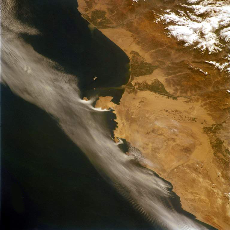
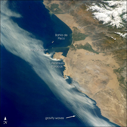
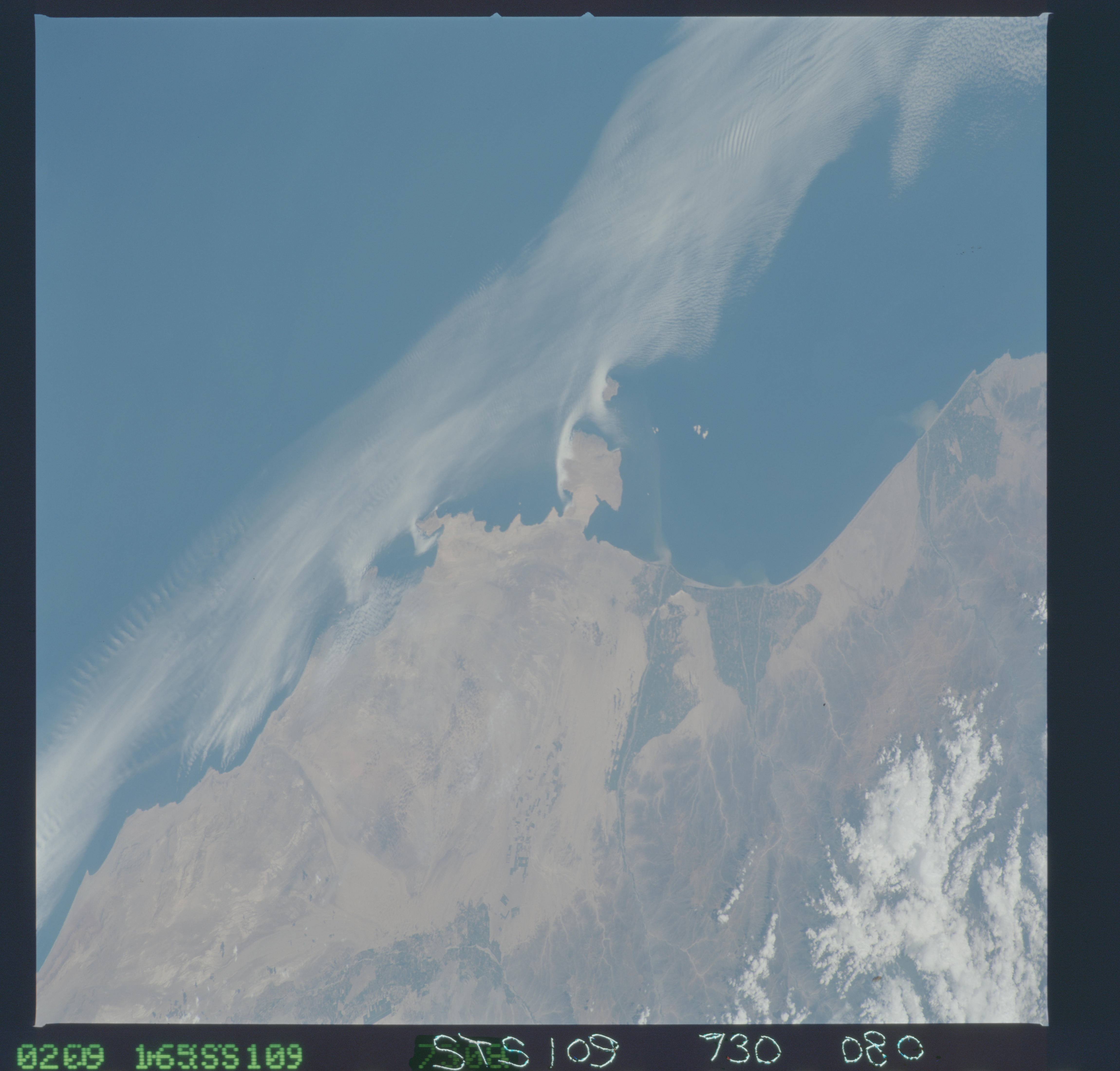
Image Caption: Coastal fog commonly drapes the Peruvian coast. This image captures complex interactions between land, sea, and atmosphere along the southern Peruvian coast. When Shuttle astronauts took the image in March of 2002, the layers of coastal fog and stratus were being progressively scoured away by brisk south to southeast winds. Remnants of the cloud deck banked against the larger, obstructing headlands like Peninsula Paracas and Isla Sangayan, giving the prominent "white comma" effect. Southerlies also produced ripples of internal gravity waves in the clouds offshore where warm, dry air aloft interacts with a thinning layer of cool, moist air near the sea surface on the outer edge of the remaining cloud bank. South of Peninsula Baracas, the small headlands channeled the clouds into streaks--local horizontal vortices caused by the headlands provided enough lift to give points of origin of the clouds in some bays. Besides the shelter of the peninsula, the Bahia de Pisco appears to be cloud-free due to a dry, offshore flow down the valley of the Rio Ica.
