STS109-718-102
| NASA Photo ID | STS109-718-102 |
| Focal Length | 250mm |
| Date taken | 2002.03.10 |
| Time taken | 14:49:33 GMT |
Resolutions offered for this image:
4600 x 4400 pixels 768 x 768 pixels 875 x 836 pixels 540 x 540 pixels 4600 x 4400 pixels 515 x 492 pixels 6810 x 6810 pixels 639 x 639 pixels 400 x 400 pixels
4600 x 4400 pixels 768 x 768 pixels 875 x 836 pixels 540 x 540 pixels 4600 x 4400 pixels 515 x 492 pixels 6810 x 6810 pixels 639 x 639 pixels 400 x 400 pixels


Cloud masks available for this image:
Spacecraft nadir point: 2.8° S, 90.4° W
Photo center point: 0.5° S, 91.0° W
Photo center point by machine learning:
Photo center point: 0.5° S, 91.0° W
Photo center point by machine learning:
Nadir to Photo Center: North
Spacecraft Altitude: 303 nautical miles (561km)
Country or Geographic Name: | GALAPAGOS ISLANDS |
Features: | ISABELA & FERNANDINA I. |
| Features Found Using Machine Learning: | |
Cloud Cover Percentage: | 25 (11-25)% |
Sun Elevation Angle: | 40° |
Sun Azimuth: | 93° |
Camera: | Hasselblad |
Focal Length: | 250mm |
Camera Tilt: | 25 degrees |
Format: | 5069: Kodak Elite 100S, E6 Reversal, Replaces Lumiere, Warmer in tone vs. Lumiere |
Film Exposure: | |
| Additional Information | |
| Width | Height | Annotated | Cropped | Purpose | Links |
|---|---|---|---|---|---|
| 4600 pixels | 4400 pixels | No | No | Photographic Highlights | Download Image |
| 768 pixels | 768 pixels | Photographic Highlights | Download Image | ||
| 875 pixels | 836 pixels | No | No | Photographic Highlights | Download Image |
| 540 pixels | 540 pixels | Photographic Highlights | Download Image | ||
| 4600 pixels | 4400 pixels | No | No | Download Image | |
| 515 pixels | 492 pixels | No | No | Download Image | |
| 6810 pixels | 6810 pixels | Public Affairs Office (PAO) | Download Image | ||
| 639 pixels | 639 pixels | No | No | Public Affairs Office (PAO) | Download Image |
| 400 pixels | 400 pixels | No | No | Photographic Highlights | Download Image |
Download Packaged File
Download a Google Earth KML for this Image
View photo footprint information
Download a GeoTIFF for this photo
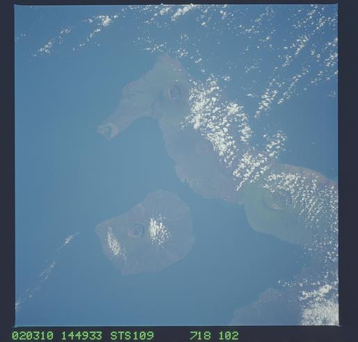
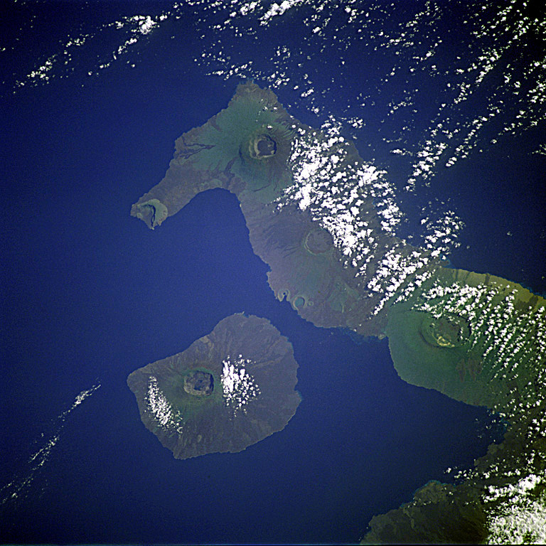
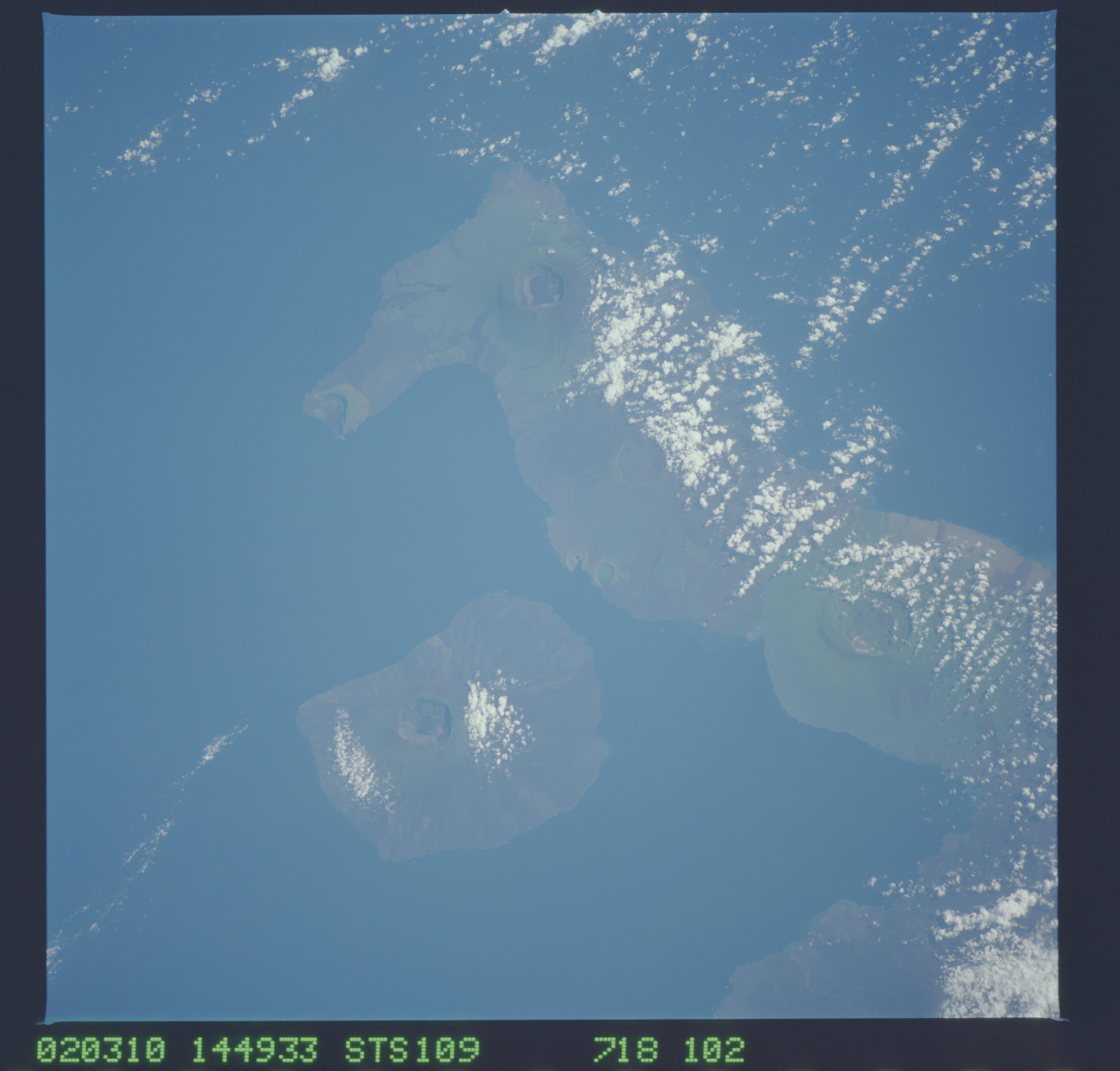
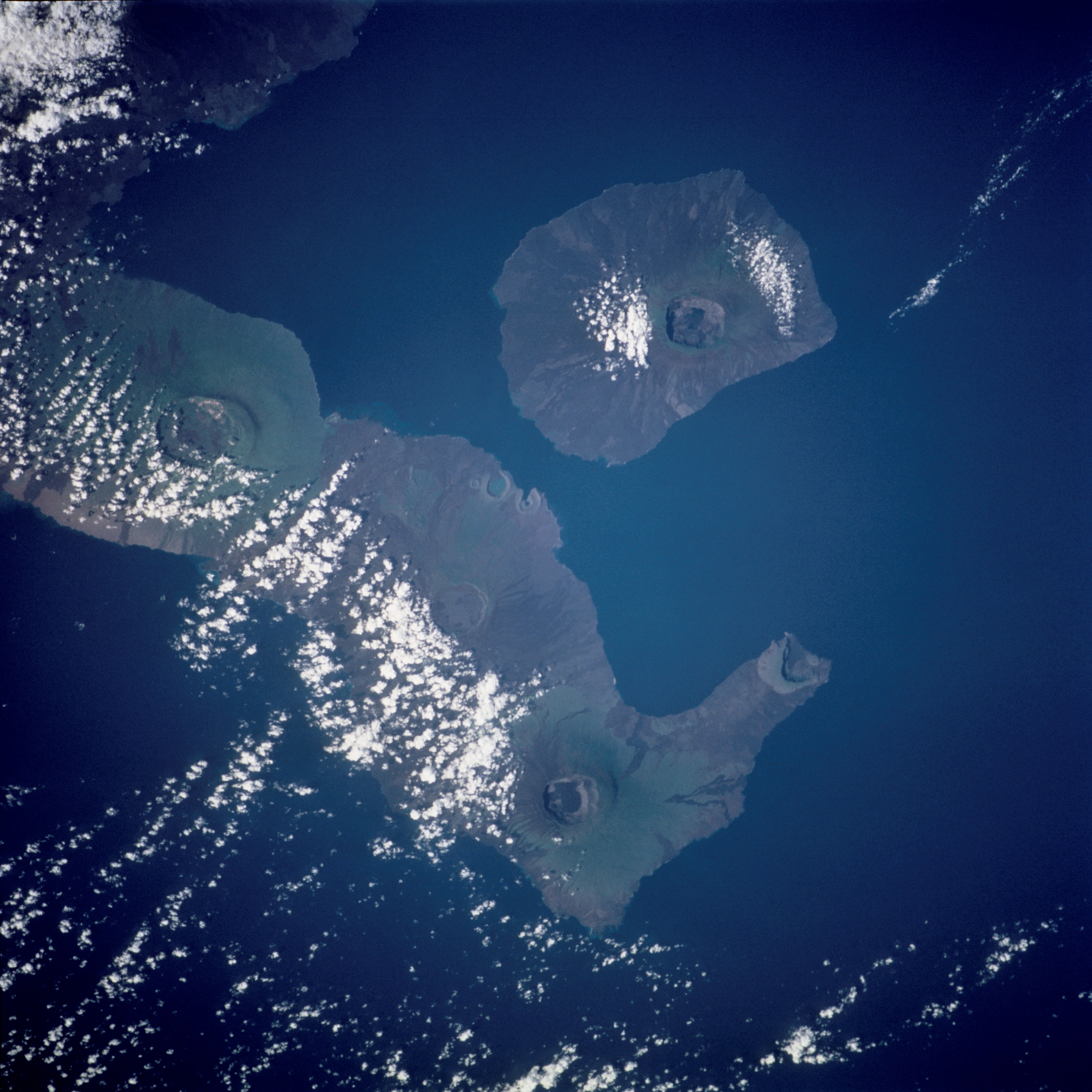
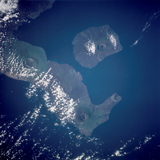
Image Caption: Galapagos Islands, Ecuador
Most of the largest island in the Galapagos group, Isla Isabela, stretches across the middle of the view. The circular feature on this island at the bottom of the view is Volcano Wolf (1707 m in altitude). Volcano Darwin (1280 m) is the next volcano above and to the left, partly ringed with cloud. The single island top right is Isla Fernandina, the top of another volcano (1547 m). Recent lava flows appear as darker surfaces and the older surfaces appear green, as a result of unusual rains and vegetation greening in this normally arid part of the world. The Equator passes exactly through Volcano Wolf, roughly left to right (north is towards the bottom of the view).
Most of the largest island in the Galapagos group, Isla Isabela, stretches across the middle of the view. The circular feature on this island at the bottom of the view is Volcano Wolf (1707 m in altitude). Volcano Darwin (1280 m) is the next volcano above and to the left, partly ringed with cloud. The single island top right is Isla Fernandina, the top of another volcano (1547 m). Recent lava flows appear as darker surfaces and the older surfaces appear green, as a result of unusual rains and vegetation greening in this normally arid part of the world. The Equator passes exactly through Volcano Wolf, roughly left to right (north is towards the bottom of the view).
