STS108-713-52

| NASA Photo ID | STS108-713-52 |
| Focal Length | 110mm |
| Date taken | 2001.12.17 |
| Time taken | 13:03:06 GMT |
Resolutions offered for this image:
1035 x 1024 pixels 2071 x 2048 pixels 4143 x 4096 pixels 517 x 512 pixels 4096 x 4096 pixels 640 x 640 pixels 400 x 396 pixels
1035 x 1024 pixels 2071 x 2048 pixels 4143 x 4096 pixels 517 x 512 pixels 4096 x 4096 pixels 640 x 640 pixels 400 x 396 pixels


Cloud masks available for this image:
Spacecraft nadir point: 12.5° N, 25.7° W
Photo center point: 17.0° N, 25.0° W
Photo center point by machine learning:
Photo center point: 17.0° N, 25.0° W
Photo center point by machine learning:
Nadir to Photo Center: North
Spacecraft Altitude: 191 nautical miles (354km)
Country or Geographic Name: | CAPE VERDE ISLANDS |
Features: | ISLANDS |
| Features Found Using Machine Learning: | |
Cloud Cover Percentage: | 25 (11-25)% |
Sun Elevation Angle: | 53° |
Sun Azimuth: | 166° |
Camera: | Hasselblad |
Focal Length: | 110mm |
Camera Tilt: | 55 degrees |
Format: | 5069: Kodak Elite 100S, E6 Reversal, Replaces Lumiere, Warmer in tone vs. Lumiere |
Film Exposure: | |
| Additional Information | |
| Width | Height | Annotated | Cropped | Purpose | Links |
|---|---|---|---|---|---|
| 1035 pixels | 1024 pixels | No | No | Download Image | |
| 2071 pixels | 2048 pixels | No | No | Download Image | |
| 4143 pixels | 4096 pixels | No | No | Download Image | |
| 517 pixels | 512 pixels | No | No | Download Image | |
| 4096 pixels | 4096 pixels | Public Affairs Office (PAO) | Download Image | ||
| 640 pixels | 640 pixels | No | No | Public Affairs Office (PAO) | Download Image |
| 400 pixels | 396 pixels | No | No | Photographic Highlights | Download Image |
Download Packaged File
Download a Google Earth KML for this Image
View photo footprint information
Download a GeoTIFF for this photo
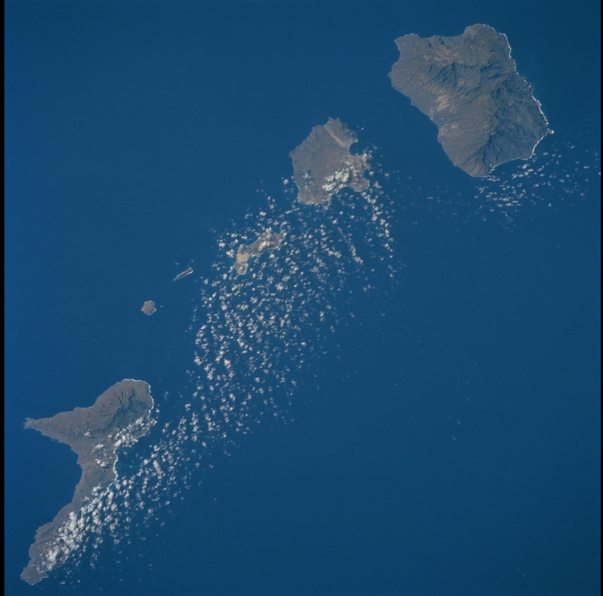
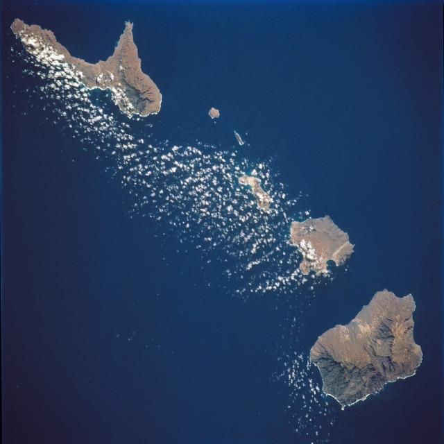
Image Caption: Cape Verde Islands
This image shows several of the northwestern islands in the Cape Verde chain in the North Atlantic Ocean, some 500 miles from the coast of Senegal, Africa. From the upper left to lower right (southeast to northwest) are Sao Nicolau, Razo, Branco, Santa Luzia, Sao Vicente and Santo Antao.
This image shows several of the northwestern islands in the Cape Verde chain in the North Atlantic Ocean, some 500 miles from the coast of Senegal, Africa. From the upper left to lower right (southeast to northwest) are Sao Nicolau, Razo, Branco, Santa Luzia, Sao Vicente and Santo Antao.
