STS108-711-25

| NASA Photo ID | STS108-711-25 |
| Focal Length | 110mm |
| Date taken | 2001.12.15 |
| Time taken | 13:35:59 GMT |
Resolutions offered for this image:
540 x 540 pixels 1031 x 1024 pixels 2063 x 2048 pixels 4127 x 4096 pixels 515 x 512 pixels 1234 x 1264 pixels 1288 x 1282 pixels 1280 x 1248 pixels 400 x 400 pixels
540 x 540 pixels 1031 x 1024 pixels 2063 x 2048 pixels 4127 x 4096 pixels 515 x 512 pixels 1234 x 1264 pixels 1288 x 1282 pixels 1280 x 1248 pixels 400 x 400 pixels


Cloud masks available for this image:
Spacecraft nadir point: 25.6° N, 10.1° W
Photo center point: 29.0° N, 9.0° W
Photo center point by machine learning:
Photo center point: 29.0° N, 9.0° W
Photo center point by machine learning:
Nadir to Photo Center: North
Spacecraft Altitude: 207 nautical miles (383km)
Country or Geographic Name: | MOROCCO |
Features: | ANTI ATLAS MOUNTAINS |
| Features Found Using Machine Learning: | |
Cloud Cover Percentage: | 10 (1-10)% |
Sun Elevation Angle: | 39° |
Sun Azimuth: | 198° |
Camera: | Hasselblad |
Focal Length: | 110mm |
Camera Tilt: | 46 degrees |
Format: | 5069: Kodak Elite 100S, E6 Reversal, Replaces Lumiere, Warmer in tone vs. Lumiere |
Film Exposure: | |
| Additional Information | |
| Width | Height | Annotated | Cropped | Purpose | Links |
|---|---|---|---|---|---|
| 540 pixels | 540 pixels | Yes | Yes | Earth From Space collection | Download Image |
| 1031 pixels | 1024 pixels | No | No | Download Image | |
| 2063 pixels | 2048 pixels | No | No | Download Image | |
| 4127 pixels | 4096 pixels | No | No | Download Image | |
| 515 pixels | 512 pixels | No | No | Download Image | |
| 1234 pixels | 1264 pixels | No | Yes | Photographic Highlights | Download Image |
| 1288 pixels | 1282 pixels | No | No | Download Image | |
| 1280 pixels | 1248 pixels | No | No | Download Image | |
| 400 pixels | 400 pixels | Yes | Photographic Highlights | Download Image |
Download Packaged File
Download a Google Earth KML for this Image
View photo footprint information
Download a GeoTIFF for this photo
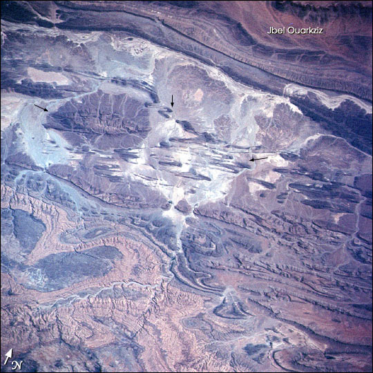
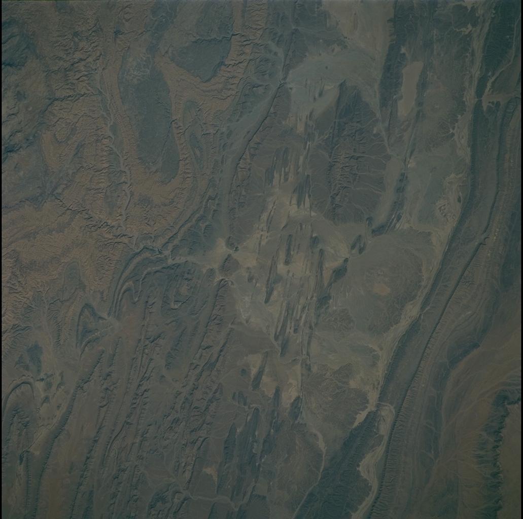
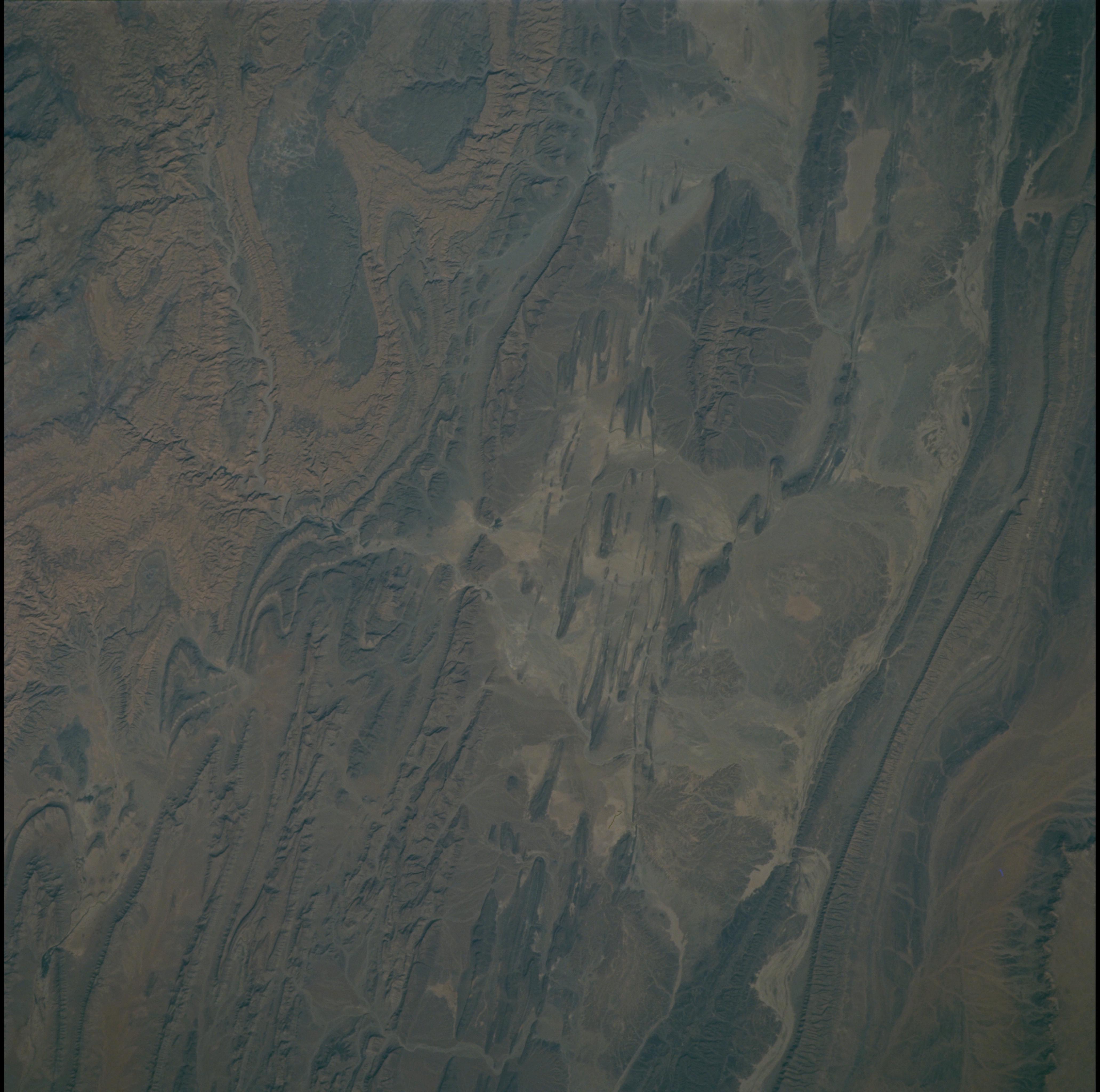
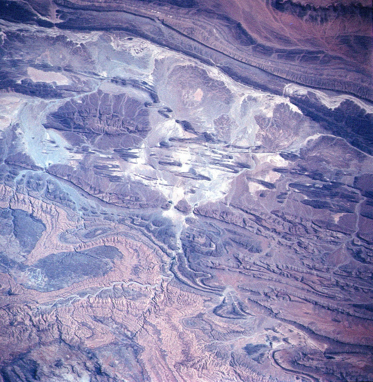
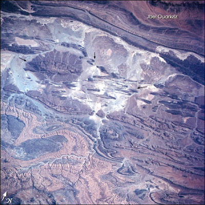
Image Caption: The Anti-Atlas Mountains of northern Africa and the nearby Atlas mountains were created by the prolonged collision of the African and Eurasian tectonic plates, beginning about 80 million years ago. Massive sandstone and limestone layers have been crumpled and uplifted more than 4,000 meters in the High Atlas and to lower elevations in the Anti-Atlas. Between more continuous major fold structures, such as the Jbel Ouarkziz in the southwestern Anti-Atlas, tighter secondary folds (arrow) have developed.
Earlier, the supercontinent of Pangea rifted apart to form precursors to the Mediterranean and the Atlantic Ocean (Beauchamp and others, 1996). In those seas sands, clays, limey sediments, and evaporite layers (gypsum, rock salt) were deposited. Later, during the mountain-building plate collision, the gypsum layers flowed under the pressure and provided a slippery surface on which overlying rigid rocks could glide (Burkhard, 2001). The broad, open style of folds seen in this view is common where evaporites are involved in the deformation. Other examples can be found in the Southern Zagros of Iran and the Sierra Madre Oriental of Mexico.
Earlier, the supercontinent of Pangea rifted apart to form precursors to the Mediterranean and the Atlantic Ocean (Beauchamp and others, 1996). In those seas sands, clays, limey sediments, and evaporite layers (gypsum, rock salt) were deposited. Later, during the mountain-building plate collision, the gypsum layers flowed under the pressure and provided a slippery surface on which overlying rigid rocks could glide (Burkhard, 2001). The broad, open style of folds seen in this view is common where evaporites are involved in the deformation. Other examples can be found in the Southern Zagros of Iran and the Sierra Madre Oriental of Mexico.
