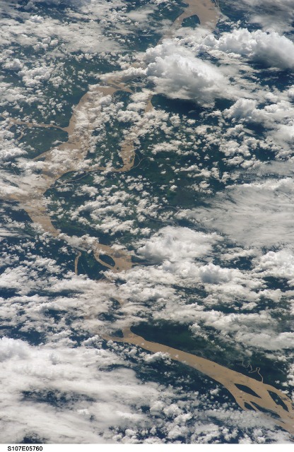
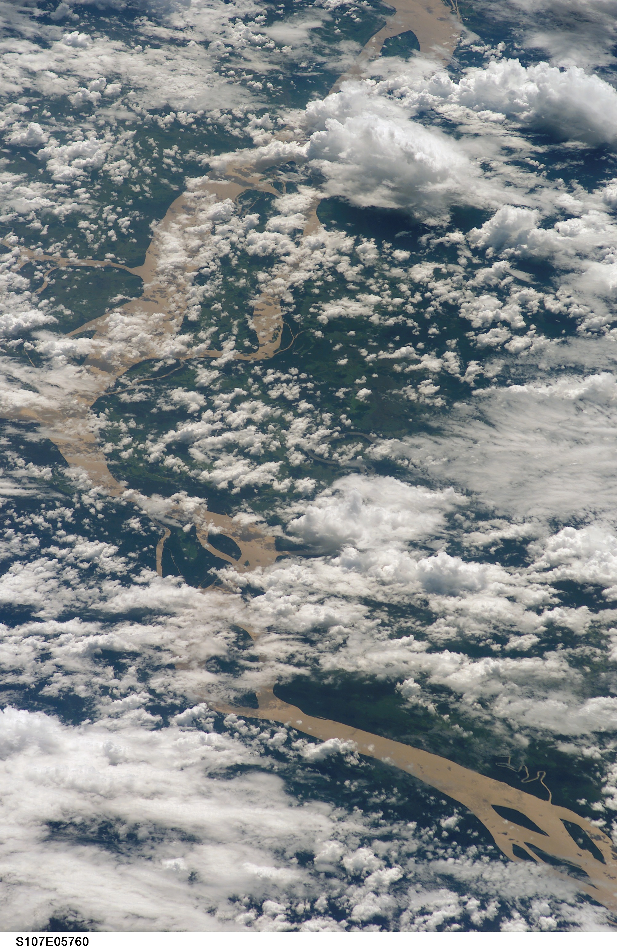
STS107-E-5760
| NASA Photo ID | STS107-E-5760 |
| Focal Length | 180mm |
| Date taken | 2003.01.26 |
| Time taken | 17:34:04 GMT |
Cloud masks available for this image:
Spacecraft nadir point: 1.3° N, 48.8° W
Photo center point: 1.0° S, 52.5° W
Photo center point by machine learning:
Photo center point: 1.0° S, 52.5° W
Photo center point by machine learning:
Nadir to Photo Center: Southwest
Spacecraft Altitude: 147 nautical miles (272km)
Country or Geographic Name: | BRAZIL |
Features: | AMAZON RIVER, ISLANDS, CLOUDS |
| Features Found Using Machine Learning: | |
Cloud Cover Percentage: | 100 (76-100)% |
Sun Elevation Angle: | 53° |
Sun Azimuth: | 236° |
Camera: | Kodak DCS760c Electronic Still Camera |
Focal Length: | 180mm |
Camera Tilt: | High Oblique |
Format: | 3060E: 3060 x 2036 pixel CCD, RGBG array |
Film Exposure: | |
| Additional Information | |
| Width | Height | Annotated | Cropped | Purpose | Links |
|---|---|---|---|---|---|
| 2008 pixels | 3088 pixels | No | No | Download Image | |
| 416 pixels | 640 pixels | No | No | Download Image |
Download Packaged File
Download a Google Earth KML for this Image
View photo footprint information
Download a GeoTIFF for this photo
Image Caption: none
