STS106-719-48
| NASA Photo ID | STS106-719-48 |
| Focal Length | 250mm |
| Date taken | 2000.09.20 |
| Time taken | 03:47:11 GMT |
Resolutions offered for this image:
1031 x 1024 pixels 2063 x 2048 pixels 4127 x 4096 pixels 515 x 512 pixels 1212 x 1274 pixels 380 x 400 pixels
1031 x 1024 pixels 2063 x 2048 pixels 4127 x 4096 pixels 515 x 512 pixels 1212 x 1274 pixels 380 x 400 pixels


Cloud masks available for this image:
Spacecraft nadir point: 4.2° S, 142.5° E
Photo center point: 4.0° S, 145.0° E
Photo center point by machine learning:
Photo center point: 4.0° S, 145.0° E
Photo center point by machine learning:
Nadir to Photo Center: East
Spacecraft Altitude: 205 nautical miles (380km)
Country or Geographic Name: | PAPUA NEW GUINEA |
Features: | MANAM VOLCANO, SMOKE |
| Features Found Using Machine Learning: | |
Cloud Cover Percentage: | 10 (1-10)% |
Sun Elevation Angle: | 68° |
Sun Azimuth: | 284° |
Camera: | Hasselblad |
Focal Length: | 250mm |
Camera Tilt: | 36 degrees |
Format: | 5069: Kodak Elite 100S, E6 Reversal, Replaces Lumiere, Warmer in tone vs. Lumiere |
Film Exposure: | |
| Additional Information | |
| Width | Height | Annotated | Cropped | Purpose | Links |
|---|---|---|---|---|---|
| 1031 pixels | 1024 pixels | No | No | Download Image | |
| 2063 pixels | 2048 pixels | No | No | Download Image | |
| 4127 pixels | 4096 pixels | No | No | Download Image | |
| 515 pixels | 512 pixels | No | No | Download Image | |
| 1212 pixels | 1274 pixels | No | No | Download Image | |
| 380 pixels | 400 pixels | Download Image |
Download Packaged File
Download a Google Earth KML for this Image
View photo footprint information
Download a GeoTIFF for this photo
Image Caption: Source:Patricia W. Dickerson
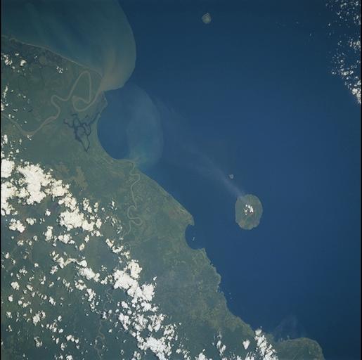
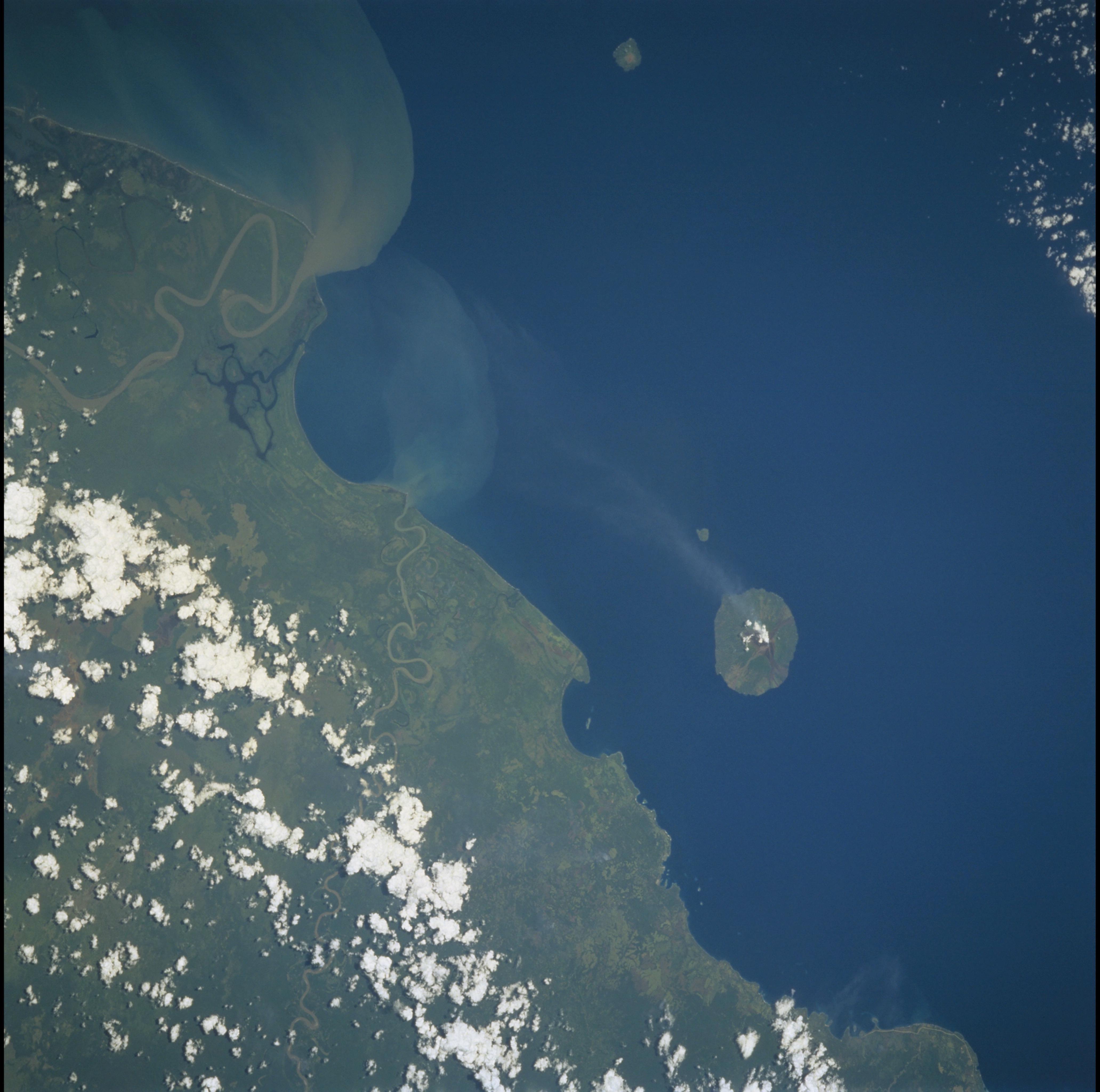
Manam Volcano
Manam, with a plume of smoke attesting to its ongoing activity, is off
the northeastern coast of Papua New Guinea and rises to an elevation of
1807 m. The first known eruption of Manam was in 1616, and in 1994 an
explosive eruption sent ash and incandescent material 10 km into the
air. Plumes of sediment enter the sea at the mouths of the Sepik (large
river at left) and the Ramu Rivers (closer to Manam), following heavy
rains from a recent tropical storm.
