STS106-713-9
| NASA Photo ID | STS106-713-9 |
| Focal Length | 250mm |
| Date taken | 2000.09.19 |
| Time taken | 09:09:55 GMT |
Resolutions offered for this image:
1031 x 1024 pixels 2063 x 2048 pixels 4127 x 4096 pixels 515 x 512 pixels
1031 x 1024 pixels 2063 x 2048 pixels 4127 x 4096 pixels 515 x 512 pixels


Cloud masks available for this image:
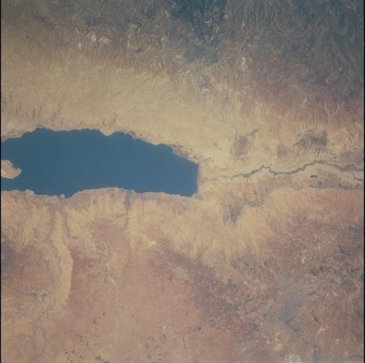
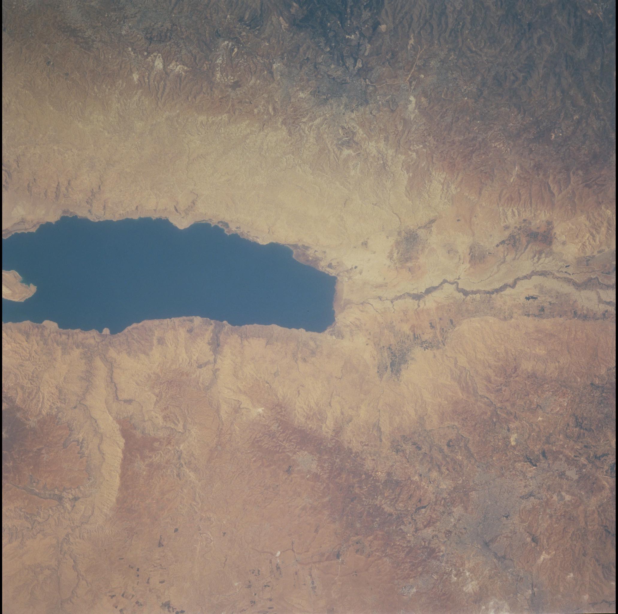
Spacecraft nadir point: 31.4° N, 34.3° E
Photo center point: 31.5° N, 35.5° E
Photo center point by machine learning:
Photo center point: 31.5° N, 35.5° E
Photo center point by machine learning:
Nadir to Photo Center: East
Spacecraft Altitude: 204 nautical miles (378km)
Camera: | Hasselblad |
Focal Length: | 250mm |
Camera Tilt: | 20 degrees |
Format: | 5069: Kodak Elite 100S, E6 Reversal, Replaces Lumiere, Warmer in tone vs. Lumiere |
Film Exposure: | |
| Additional Information | |
| Width | Height | Annotated | Cropped | Purpose | Links |
|---|---|---|---|---|---|
| 1031 pixels | 1024 pixels | No | No | Download Image | |
| 2063 pixels | 2048 pixels | No | No | Download Image | |
| 4127 pixels | 4096 pixels | No | No | Download Image | |
| 515 pixels | 512 pixels | No | No | Download Image |
Download Packaged File
Download a Google Earth KML for this Image
View photo footprint information
Download a GeoTIFF for this photo
Image Caption: The City of Jerusalem is nearly due west of the northern tip of the Dead Sea approximately 20 miles. It is not very visible in photography. This is due to most of the buildings being made out of native materials. There is also not much vegetation to provide contrast with the city. However, the contrast in this shot is superior to previous astrounaut photographs of Jerusalem, making it an outstanding addition to the collection of "Cities from Space."
