STS106-710-60
| NASA Photo ID | STS106-710-60 |
| Focal Length | 250mm |
| Date taken | 2000.09.__ |
| Time taken | GMT |
Resolutions offered for this image:
1031 x 1024 pixels 2063 x 2048 pixels 4127 x 4096 pixels 636 x 639 pixels 515 x 512 pixels
1031 x 1024 pixels 2063 x 2048 pixels 4127 x 4096 pixels 636 x 639 pixels 515 x 512 pixels


Cloud masks available for this image:
Spacecraft nadir point:
Photo center point: 41.5° N, 70.5° W
Photo center point by machine learning:
Photo center point: 41.5° N, 70.5° W
Photo center point by machine learning:
Nadir to Photo Center:
Spacecraft Altitude: nautical miles (0km)
Camera: | Hasselblad |
Focal Length: | 250mm |
Camera Tilt: | |
Format: | 5069: Kodak Elite 100S, E6 Reversal, Replaces Lumiere, Warmer in tone vs. Lumiere |
Film Exposure: | |
| Additional Information | |
| Width | Height | Annotated | Cropped | Purpose | Links |
|---|---|---|---|---|---|
| 1031 pixels | 1024 pixels | No | No | Download Image | |
| 2063 pixels | 2048 pixels | No | No | Download Image | |
| 4127 pixels | 4096 pixels | No | No | Download Image | |
| 636 pixels | 639 pixels | No | No | Download Image | |
| 515 pixels | 512 pixels | No | No | Download Image |
Download Packaged File
Download a Google Earth KML for this Image
View photo footprint information
Download a GeoTIFF for this photo
Image Caption: Source: Kim Willis
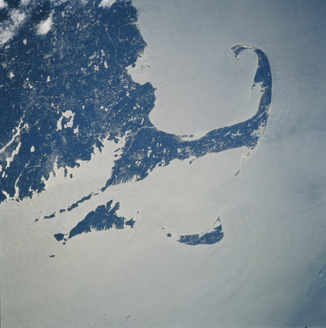
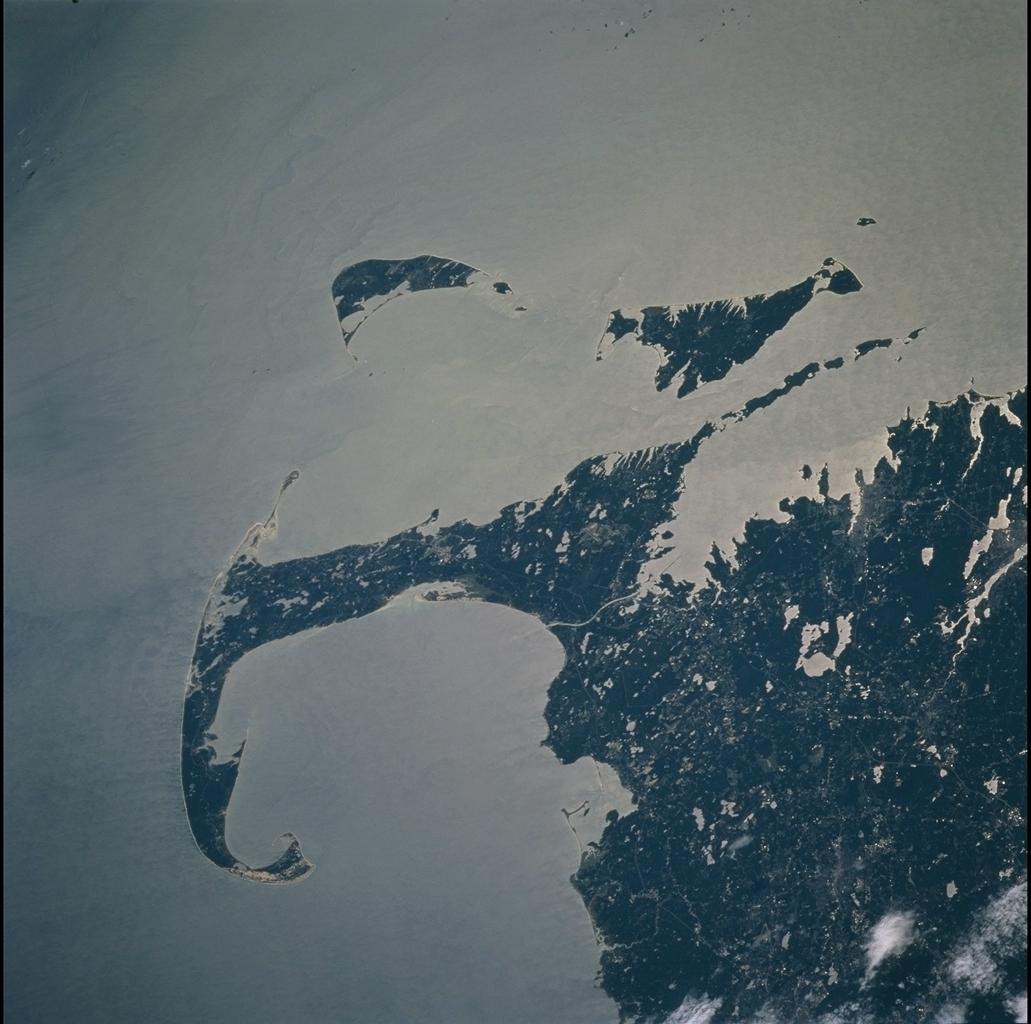
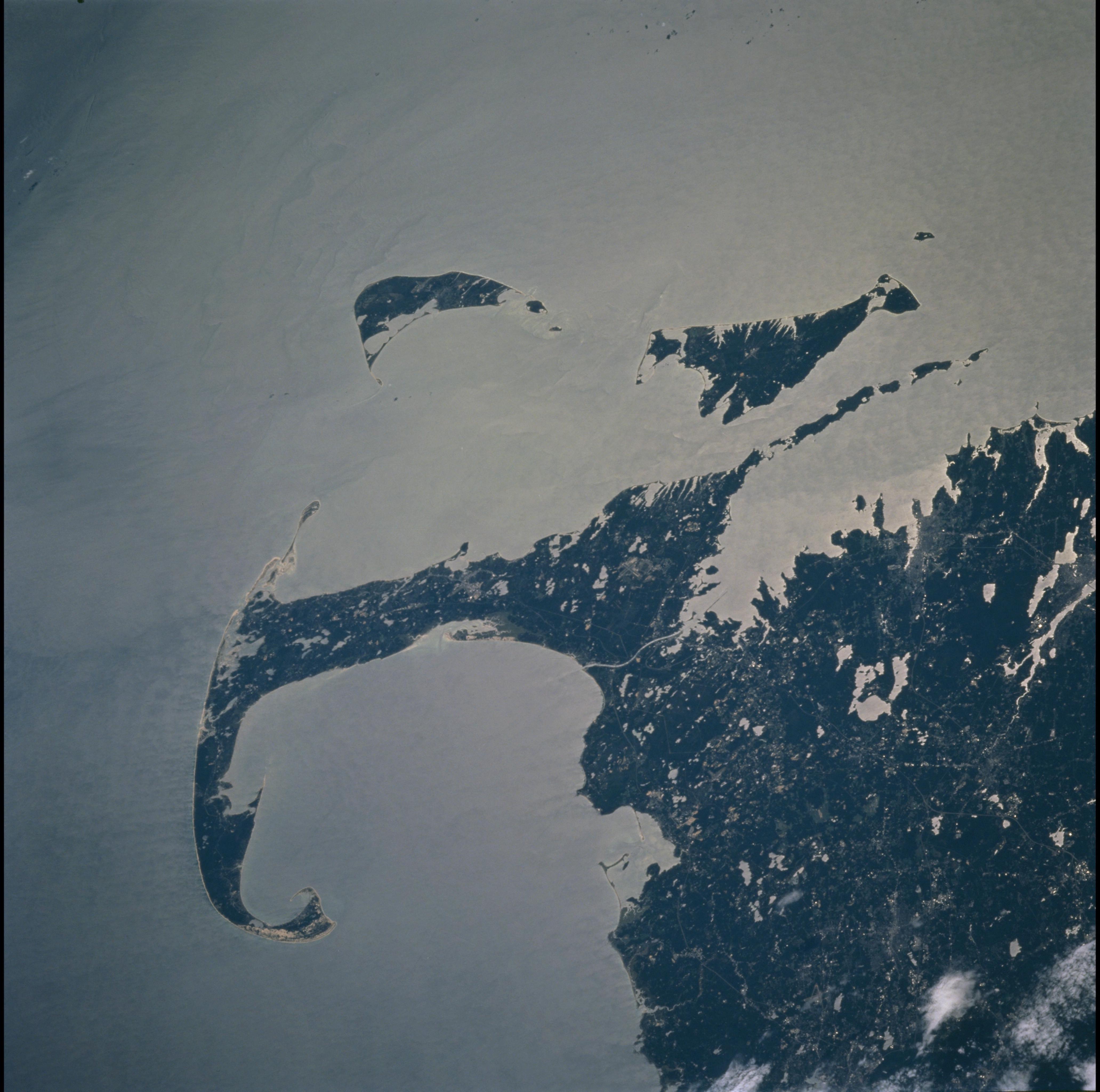
Cape Cod, Massachusetts
Partial sunglint highlights the coastline and brings out subtle details
in the waters around Massachusetts. The maximum advance of an ice sheet
23,000 years ago is marked by the unique shape of Cape Cod and by the
islands of Nantucket and Martha's Vineyard. Rocks and debris left at the
edges of the ice fronts made parts of the landscape slightly higher and
more resistant to erosion. Glacial retreat and sea level rise covered
the lower ground and gave us the more modern coastline that we are
familiar with. The city of New Bedford can be located near the coast and
just below the circular lakes of Long Pond, Great Quiittacas Pond, and
Assawompset Pond.
