STS104-720-7
| NASA Photo ID | STS104-720-7 |
| Focal Length | 250mm |
| Date taken | 2001.07.15 |
| Time taken | 13:21:56 GMT |
Resolutions offered for this image:
1035 x 1024 pixels 2071 x 2048 pixels 4143 x 4096 pixels 517 x 512 pixels 4096 x 4096 pixels 640 x 640 pixels 400 x 400 pixels
1035 x 1024 pixels 2071 x 2048 pixels 4143 x 4096 pixels 517 x 512 pixels 4096 x 4096 pixels 640 x 640 pixels 400 x 400 pixels


Cloud masks available for this image:
Spacecraft nadir point: 45.8° N, 63.1° W
Photo center point: 42.0° N, 71.0° W
Photo center point by machine learning:
Photo center point: 42.0° N, 71.0° W
Photo center point by machine learning:
Nadir to Photo Center: West
Spacecraft Altitude: 205 nautical miles (380km)
Country or Geographic Name: | USA-MASSACHUSETTS |
Features: | VIEW BOSTON, CAPE COD |
| Features Found Using Machine Learning: | |
Cloud Cover Percentage: | 10 (1-10)% |
Sun Elevation Angle: | 47° |
Sun Azimuth: | 109° |
Camera: | Hasselblad |
Focal Length: | 250mm |
Camera Tilt: | High Oblique |
Format: | 5069: Kodak Elite 100S, E6 Reversal, Replaces Lumiere, Warmer in tone vs. Lumiere |
Film Exposure: | |
| Additional Information | |
| Width | Height | Annotated | Cropped | Purpose | Links |
|---|---|---|---|---|---|
| 1035 pixels | 1024 pixels | No | No | Download Image | |
| 2071 pixels | 2048 pixels | No | No | Download Image | |
| 4143 pixels | 4096 pixels | No | No | Download Image | |
| 517 pixels | 512 pixels | No | No | Download Image | |
| 4096 pixels | 4096 pixels | No | No | Public Affairs Office (PAO) | Download Image |
| 640 pixels | 640 pixels | No | No | Public Affairs Office (PAO) | Download Image |
| 400 pixels | 400 pixels | No | No | Photographic Highlights | Download Image |
Download Packaged File
Download a Google Earth KML for this Image
View photo footprint information
Download a GeoTIFF for this photo
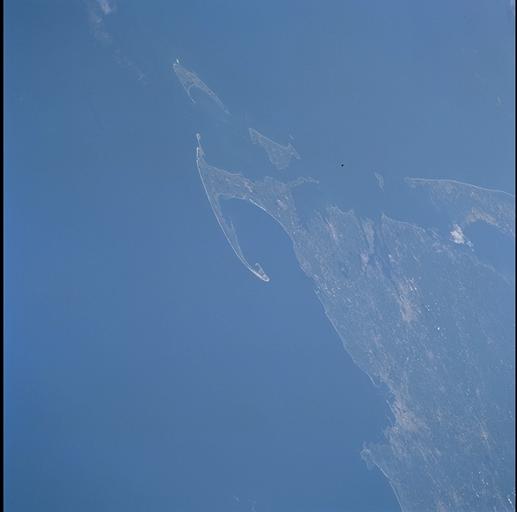
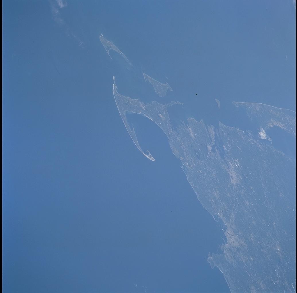
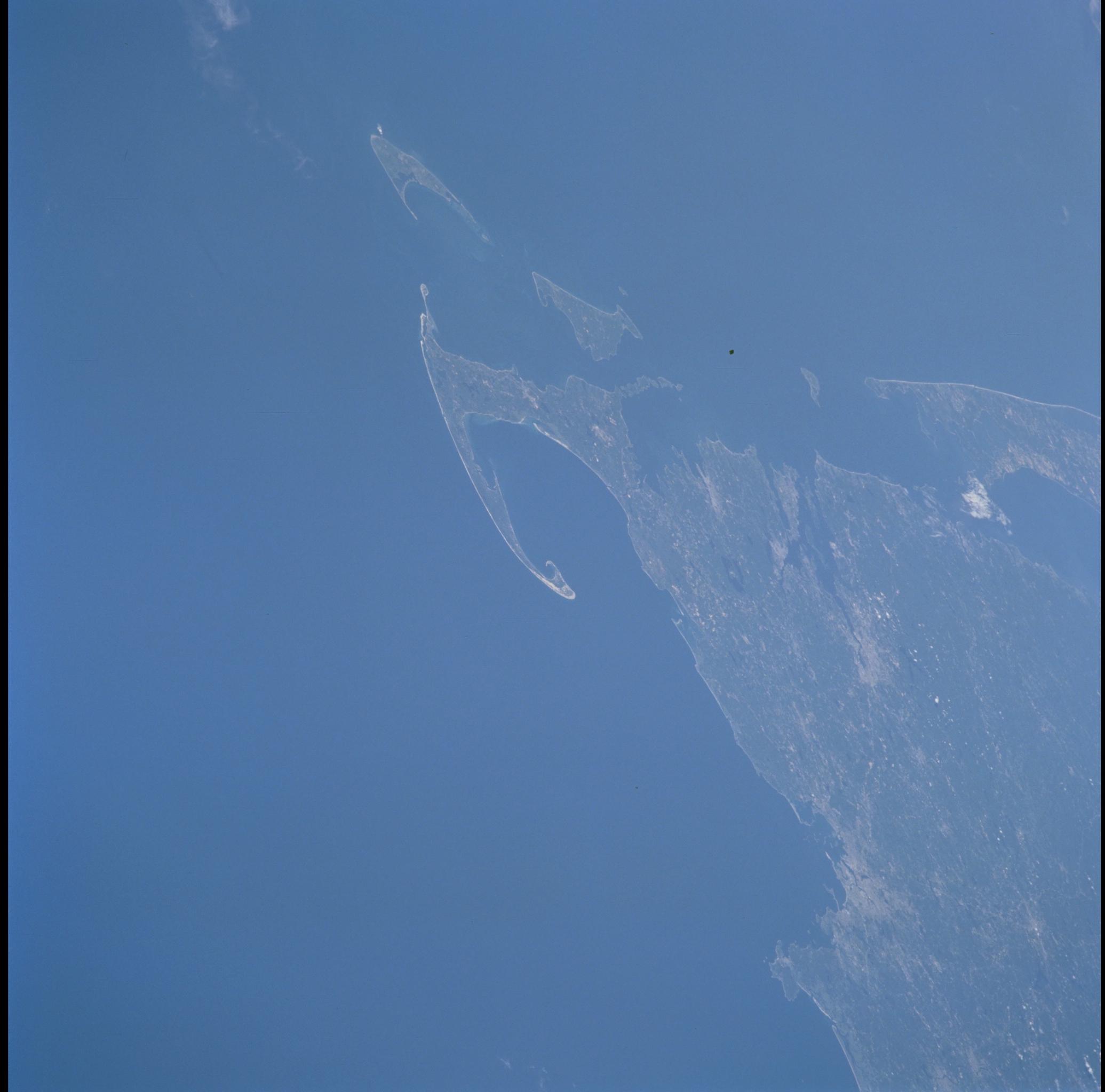
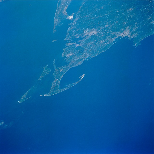
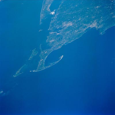
Image Caption: Cape Cod, Massachusetts
The sandy peninsula of Cape Cod can be seen in this west-looking view. The view is oblique enough that there is some spatial distortion and foreshortening. Cape Cod is 65 miles (105 km) long and varies in width from 1 to 20 miles (1.6 to 32 km). A major recreational area, much of Cape Cod is part of the United States National Park system. West of the peninsula of Cape Cod is Cape Cod Bay. To the south, the islands of Martha's Vineyard (larger island) and Nantucket are visible. Near the upper center of the image, eastern Long Island can be seen. The large metropolitan areas of Providence (near the center of the image) and Boston (right center) are discernible. It is at the northern tip of Cape Cod near the present small city of Provincetown where the pilgrims landed in 1620.
The sandy peninsula of Cape Cod can be seen in this west-looking view. The view is oblique enough that there is some spatial distortion and foreshortening. Cape Cod is 65 miles (105 km) long and varies in width from 1 to 20 miles (1.6 to 32 km). A major recreational area, much of Cape Cod is part of the United States National Park system. West of the peninsula of Cape Cod is Cape Cod Bay. To the south, the islands of Martha's Vineyard (larger island) and Nantucket are visible. Near the upper center of the image, eastern Long Island can be seen. The large metropolitan areas of Providence (near the center of the image) and Boston (right center) are discernible. It is at the northern tip of Cape Cod near the present small city of Provincetown where the pilgrims landed in 1620.
