STS104-704-78

| NASA Photo ID | STS104-704-78 |
| Focal Length | 250mm |
| Date taken | 2001.07.16 |
| Time taken | 21:44:26 GMT |
Resolutions offered for this image:
1031 x 1024 pixels 2067 x 2048 pixels 4135 x 4096 pixels 515 x 512 pixels 4096 x 4096 pixels 640 x 640 pixels 400 x 400 pixels
1031 x 1024 pixels 2067 x 2048 pixels 4135 x 4096 pixels 515 x 512 pixels 4096 x 4096 pixels 640 x 640 pixels 400 x 400 pixels


Cloud masks available for this image:
Spacecraft nadir point: 20.8° N, 160.1° W
Photo center point: 20.0° N, 155.5° W
Photo center point by machine learning:
Photo center point: 20.0° N, 155.5° W
Photo center point by machine learning:
Nadir to Photo Center: East
Spacecraft Altitude: 207 nautical miles (383km)
Country or Geographic Name: | USA-HAWAII |
Features: | BIG ISLAND |
| Features Found Using Machine Learning: | |
Cloud Cover Percentage: | 50 (26-50)% |
Sun Elevation Angle: | 75° |
Sun Azimuth: | 85° |
Camera: | Hasselblad |
Focal Length: | 250mm |
Camera Tilt: | 54 degrees |
Format: | 5069: Kodak Elite 100S, E6 Reversal, Replaces Lumiere, Warmer in tone vs. Lumiere |
Film Exposure: | |
| Additional Information | |
| Width | Height | Annotated | Cropped | Purpose | Links |
|---|---|---|---|---|---|
| 1031 pixels | 1024 pixels | No | No | Download Image | |
| 2067 pixels | 2048 pixels | No | No | Download Image | |
| 4135 pixels | 4096 pixels | No | No | Download Image | |
| 515 pixels | 512 pixels | No | No | Download Image | |
| 4096 pixels | 4096 pixels | No | No | Public Affairs Office (PAO) | Download Image |
| 640 pixels | 640 pixels | No | No | Public Affairs Office (PAO) | Download Image |
| 400 pixels | 400 pixels | No | No | Photographic Highlights | Download Image |
Download Packaged File
Download a Google Earth KML for this Image
View photo footprint information
Download a GeoTIFF for this photo
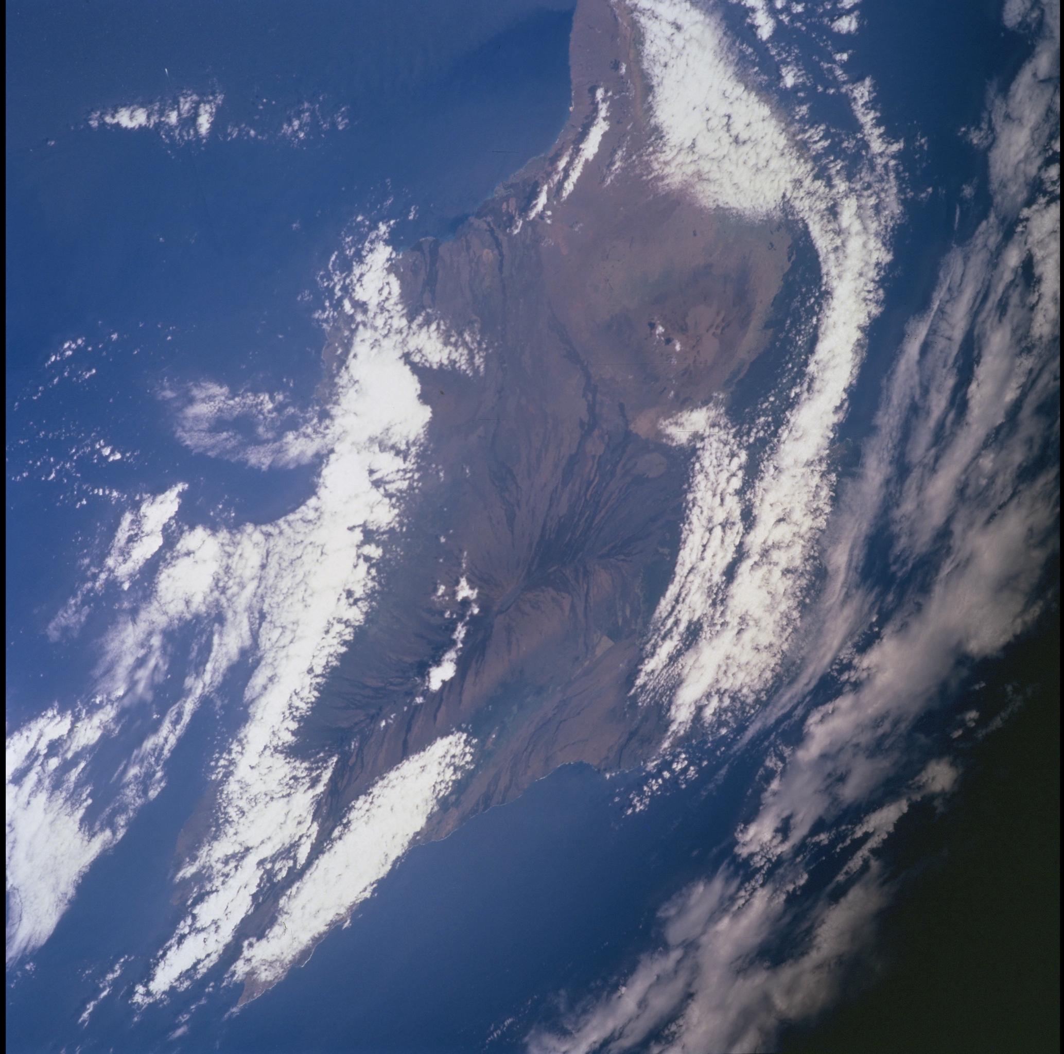
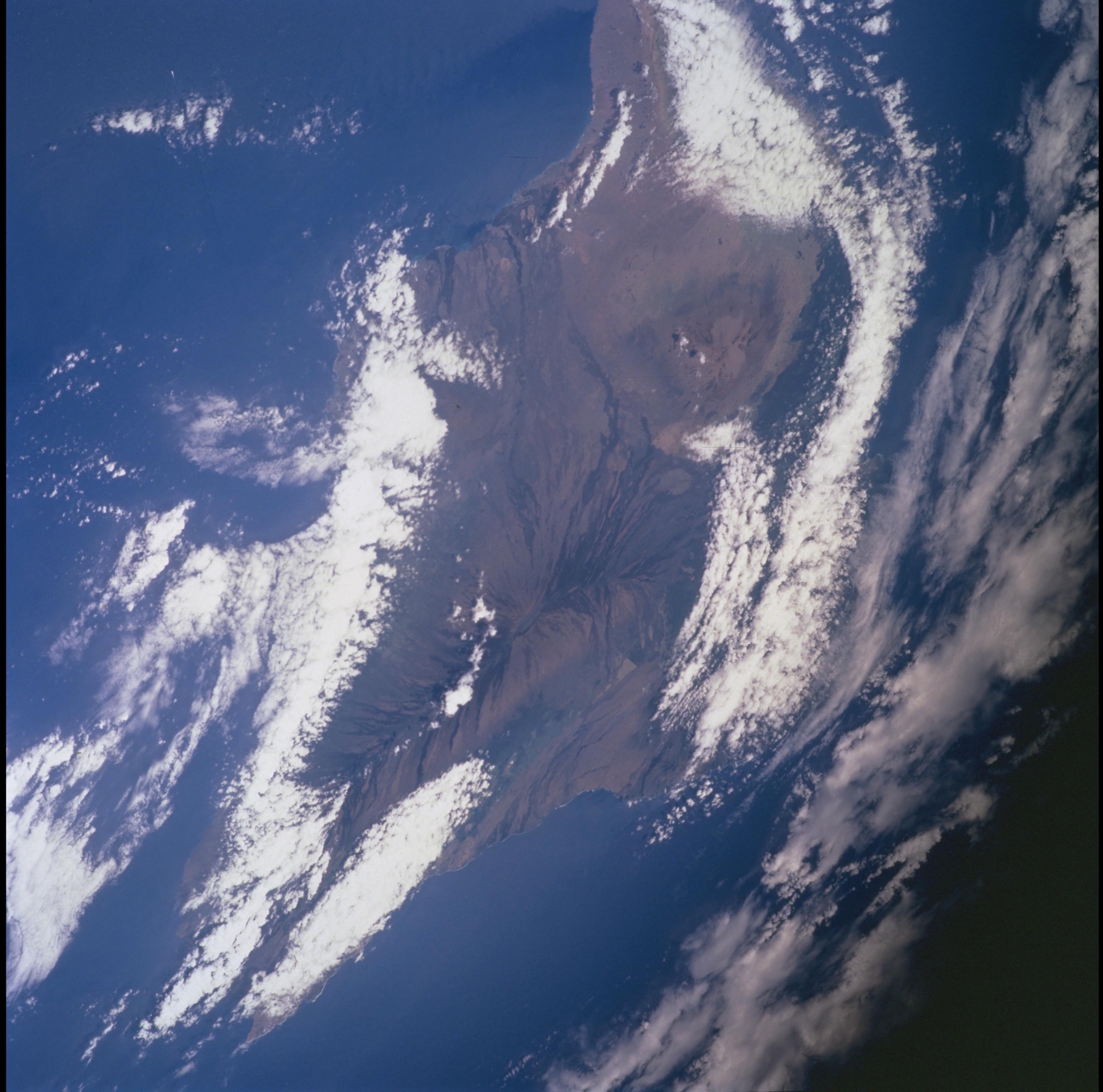
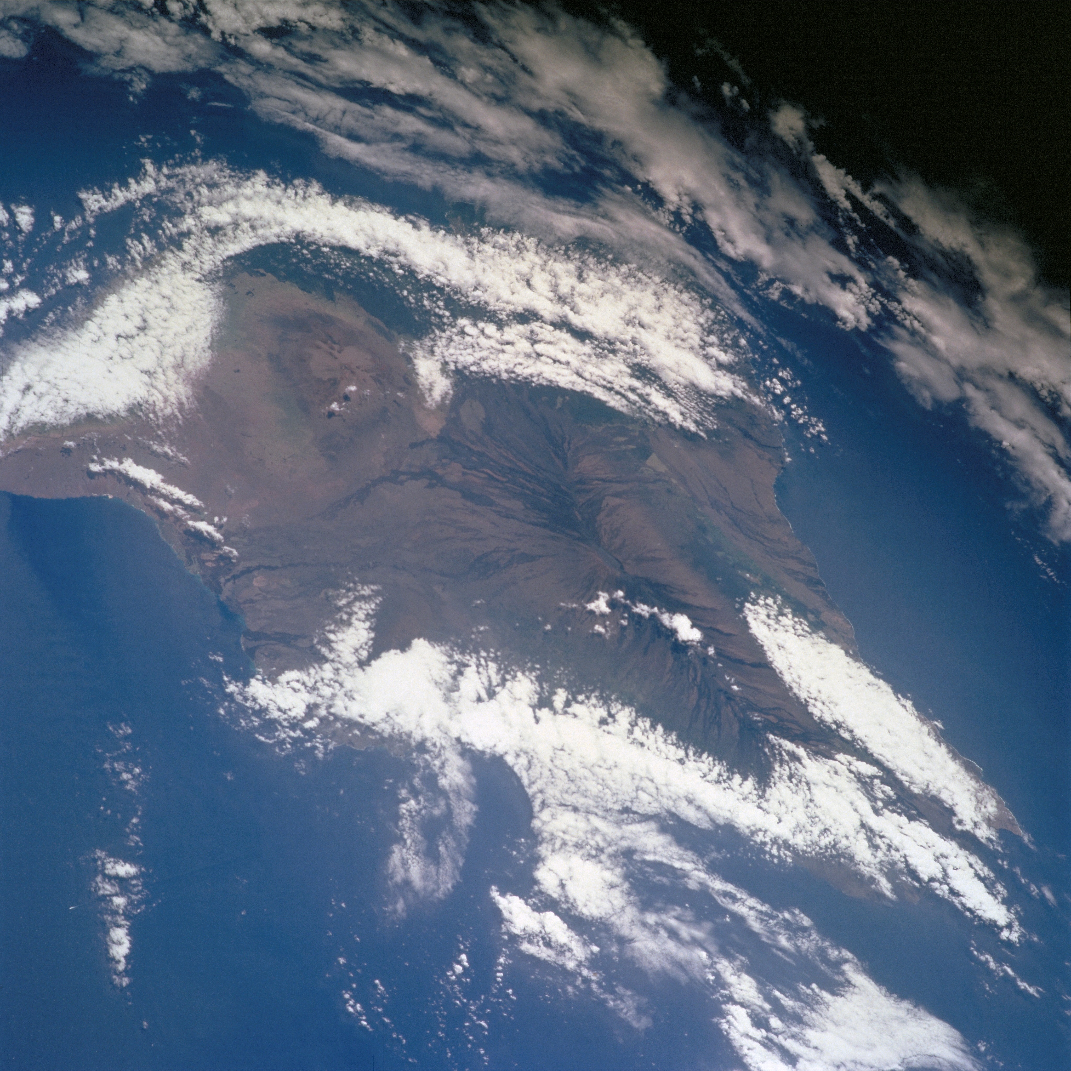
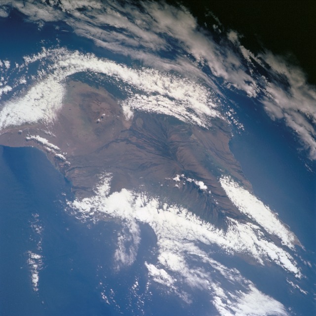
Image Caption: Mauna Kea and Mauna Loa, Hawaii
The Big Island of Hawaii is almost completely enshrouded by clouds at the lower coastal elevations while the tall volcanoes of Mauna Kea and Mauna Loa are visible above the clouds in this east-looking view. The Hawaiian Islands began to form over 30 million years ago as the Pacific Plate moved northwest over a stationary "hot spot". Formation of the Big Island of Hawaii began over 1 million years ago. Mauna Kea, now an extinct shield volcano (upper left of center of the image), rises to 13796 feet (4260 meters). It is the world's tallest mountain from its base on the ocean floor to its summit and measures 31796 feet (9698 meters). Mauna Loa (center of the image) with its numerous dark looking lava flows descending from its summit in all directions, is the world's tallest active volcano at 13677 feet (4170 meters). A shield volcano, Mauna Loa is the most massive mountain on earth measuring 10000 cubic miles (41700 cubic km), more that 100 times the size of Mount Rainier in Washington state. Mauna Loa has erupted 37 times since 1832, the last in 1984.
The Big Island of Hawaii is almost completely enshrouded by clouds at the lower coastal elevations while the tall volcanoes of Mauna Kea and Mauna Loa are visible above the clouds in this east-looking view. The Hawaiian Islands began to form over 30 million years ago as the Pacific Plate moved northwest over a stationary "hot spot". Formation of the Big Island of Hawaii began over 1 million years ago. Mauna Kea, now an extinct shield volcano (upper left of center of the image), rises to 13796 feet (4260 meters). It is the world's tallest mountain from its base on the ocean floor to its summit and measures 31796 feet (9698 meters). Mauna Loa (center of the image) with its numerous dark looking lava flows descending from its summit in all directions, is the world's tallest active volcano at 13677 feet (4170 meters). A shield volcano, Mauna Loa is the most massive mountain on earth measuring 10000 cubic miles (41700 cubic km), more that 100 times the size of Mount Rainier in Washington state. Mauna Loa has erupted 37 times since 1832, the last in 1984.
