STS103-734-20

| NASA Photo ID | STS103-734-20 |
| Focal Length | 40mm |
| Date taken | 1999.12.25 |
| Time taken | 17:00:30 GMT |
Resolutions offered for this image:
1031 x 1024 pixels 2063 x 2048 pixels 2567 x 2048 pixels 515 x 512 pixels 3277 x 3521 pixels 595 x 639 pixels
1031 x 1024 pixels 2063 x 2048 pixels 2567 x 2048 pixels 515 x 512 pixels 3277 x 3521 pixels 595 x 639 pixels
Cloud masks available for this image:
Spacecraft nadir point: 24.9° N, 20.9° W
Photo center point: 22.0° N, 19.0° W
Photo center point by machine learning:
Photo center point: 22.0° N, 19.0° W
Photo center point by machine learning:
Nadir to Photo Center: Southeast
Spacecraft Altitude: 316 nautical miles (585km)
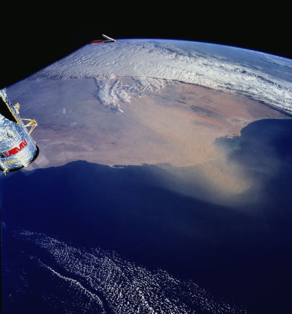
Country or Geographic Name: | WESTERN SAHARA |
Features: | PAN-DUST STORM, COAST |
| Features Found Using Machine Learning: | |
Cloud Cover Percentage: | 25 (11-25)% |
Sun Elevation Angle: | 19° |
Sun Azimuth: | 232° |
Camera: | Hasselblad |
Focal Length: | 40mm |
Camera Tilt: | High Oblique |
Format: | 5069: Kodak Elite 100S, E6 Reversal, Replaces Lumiere, Warmer in tone vs. Lumiere |
Film Exposure: | |
| Additional Information | |
| Width | Height | Annotated | Cropped | Purpose | Links |
|---|---|---|---|---|---|
| 1031 pixels | 1024 pixels | No | No | Download Image | |
| 2063 pixels | 2048 pixels | No | No | Download Image | |
| 2567 pixels | 2048 pixels | No | No | Download Image | |
| 515 pixels | 512 pixels | No | No | Download Image | |
| 3277 pixels | 3521 pixels | No | No | Public Affairs Office (PAO) | Download Image |
| 595 pixels | 639 pixels | No | No | Public Affairs Office (PAO) | Download Image |
Download Packaged File
Download a Google Earth KML for this Image
View photo footprint information
Download a GeoTIFF for this photo
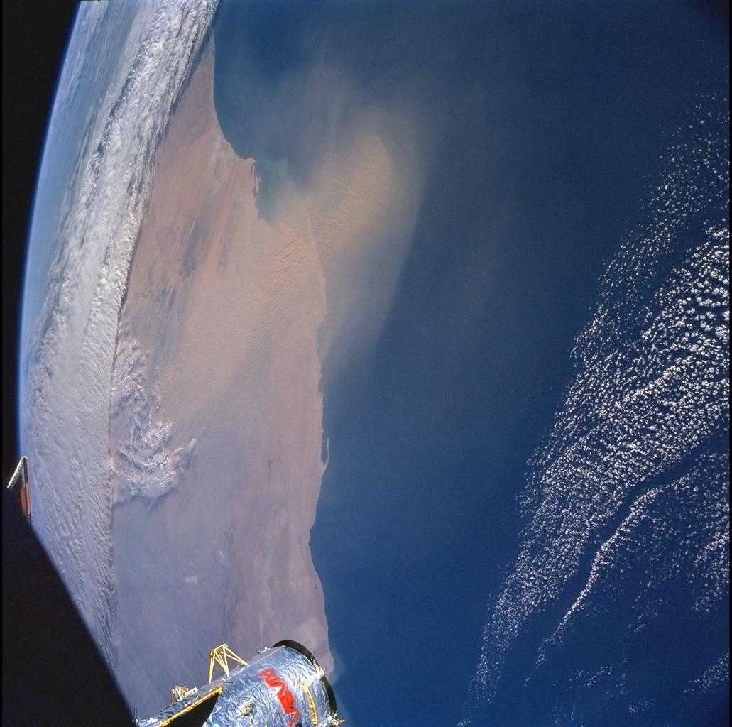
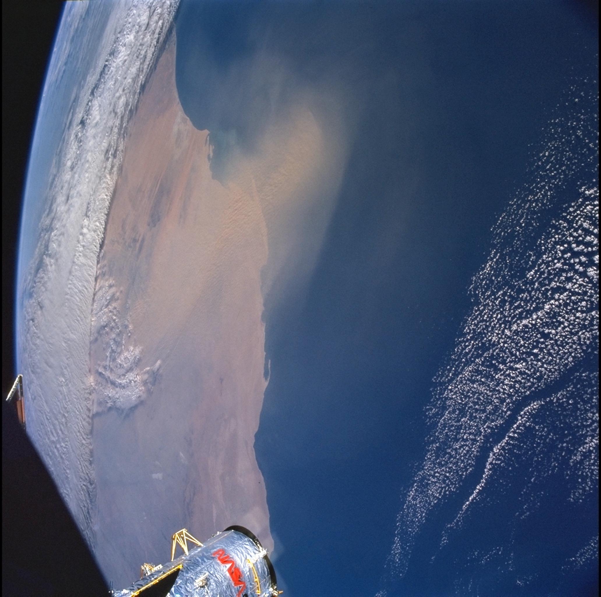
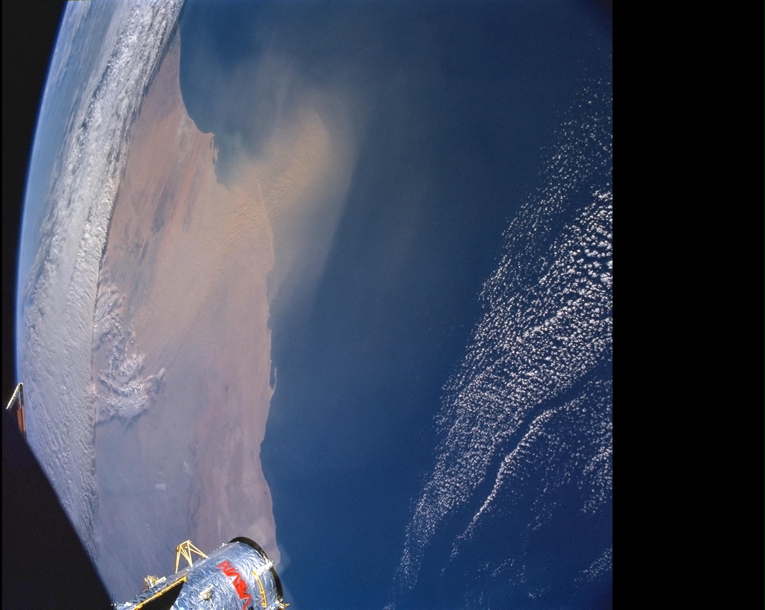
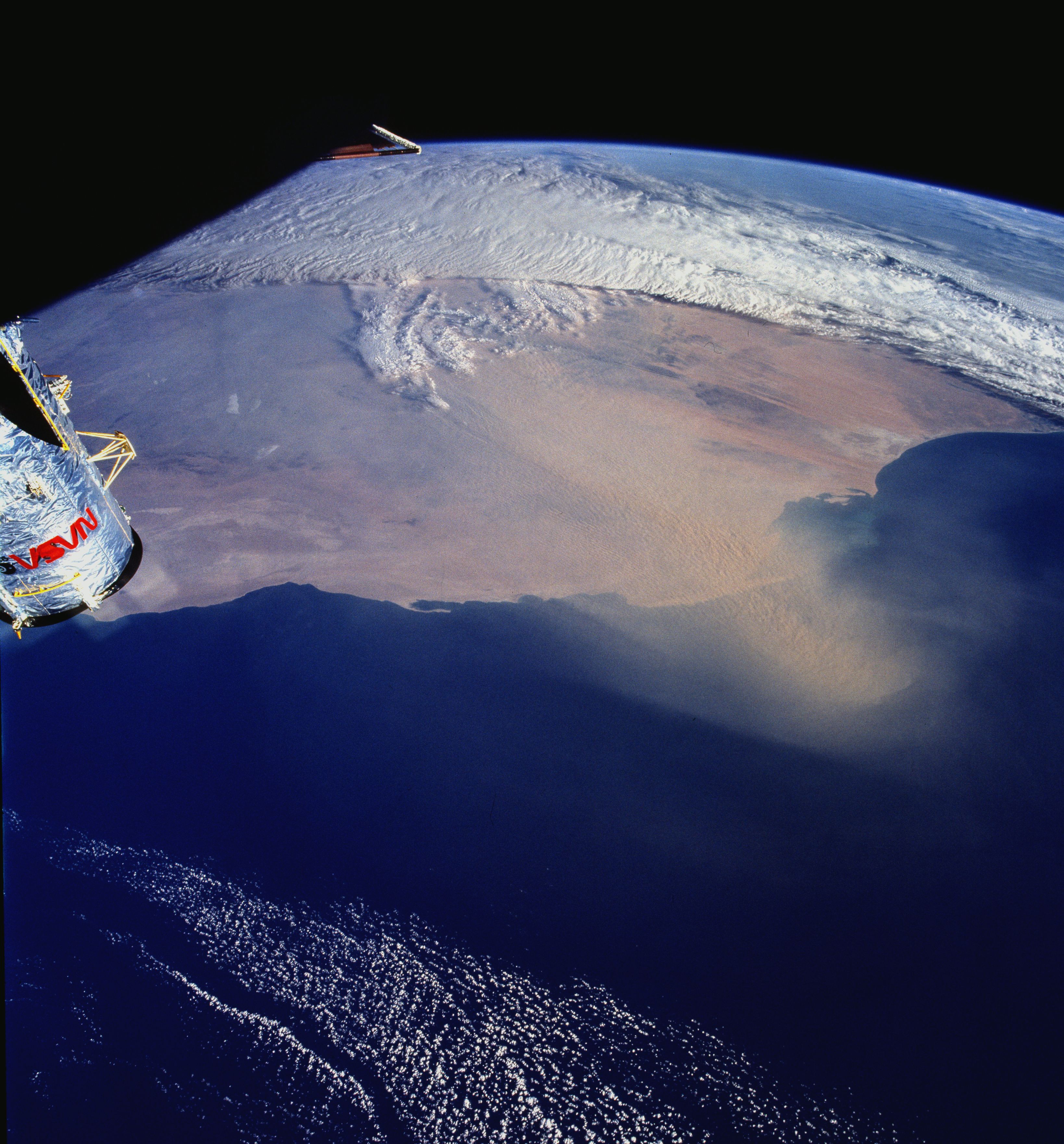
Image Caption: Hot, dry winds that blow out of the northeast or east primarily during the winter are the
probable cause for the dust blowing out of Mauritania and into the Atlantic Ocean. These
clouds of dust can extend several hundreds of kilometers out into the Atlantic. The winds
are part of a low pressure center that forms on the northern coast of the Gulf of Guinea.
probable cause for the dust blowing out of Mauritania and into the Atlantic Ocean. These
clouds of dust can extend several hundreds of kilometers out into the Atlantic. The winds
are part of a low pressure center that forms on the northern coast of the Gulf of Guinea.
