STS103-710-84
| NASA Photo ID | STS103-710-84 |
| Focal Length | 40mm |
| Date taken | 1999.12.24 |
| Time taken | 15:16:26 GMT |
Resolutions offered for this image:
2050 x 2048 pixels 4100 x 4096 pixels 515 x 514 pixels 1028 x 1024 pixels 514 x 512 pixels 1532 x 1535 pixels 638 x 639 pixels
2050 x 2048 pixels 4100 x 4096 pixels 515 x 514 pixels 1028 x 1024 pixels 514 x 512 pixels 1532 x 1535 pixels 638 x 639 pixels


Cloud masks available for this image:
Spacecraft nadir point: 25.0° N, 13.5° E
Photo center point: 28.0° N, 6.0° E
Photo center point by machine learning:
Photo center point: 28.0° N, 6.0° E
Photo center point by machine learning:
Nadir to Photo Center: West
Spacecraft Altitude: 316 nautical miles (585km)
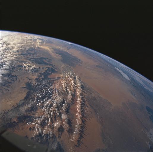
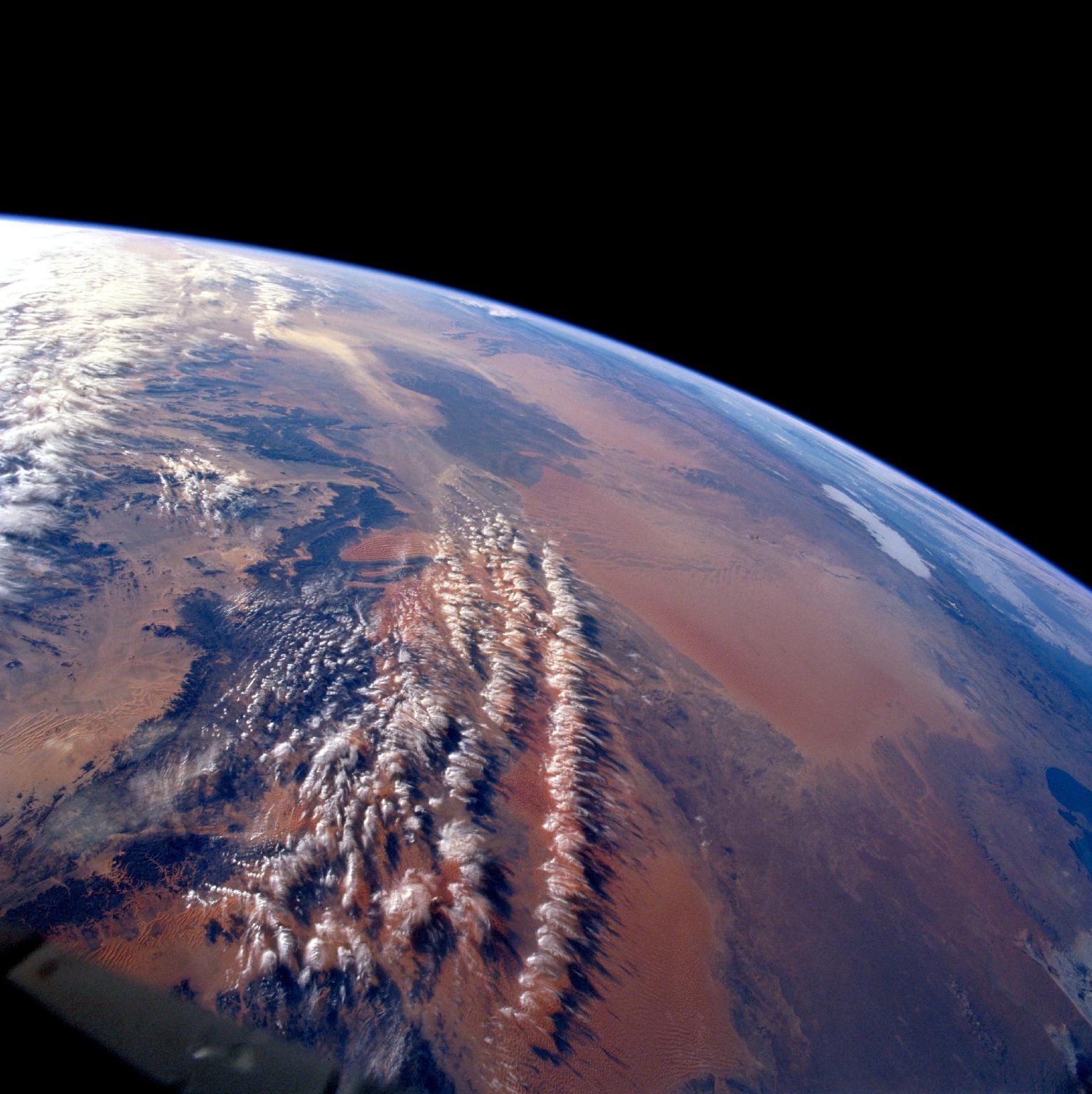
Country or Geographic Name: | ALGERIA |
Features: | PAN-GRAND ERG ORIENTAL |
| Features Found Using Machine Learning: | |
Cloud Cover Percentage: | 25 (11-25)% |
Sun Elevation Angle: | 12° |
Sun Azimuth: | 237° |
Camera: | Hasselblad |
Focal Length: | 40mm |
Camera Tilt: | High Oblique |
Format: | 5069: Kodak Elite 100S, E6 Reversal, Replaces Lumiere, Warmer in tone vs. Lumiere |
Film Exposure: | |
| Additional Information | |
| Width | Height | Annotated | Cropped | Purpose | Links |
|---|---|---|---|---|---|
| 2050 pixels | 2048 pixels | No | No | Download Image | |
| 4100 pixels | 4096 pixels | No | No | Download Image | |
| 515 pixels | 514 pixels | No | No | Download Image | |
| 1028 pixels | 1024 pixels | No | No | Public Affairs Office (PAO) | Download Image |
| 514 pixels | 512 pixels | No | No | Public Affairs Office (PAO) | Download Image |
| 1532 pixels | 1535 pixels | Download Image | |||
| 638 pixels | 639 pixels | Download Image |
Download Packaged File
Download a Google Earth KML for this Image
View photo footprint information
Download a GeoTIFF for this photo
Image Caption: Two great sand seas occupy northern Algeria, Grand Erg Oriental (Eastern Sand Sea) and Grand Erg
Occidental (Western Sand Sea). Both sand seas occupy depressions that are separated by a north-south rise
called Mizab. Ergs are areas of large accumulations of sand that take the form of actively shifting dunes,
fossilized dunes, or extensive sand sheets.
Occidental (Western Sand Sea). Both sand seas occupy depressions that are separated by a north-south rise
called Mizab. Ergs are areas of large accumulations of sand that take the form of actively shifting dunes,
fossilized dunes, or extensive sand sheets.
