STS102-344-23
| NASA Photo ID | STS102-344-23 |
| Focal Length | mm |
| Date taken | 2001.03.18 |
| Time taken | 07:33:05 GMT |
Resolutions offered for this image:
540 x 347 pixels 1362 x 874 pixels 640 x 426 pixels 1362 x 874 pixels 400 x 257 pixels
540 x 347 pixels 1362 x 874 pixels 640 x 426 pixels 1362 x 874 pixels 400 x 257 pixels

Cloud masks available for this image:
Spacecraft nadir point: 35.6° N, 43.2° E
Photo center point: 39.5° N, 44.5° E
Photo center point by machine learning:
Photo center point: 39.5° N, 44.5° E
Photo center point by machine learning:
Nadir to Photo Center: North
Spacecraft Altitude: 205 nautical miles (380km)
Country or Geographic Name: | TURKEY |
Features: | MT. ARARAT, SNOW |
| Features Found Using Machine Learning: | |
Cloud Cover Percentage: | 10 (1-10)% |
Sun Elevation Angle: | 47° |
Sun Azimuth: | 141° |
Camera: | |
Focal Length: | mm |
Camera Tilt: | 50 degrees |
Format: | |
Film Exposure: | |
| Additional Information | |
| Width | Height | Annotated | Cropped | Purpose | Links |
|---|---|---|---|---|---|
| 540 pixels | 347 pixels | Yes | Yes | Earth From Space collection | Download Image |
| 1362 pixels | 874 pixels | No | Yes | NASA's Earth Observatory web site | Download Image |
| 640 pixels | 426 pixels | No | No | Download Image | |
| 1362 pixels | 874 pixels | No | No | Download Image | |
| 400 pixels | 257 pixels | Yes | Photographic Highlights | Download Image |
Download Packaged File
Download a Google Earth KML for this Image
View photo footprint information
Download a GeoTIFF for this photo
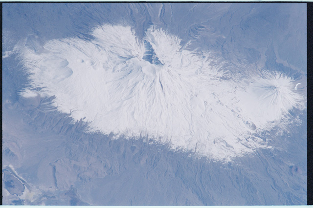
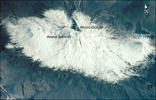
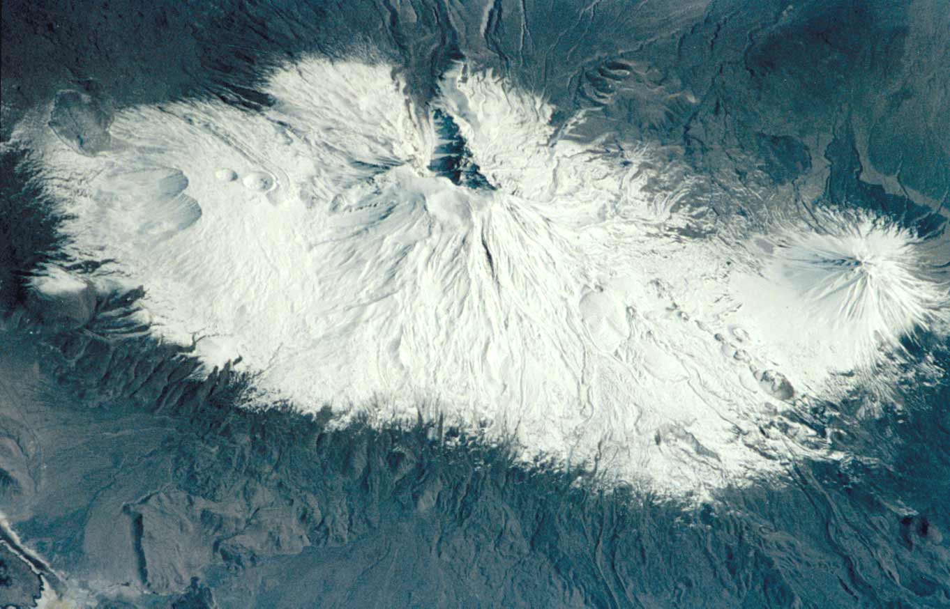
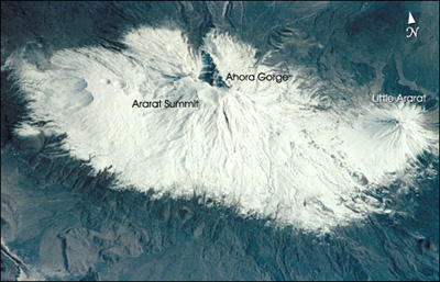
Image Caption: Mount Ararat (16,940 feet, 5165 m) is the largest volcano in Turkey. Although not currently active, its most recent eruption has probably been within the last 10,000 years. It is located in extreme northeastern Turkey, near the borders with Iran and Armenia. Southwest of the main peak lies Little Ararat ( 12,877 feet, 3896 m). Ahora Gorge is a northeast-trending chasm dropping 6000 feet from the top of the mountain and was the focus of a major earthquake in 1840. A number of claims by different explorers to have found remnants of Noah's Ark on Mt. Ararat have led to continuing expeditions to the mountain, many of which have focused their searches on the gorge area.
