STS102-303-17

| NASA Photo ID | STS102-303-17 |
| Focal Length | 110mm |
| Date taken | 2001.03.18 |
| Time taken | 09:09:21 GMT |
Resolutions offered for this image:
540 x 420 pixels 2970 x 1960 pixels 3070 x 2044 pixels 400 x 264 pixels 640 x 426 pixels
540 x 420 pixels 2970 x 1960 pixels 3070 x 2044 pixels 400 x 264 pixels 640 x 426 pixels

Cloud masks available for this image:
Spacecraft nadir point: 24.7° N, 31.9° E
Photo center point: 24.0° N, 33.0° E
Photo center point by machine learning:
Photo center point: 24.0° N, 33.0° E
Photo center point by machine learning:
Nadir to Photo Center: Southeast
Spacecraft Altitude: 205 nautical miles (380km)
Country or Geographic Name: | EGYPT |
Features: | ASWAN HIGH DAM, LAKE NASSER |
| Features Found Using Machine Learning: | |
Cloud Cover Percentage: | 10 (1-10)% |
Sun Elevation Angle: | 62° |
Sun Azimuth: | 152° |
Camera: | Nikon 35mm film camera |
Focal Length: | 110mm |
Camera Tilt: | 21 degrees |
Format: | |
Film Exposure: | |
| Additional Information | |
| Width | Height | Annotated | Cropped | Purpose | Links |
|---|---|---|---|---|---|
| 540 pixels | 420 pixels | Yes | Yes | Earth From Space collection | Download Image |
| 2970 pixels | 1960 pixels | No | No | Download Image | |
| 3070 pixels | 2044 pixels | No | No | Scientist Request | Download Image |
| 400 pixels | 264 pixels | No | No | Photographic Highlights | Download Image |
| 640 pixels | 426 pixels | No | No | Download Image |
Download Packaged File
Download a Google Earth KML for this Image
View photo footprint information
Download a GeoTIFF for this photo
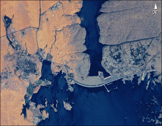
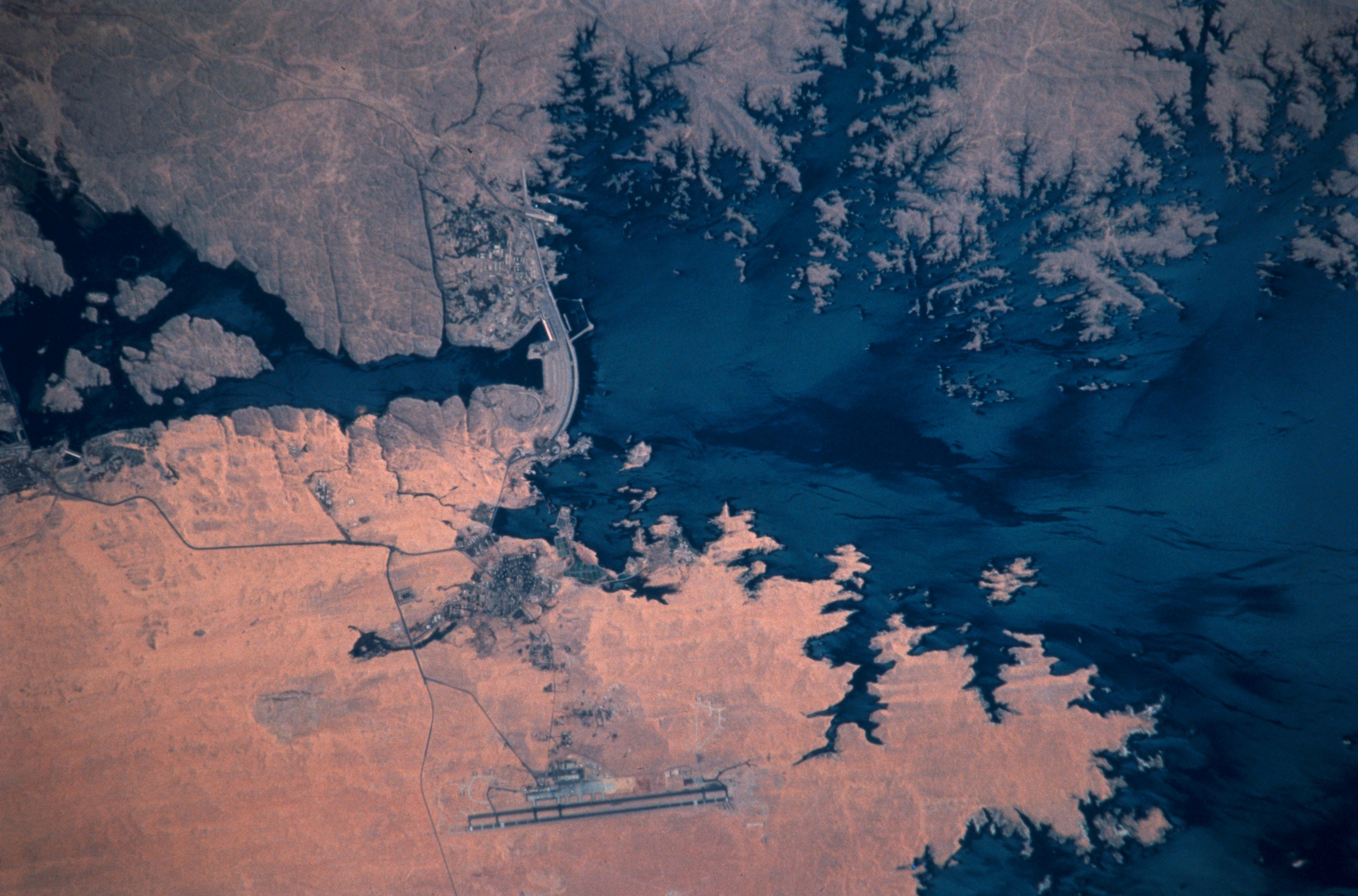
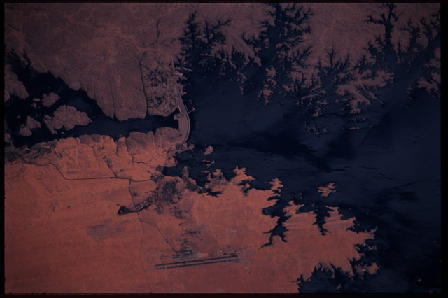
Image Caption: STS102-303-17 Aswan High Dam, Egypt
The Aswan High Dam was completed in 1970 and is one of the largest earthen embankment dams in the world. It is 364 feet (111 m) tall, 12 565 feet (3830 m) long and nearly 3281 feet (1000 m) wide. When it was built the new reservoir required relocation of nearly 100 000 residents and some archaeological sites. Although the reservoir has benefited Egypt by providing power and controlling floods, it has also had detrimental effects on the Nile system. Before the dam, an estimated 110 million tons of silt was deposited by the annual flood of the Nile, enriching agricultural lands and maintaining the land of the Nile delta. Now this sediment is trapped behind the dam, requiring artificial fertilization of agricultural lands and leading to erosion and saltwater intrusion where the Nile river meets the Mediterranean Sea.
The Aswan High Dam was completed in 1970 and is one of the largest earthen embankment dams in the world. It is 364 feet (111 m) tall, 12 565 feet (3830 m) long and nearly 3281 feet (1000 m) wide. When it was built the new reservoir required relocation of nearly 100 000 residents and some archaeological sites. Although the reservoir has benefited Egypt by providing power and controlling floods, it has also had detrimental effects on the Nile system. Before the dam, an estimated 110 million tons of silt was deposited by the annual flood of the Nile, enriching agricultural lands and maintaining the land of the Nile delta. Now this sediment is trapped behind the dam, requiring artificial fertilization of agricultural lands and leading to erosion and saltwater intrusion where the Nile river meets the Mediterranean Sea.
