STS101-715-70

| NASA Photo ID | STS101-715-70 |
| Focal Length | 250mm |
| Date taken | 2000.05.21 |
| Time taken | 10:32:10 GMT |
Resolutions offered for this image:
1031 x 1024 pixels 4064 x 4064 pixels 2063 x 2048 pixels 4127 x 4096 pixels 515 x 512 pixels
1031 x 1024 pixels 4064 x 4064 pixels 2063 x 2048 pixels 4127 x 4096 pixels 515 x 512 pixels


Cloud masks available for this image:
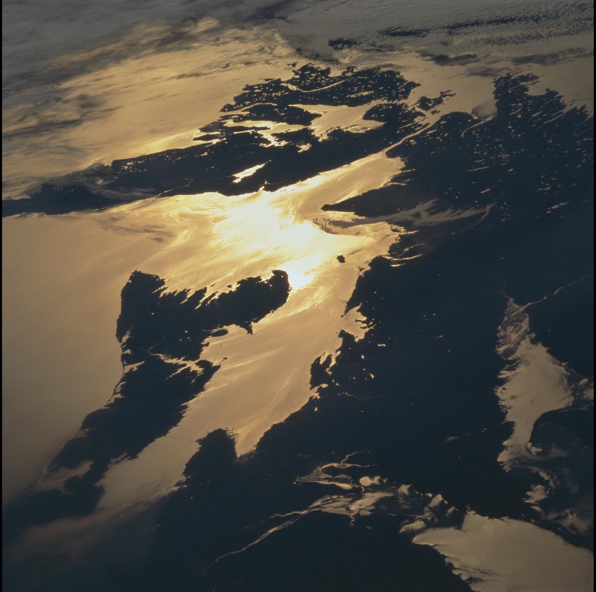
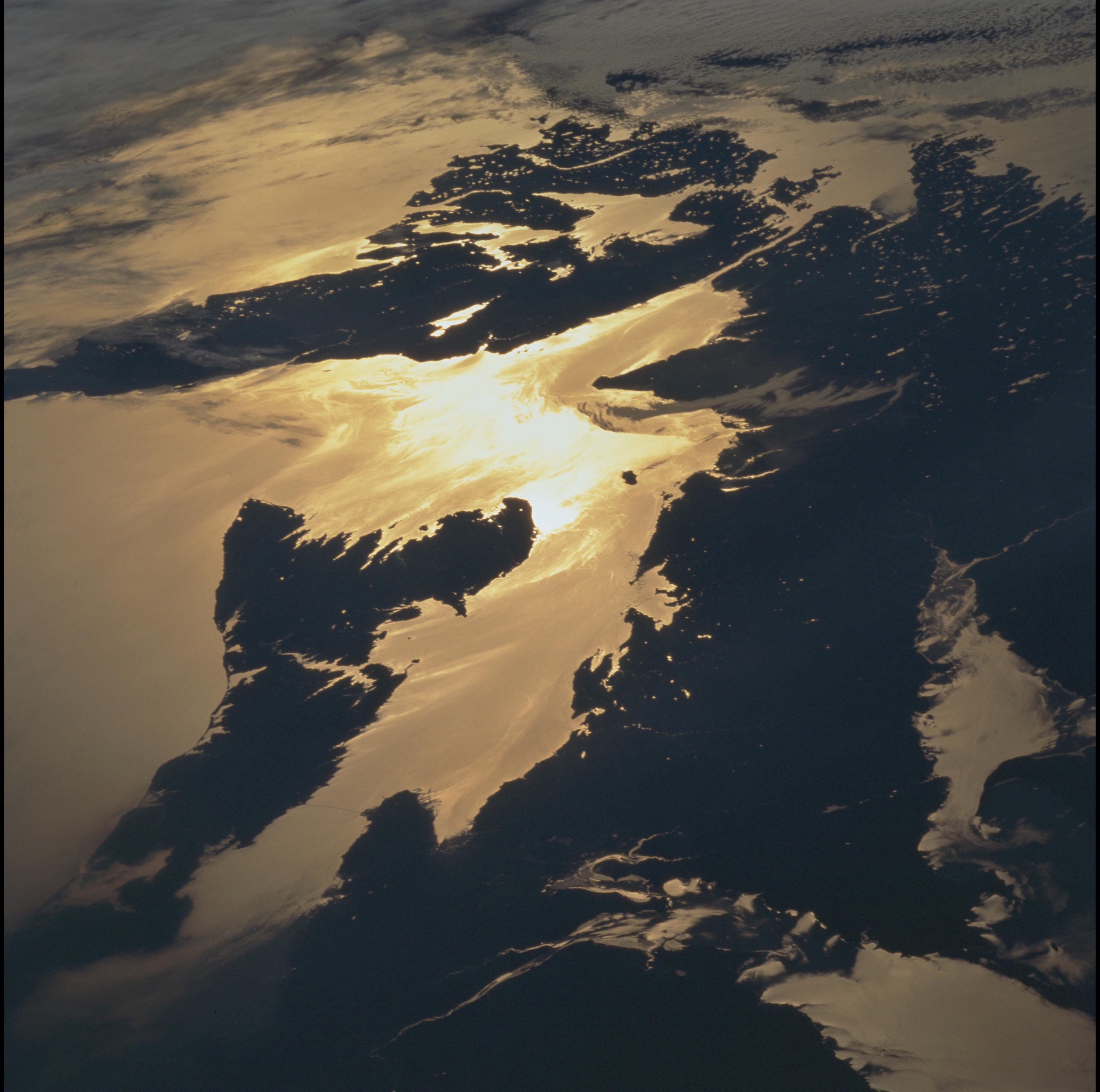
Spacecraft nadir point: 43.9° N, 72.8° W
Photo center point: 46.0° N, 62.5° W
Photo center point by machine learning:
Photo center point: 46.0° N, 62.5° W
Photo center point by machine learning:
Nadir to Photo Center: East
Spacecraft Altitude: 178 nautical miles (330km)
Country or Geographic Name: | CANADA-NS |
Features: | NORTHUMBERLND STR, SNGLNT |
| Features Found Using Machine Learning: | |
Cloud Cover Percentage: | 25 (11-25)% |
Sun Elevation Angle: | 11° |
Sun Azimuth: | 73° |
Camera: | Hasselblad |
Focal Length: | 250mm |
Camera Tilt: | High Oblique |
Format: | 5069: Kodak Elite 100S, E6 Reversal, Replaces Lumiere, Warmer in tone vs. Lumiere |
Film Exposure: | |
| Additional Information | |
| Width | Height | Annotated | Cropped | Purpose | Links |
|---|---|---|---|---|---|
| 1031 pixels | 1024 pixels | No | No | Download Image | |
| 4064 pixels | 4064 pixels | No | No | Download Image | |
| 2063 pixels | 2048 pixels | No | No | Download Image | |
| 4127 pixels | 4096 pixels | No | No | Download Image | |
| 515 pixels | 512 pixels | No | No | Download Image |
Download Packaged File
Download a Google Earth KML for this Image
View photo footprint information
Download a GeoTIFF for this photo
Image Caption: View to SE down Prince Edward Island and Northumberland Strait into St. George's
Bay and Canso Strait, which separates Nova Scotia and Cape Breton Island.
Cape Breton Island is on east (left) and Nova Scotia on west.
Bay and Canso Strait, which separates Nova Scotia and Cape Breton Island.
Cape Breton Island is on east (left) and Nova Scotia on west.
