STS100-716-108

| NASA Photo ID | STS100-716-108 |
| Focal Length | 250mm |
| Date taken | 2001.04.28 |
| Time taken | 15:43:37 GMT |
Resolutions offered for this image:
1031 x 1024 pixels 2063 x 2048 pixels 4127 x 4096 pixels 400 x 400 pixels 515 x 512 pixels 639 x 639 pixels
1031 x 1024 pixels 2063 x 2048 pixels 4127 x 4096 pixels 400 x 400 pixels 515 x 512 pixels 639 x 639 pixels


Cloud masks available for this image:
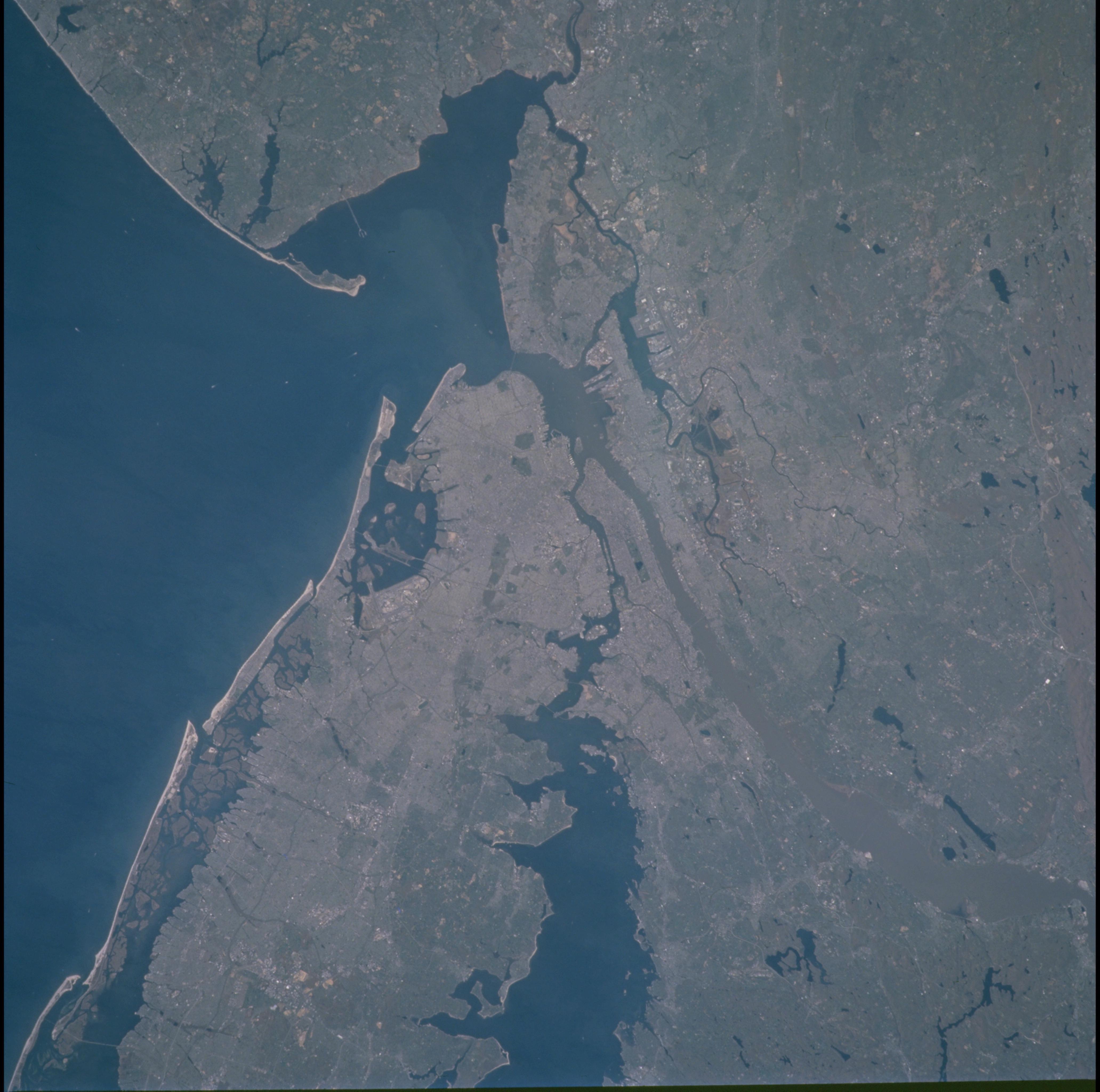
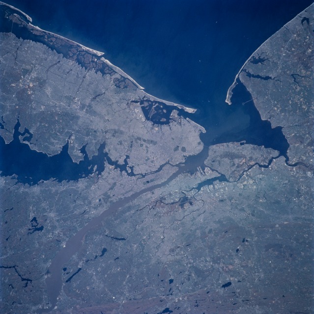
Spacecraft nadir point: 39.1° N, 74.4° W
Photo center point: 41.0° N, 73.5° W
Photo center point by machine learning:
Photo center point: 41.0° N, 73.5° W
Photo center point by machine learning:
Nadir to Photo Center: North
Spacecraft Altitude: 206 nautical miles (382km)
Country or Geographic Name: | USA-NEW YORK |
Features: | NEW YORK CITY AREA |
| Features Found Using Machine Learning: | |
Cloud Cover Percentage: | 10 (1-10)% |
Sun Elevation Angle: | 61° |
Sun Azimuth: | 142° |
Camera: | Hasselblad |
Focal Length: | 250mm |
Camera Tilt: | 31 degrees |
Format: | 5069: Kodak Elite 100S, E6 Reversal, Replaces Lumiere, Warmer in tone vs. Lumiere |
Film Exposure: | |
| Additional Information | |
| Width | Height | Annotated | Cropped | Purpose | Links |
|---|---|---|---|---|---|
| 1031 pixels | 1024 pixels | No | No | Download Image | |
| 2063 pixels | 2048 pixels | No | No | Download Image | |
| 4127 pixels | 4096 pixels | No | No | Download Image | |
| 400 pixels | 400 pixels | No | No | Photographic Highlights | Download Image |
| 515 pixels | 512 pixels | No | No | Download Image | |
| 639 pixels | 639 pixels | No | No | Public Affairs Office (PAO) | Download Image |
Download Packaged File
Download a Google Earth KML for this Image
View photo footprint information
Download a GeoTIFF for this photo
Image Caption: This near-vertical view shows one of the most dynamic cities in the world, New York. With a population in the metropolitan New York of 11,685,650, and in the city of 8,008,278 (March 2001), the New York City area is one of the leading commercial, financial, cultural, and communication centers in the world. The sediment-laden Hudson River enters the scene near the bottom left (north) of the image and can be seen flowing south emptying into Upper and Lower New York Bays (right of center of the image). Long Island is visible extending to the east at the upper left of the image. Right (west) of the Hudson River, the state of New Jersey and the Newark metropolitan area are visible. Sandy Hook in New Jersey can be seen in the upper right quadrant of the image.
