STS100-713-64

| NASA Photo ID | STS100-713-64 |
| Focal Length | 250mm |
| Date taken | 2001.04.24 |
| Time taken | 11:48:59 GMT |
Resolutions offered for this image:
1031 x 1024 pixels 2063 x 2048 pixels 4127 x 4096 pixels 400 x 400 pixels 515 x 512 pixels 640 x 640 pixels
1031 x 1024 pixels 2063 x 2048 pixels 4127 x 4096 pixels 400 x 400 pixels 515 x 512 pixels 640 x 640 pixels


Cloud masks available for this image:
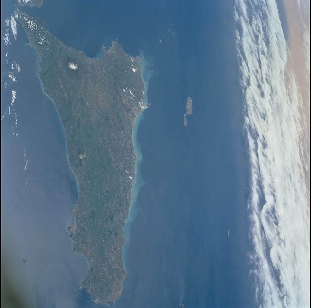
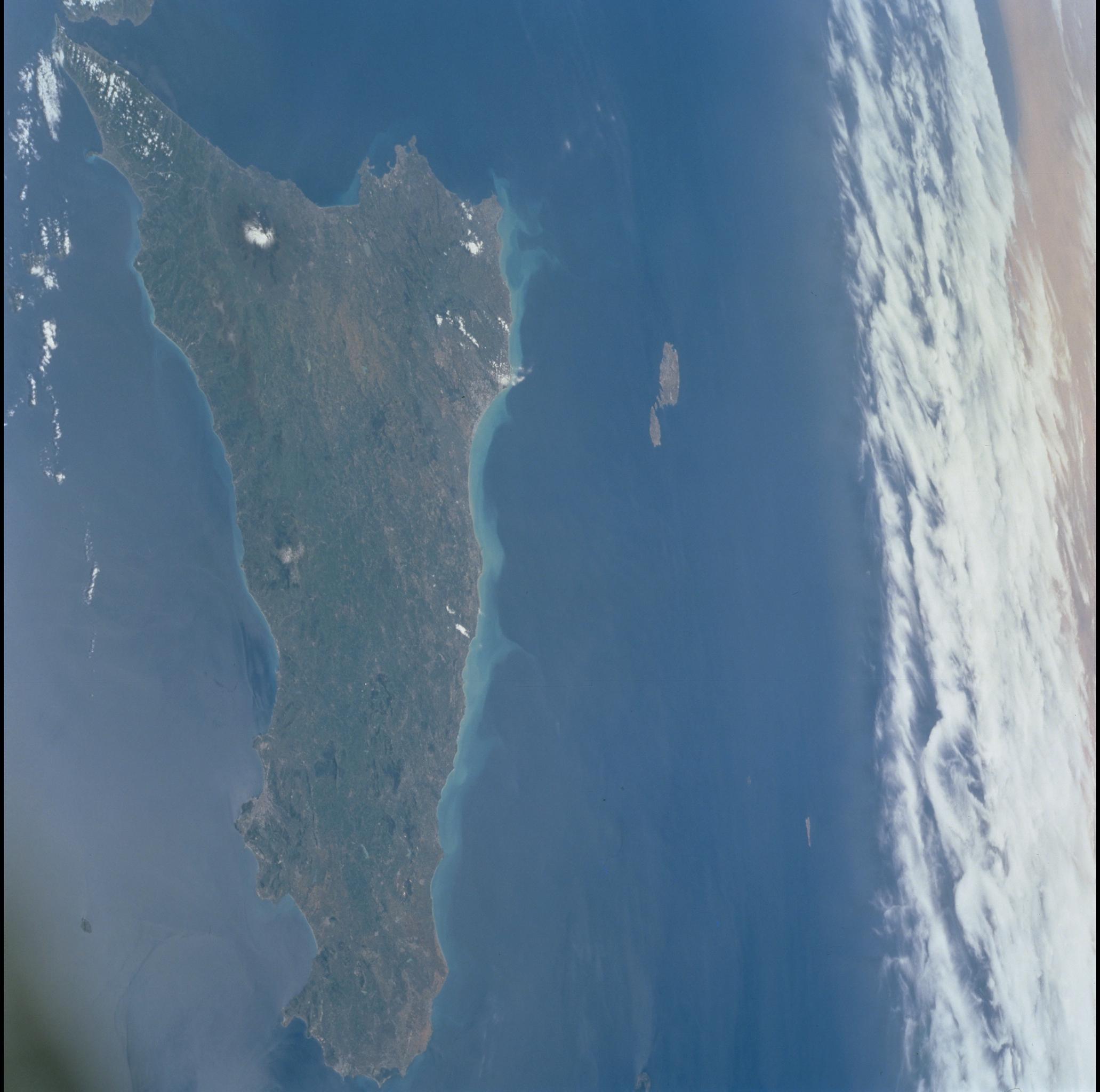
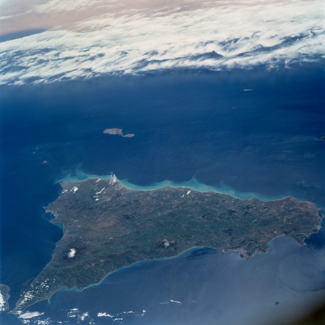
Spacecraft nadir point: 41.3° N, 13.2° E
Photo center point: 37.0° N, 14.0° E
Photo center point by machine learning:
Photo center point: 37.0° N, 14.0° E
Photo center point by machine learning:
Nadir to Photo Center: South
Spacecraft Altitude: 205 nautical miles (380km)
Country or Geographic Name: | SICILY |
Features: | ISLAND OF SICILY |
| Features Found Using Machine Learning: | |
Cloud Cover Percentage: | 25 (11-25)% |
Sun Elevation Angle: | 60° |
Sun Azimuth: | 202° |
Camera: | Hasselblad |
Focal Length: | 250mm |
Camera Tilt: | 52 degrees |
Format: | 5069: Kodak Elite 100S, E6 Reversal, Replaces Lumiere, Warmer in tone vs. Lumiere |
Film Exposure: | |
| Additional Information | |
| Width | Height | Annotated | Cropped | Purpose | Links |
|---|---|---|---|---|---|
| 1031 pixels | 1024 pixels | No | No | Download Image | |
| 2063 pixels | 2048 pixels | No | No | Download Image | |
| 4127 pixels | 4096 pixels | No | No | Download Image | |
| 400 pixels | 400 pixels | No | No | Photographic Highlights | Download Image |
| 515 pixels | 512 pixels | No | No | Download Image | |
| 640 pixels | 640 pixels | No | No | Public Affairs Office (PAO) | Download Image |
Download Packaged File
Download a Google Earth KML for this Image
View photo footprint information
Download a GeoTIFF for this photo
Image Caption: The southerly-looking view shows the triangular-shaped island of Sicily. With only very limited coastal plains the island's topography consists of rugged hills and low mountains. Snow capped Mt. Etna, one of the world's most instrumented volcanoes, is visible near the northeast point of the island. Two other distinctive features in this image are the lighter-colored zone of suspended sediment in the water along the southern coast and, in the distance, the smaller islands of Malta.
