STS098-714A-49

| NASA Photo ID | STS098-714A-49 |
| Focal Length | 100mm |
| Date taken | 2001.02.16 |
| Time taken | 22:48:30 GMT |
Resolutions offered for this image:
1031 x 1024 pixels 2063 x 2048 pixels 4127 x 4096 pixels 640 x 640 pixels 515 x 512 pixels 4096 x 4096 pixels
1031 x 1024 pixels 2063 x 2048 pixels 4127 x 4096 pixels 640 x 640 pixels 515 x 512 pixels 4096 x 4096 pixels

Cloud masks available for this image:
Spacecraft nadir point: 37.9° N, 115.9° W
Photo center point: 36.5° N, 112.0° W
Photo center point by machine learning:
Photo center point: 36.5° N, 112.0° W
Photo center point by machine learning:
Nadir to Photo Center: East
Spacecraft Altitude: 201 nautical miles (372km)
Country or Geographic Name: | USA-ARIZONA |
Features: | KAIBAB PLATEAU |
| Features Found Using Machine Learning: | |
Cloud Cover Percentage: | 10 (1-10)% |
Sun Elevation Angle: | 26° |
Sun Azimuth: | 228° |
Camera: | Hasselblad |
Focal Length: | 100mm |
Camera Tilt: | 51 degrees |
Format: | 5069: Kodak Elite 100S, E6 Reversal, Replaces Lumiere, Warmer in tone vs. Lumiere |
Film Exposure: | |
| Additional Information | |
| Width | Height | Annotated | Cropped | Purpose | Links |
|---|---|---|---|---|---|
| 1031 pixels | 1024 pixels | No | No | Download Image | |
| 2063 pixels | 2048 pixels | No | No | Download Image | |
| 4127 pixels | 4096 pixels | No | No | Download Image | |
| 640 pixels | 640 pixels | No | No | Photographic Highlights | Download Image |
| 515 pixels | 512 pixels | No | No | Download Image | |
| 4096 pixels | 4096 pixels | No | No | Public Affairs Office (PAO) | Download Image |
Download Packaged File
Download a Google Earth KML for this Image
View photo footprint information
Download a GeoTIFF for this photo
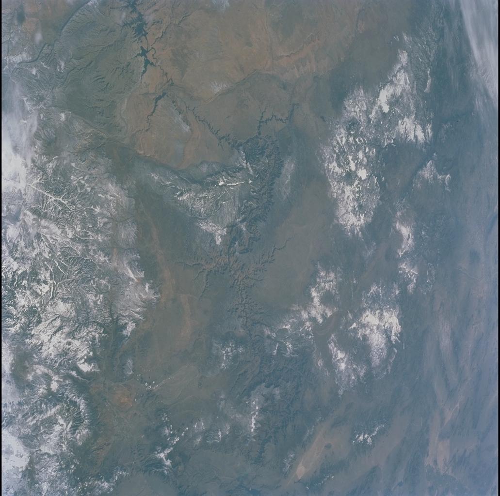
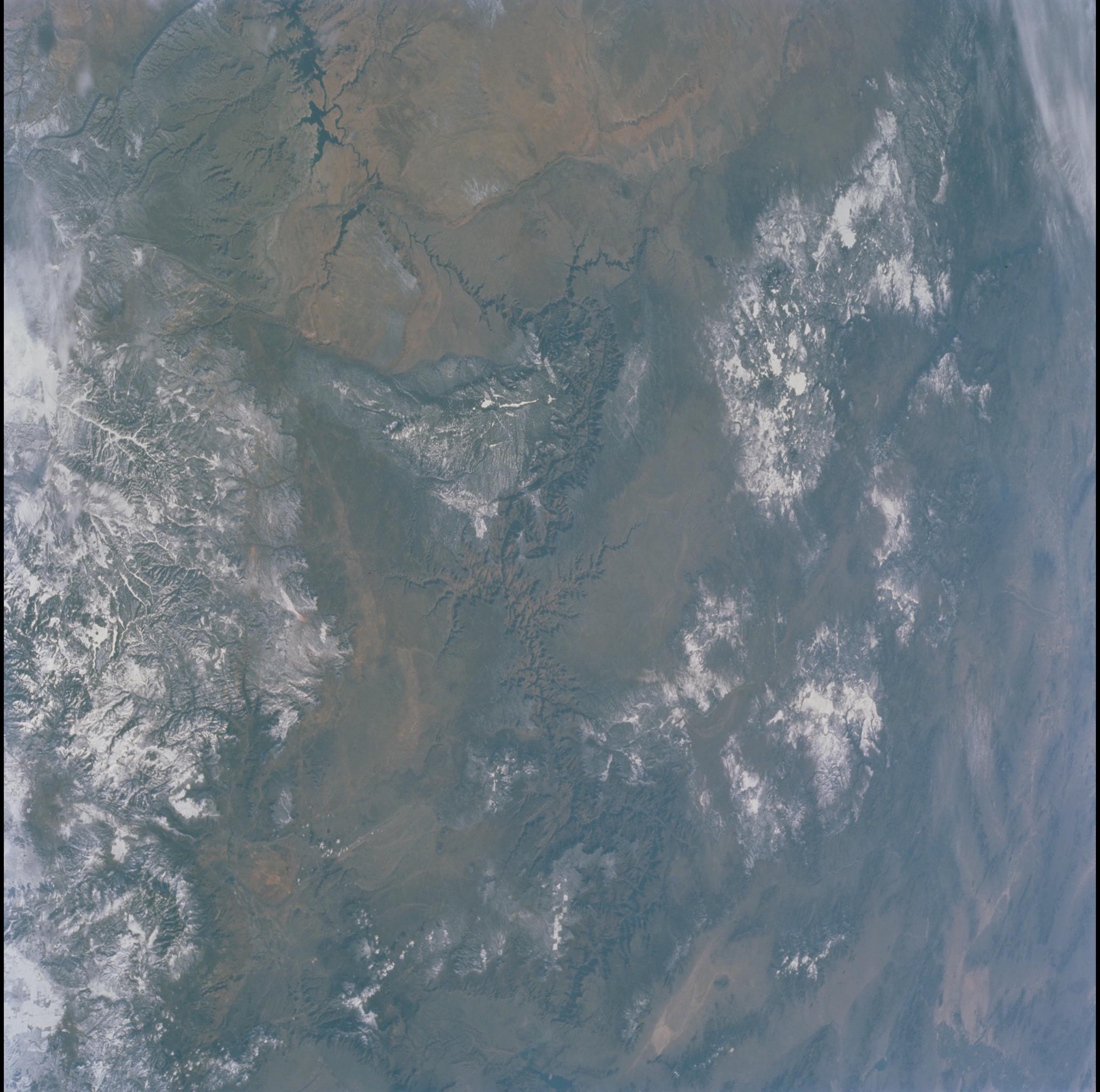
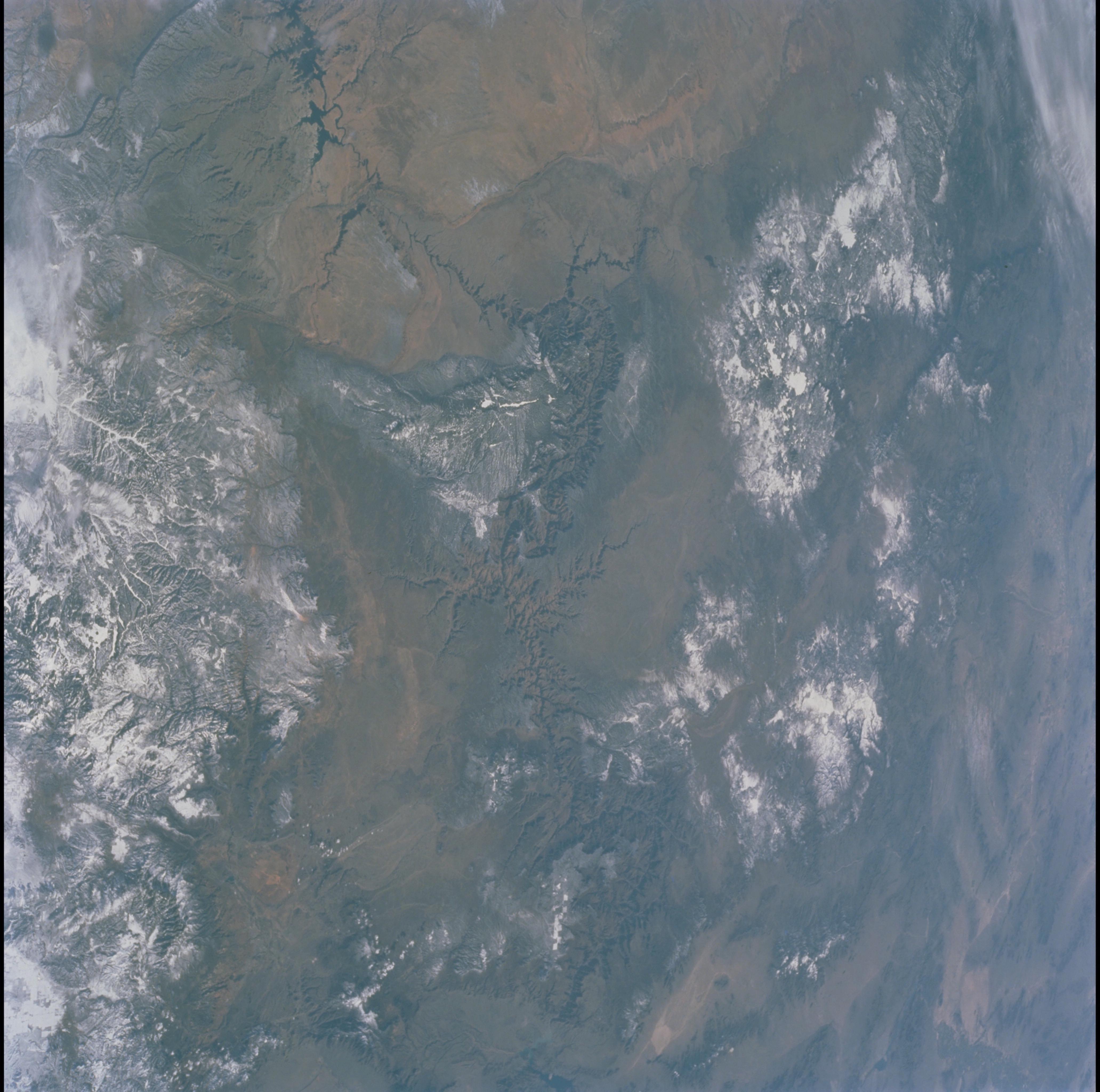
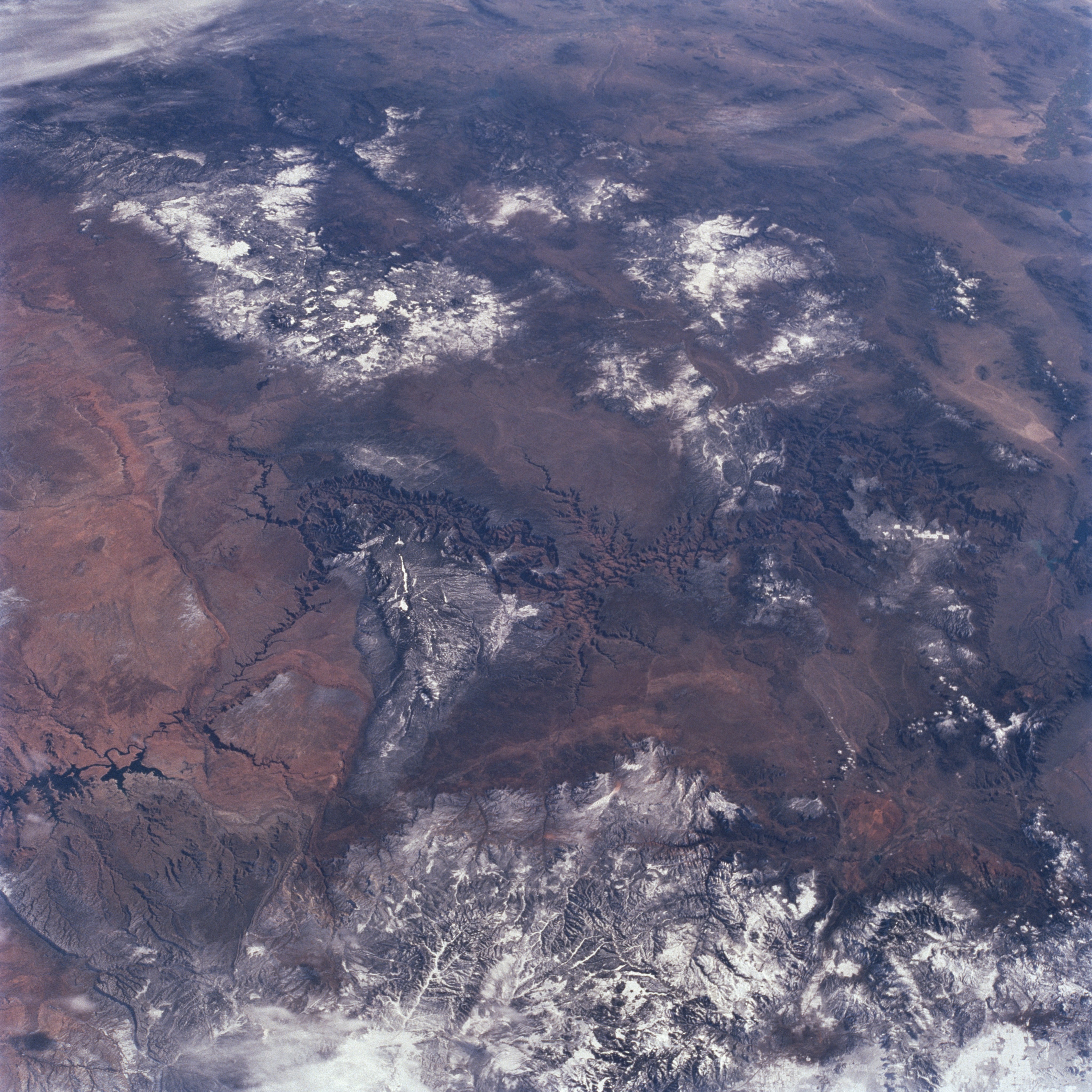
Image Caption: Grand Canyon Area, Arizona February 2001
Located on the Colorado Plateau (center of the image), the 217-mile (349 km) long Grand Canyon can be seen in this south-looking view. From 4 to 18 miles (6 to 29 km) wide the Grand Canyon is over one mile (1.6 km) deep, the deepest canyon in North America. Geologically young at 6 to 8 million years old, the Grand Canyon is a result of erosion, primarily by waters of the Colorado River. Lake Powell on the Arizona/Utah border is visible at slightly below the center left of the image. The snow-covered San Francisco Mountains can be seen to the south of the canyon slightly to the left of the center of the image. At the bottom of the image a portion of the snow-covered Vermillion Cliffs of southern Utah are visible.
Located on the Colorado Plateau (center of the image), the 217-mile (349 km) long Grand Canyon can be seen in this south-looking view. From 4 to 18 miles (6 to 29 km) wide the Grand Canyon is over one mile (1.6 km) deep, the deepest canyon in North America. Geologically young at 6 to 8 million years old, the Grand Canyon is a result of erosion, primarily by waters of the Colorado River. Lake Powell on the Arizona/Utah border is visible at slightly below the center left of the image. The snow-covered San Francisco Mountains can be seen to the south of the canyon slightly to the left of the center of the image. At the bottom of the image a portion of the snow-covered Vermillion Cliffs of southern Utah are visible.
