STS098-382-14
| NASA Photo ID | STS098-382-14 |
| Focal Length | mm |
| Date taken | 2001.02.18 |
| Time taken | 01:10:17 GMT |
Resolutions offered for this image:
3070 x 2044 pixels 515 x 342 pixels 3063 x 1992 pixels 640 x 416 pixels 540 x 351 pixels
3070 x 2044 pixels 515 x 342 pixels 3063 x 1992 pixels 640 x 416 pixels 540 x 351 pixels


Cloud masks available for this image:
Spacecraft nadir point: 45.5° N, 69.2° W
Photo center point: 41.0° N, 74.0° W
Photo center point by machine learning:
Photo center point: 41.0° N, 74.0° W
Photo center point by machine learning:
Nadir to Photo Center: Southwest
Spacecraft Altitude: 196 nautical miles (363km)
Country or Geographic Name: | USA-NEW YORK |
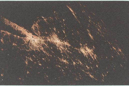
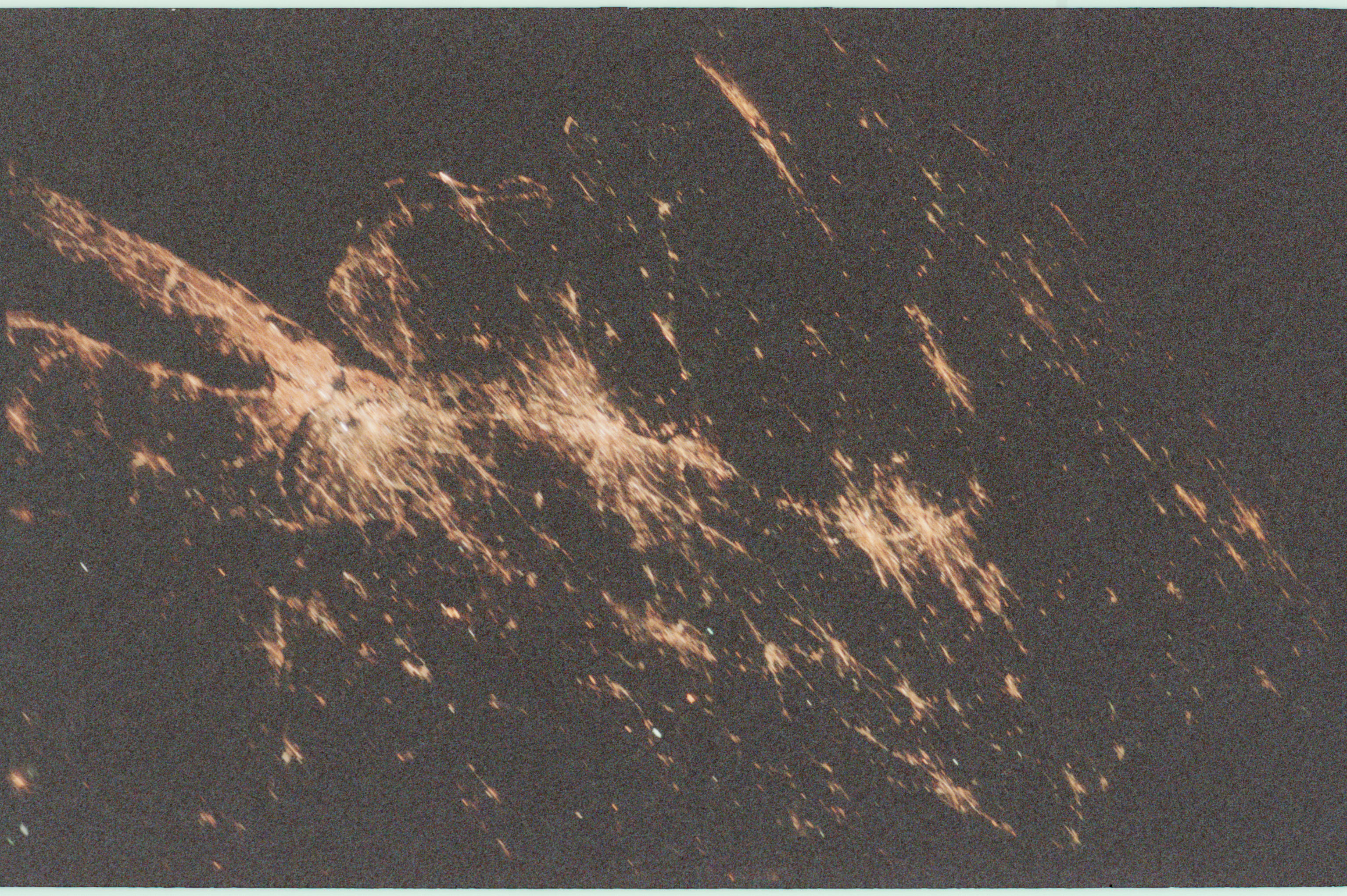
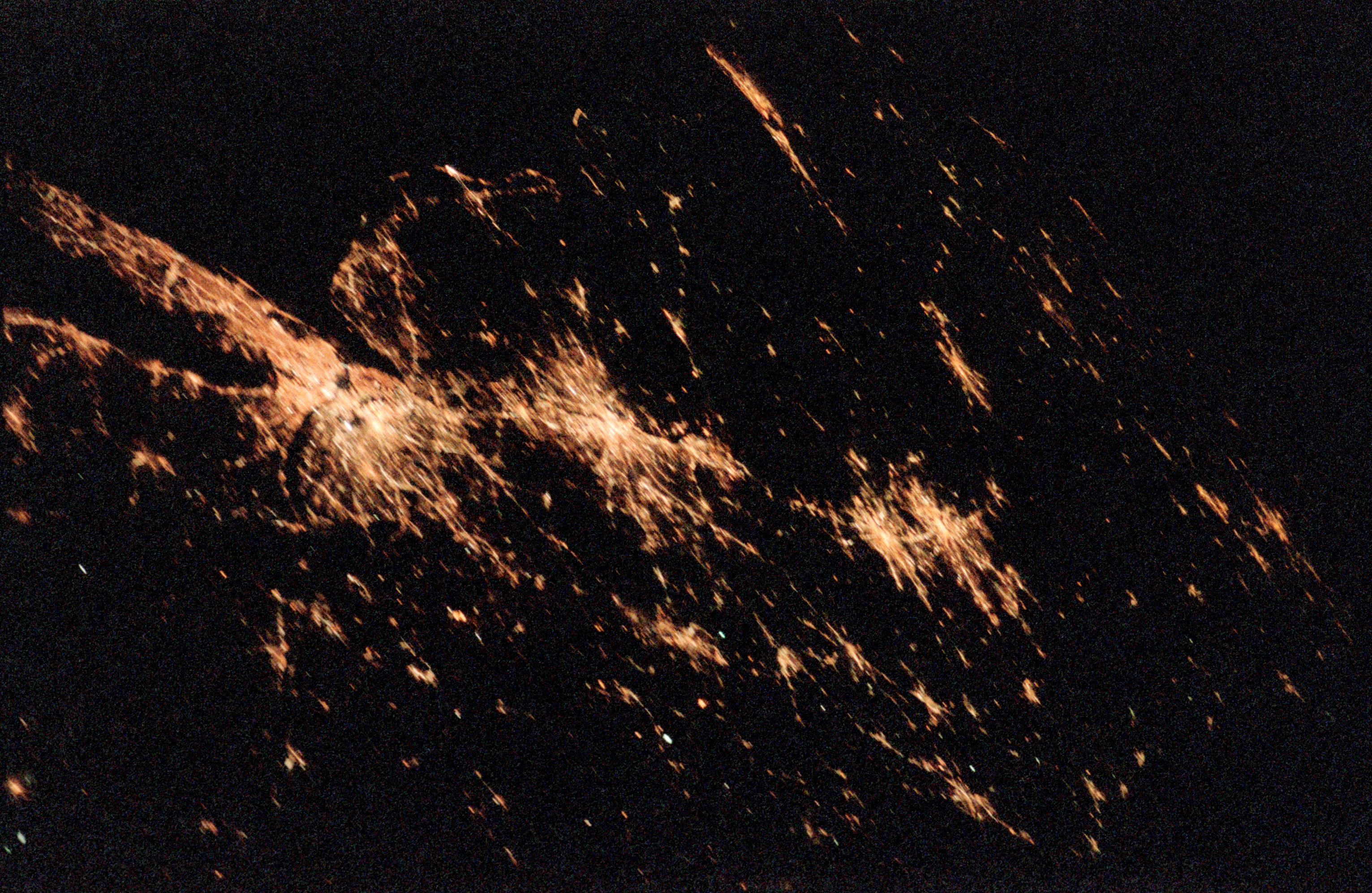
Features: | NEW YORK CITY LIGHTS |
| Features Found Using Machine Learning: | |
Cloud Cover Percentage: | 10 (1-10)% |
Sun Elevation Angle: | -33° |
Sun Azimuth: | 288° |
Camera: | Nikon 35mm film camera |
Focal Length: | mm |
Camera Tilt: | High Oblique |
Format: | FJ800: Fuji color negative, 35mm, ASA 800 |
Film Exposure: | |
| Additional Information | |
| Width | Height | Annotated | Cropped | Purpose | Links |
|---|---|---|---|---|---|
| 3070 pixels | 2044 pixels | No | No | Download Image | |
| 515 pixels | 342 pixels | No | No | Download Image | |
| 3063 pixels | 1992 pixels | No | No | Public Affairs Office (PAO) | Download Image |
| 640 pixels | 416 pixels | No | No | Public Affairs Office (PAO) | Download Image |
| 540 pixels | 351 pixels | Photographic Highlights | Download Image |
Download Packaged File
Download a Google Earth KML for this Image
View photo footprint information
Download a GeoTIFF for this photo
Image Caption: A nighttime scene of the northeastern seaboard of the United States shows the bright lights of several major cities that span a distance from Connecticut ( left middle) to states south of Virginia (right middle). City lights from both very large urban areas as well as smaller towns and cities are visible. The largest cluster of brightness emanates from the greater New York metropolitan area (left center) and then a series of bright spots progress southwesterly to include Philadelphia (PA), Baltimore (MD), Washington (D.C.), Richmond (VA), and finally ending with the Newport News/ Norfolk (VA) city lights (top center). Many of the major ground transportation arteries can be seen as radial, linear features that radiate outward from the central business districts of the cities. Even the lights of smaller cities such as Allentown, Reading, Lancaster, York, and Harrisburg (PA) are visible (bottom center).
