STS097-711-93
| NASA Photo ID | STS097-711-93 |
| Focal Length | 250mm |
| Date taken | 2000.12.10 |
| Time taken | 13:02:20 GMT |
Resolutions offered for this image:
1035 x 1024 pixels 2071 x 2048 pixels 4143 x 4096 pixels 517 x 512 pixels 1824 x 1907 pixels 382 x 400 pixels
1035 x 1024 pixels 2071 x 2048 pixels 4143 x 4096 pixels 517 x 512 pixels 1824 x 1907 pixels 382 x 400 pixels


Cloud masks available for this image:
Spacecraft nadir point: 9.7° S, 41.0° E
Photo center point: 11.0° S, 40.5° E
Photo center point by machine learning:
Photo center point: 11.0° S, 40.5° E
Photo center point by machine learning:
Nadir to Photo Center: South
Spacecraft Altitude: 191 nautical miles (354km)
Country or Geographic Name: | MOZAMBIQUE |
Features: | ROVUMA RIVER, REEFS |
| Features Found Using Machine Learning: | |
Cloud Cover Percentage: | 25 (11-25)% |
Sun Elevation Angle: | 33° |
Sun Azimuth: | 249° |
Camera: | Hasselblad |
Focal Length: | 250mm |
Camera Tilt: | 24 degrees |
Format: | 5069: Kodak Elite 100S, E6 Reversal, Replaces Lumiere, Warmer in tone vs. Lumiere |
Film Exposure: | |
| Additional Information | |
| Width | Height | Annotated | Cropped | Purpose | Links |
|---|---|---|---|---|---|
| 1035 pixels | 1024 pixels | No | No | Download Image | |
| 2071 pixels | 2048 pixels | No | No | Download Image | |
| 4143 pixels | 4096 pixels | No | No | Download Image | |
| 517 pixels | 512 pixels | No | No | Download Image | |
| 1824 pixels | 1907 pixels | No | Download Image | ||
| 382 pixels | 400 pixels | No | Photographic Highlights | Download Image |
Download Packaged File
Download a Google Earth KML for this Image
View photo footprint information
Download a GeoTIFF for this photo
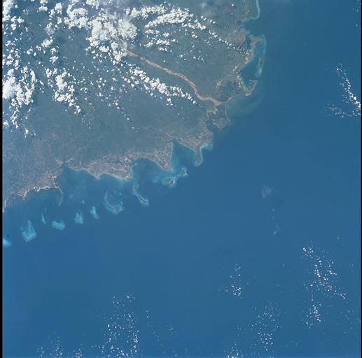
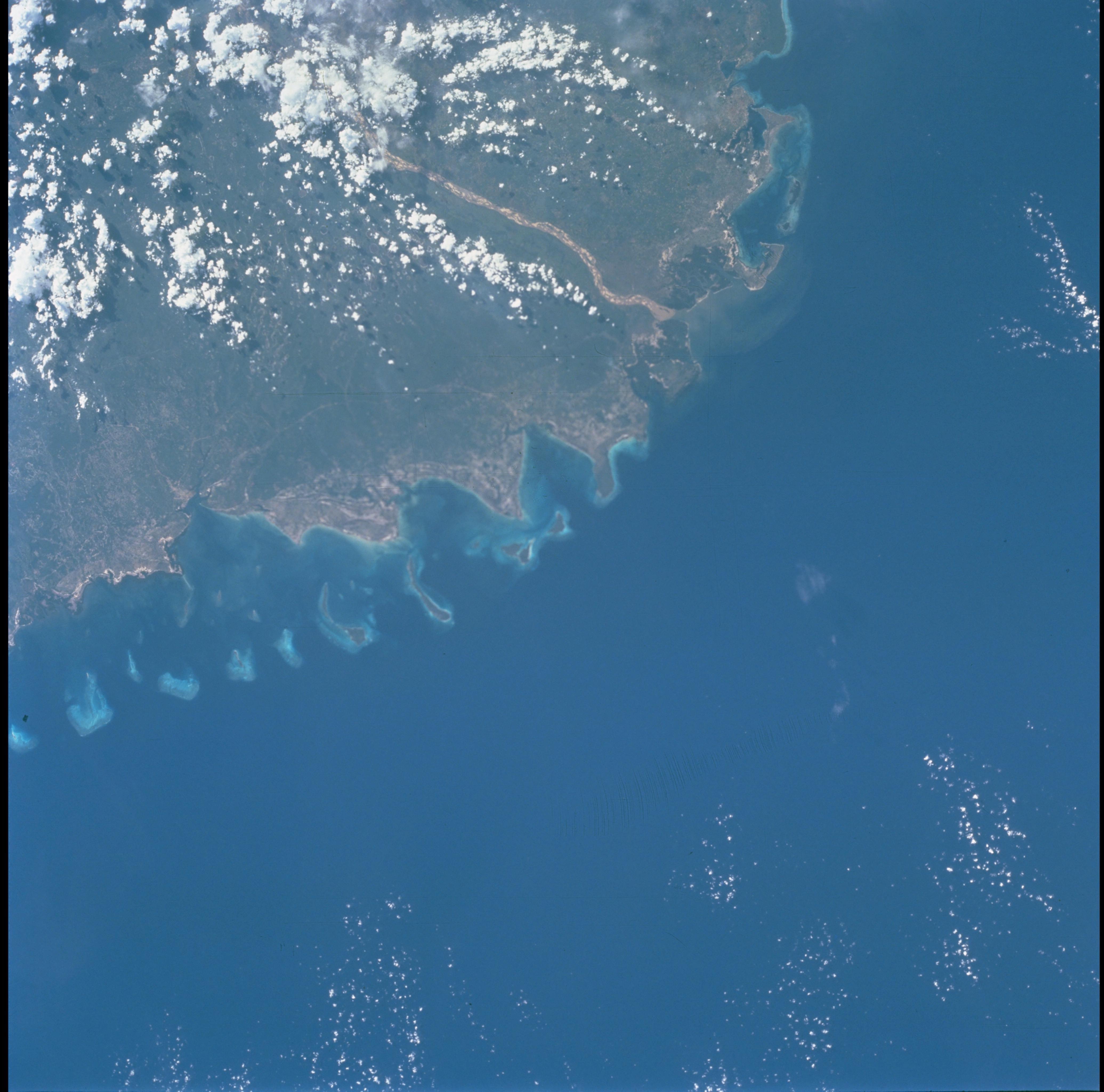
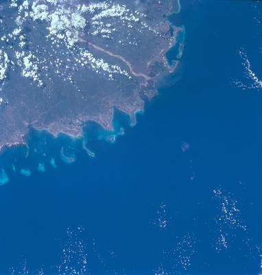
Image Caption: Cape Delgado, Tanzania & Mozambique
The Rovuma River rises in the Matagoro Mts. in southeastern Tanzania and marks
the border between Tanzania (north) and Mozambique (south). The Rovuma is
navigable to about 100 km inland, to the Upinda cataract. The delta of the
Rovuma has built outward onto the continental shelf to create the broad, arcuate
Cape Delgado. Islands and shoals, with their surrounding shallow turquoise
waters, form the delta fringe.
