STS094-721-52
| NASA Photo ID | STS094-721-52 |
| Focal Length | 250mm |
| Date taken | 1997.07.07 |
| Time taken | 17:23:24 GMT |
Resolutions offered for this image:
794 x 787 pixels 4096 x 4096 pixels 640 x 640 pixels 513 x 504 pixels
794 x 787 pixels 4096 x 4096 pixels 640 x 640 pixels 513 x 504 pixels

Cloud masks available for this image:
Spacecraft nadir point: 17.7° N, 66.3° W
Photo center point: 18.5° N, 66.0° W
Photo center point by machine learning:
Photo center point: 18.5° N, 66.0° W
Photo center point by machine learning:
Nadir to Photo Center: North
Spacecraft Altitude: 161 nautical miles (298km)
Country or Geographic Name: | PUERTO RICO |
Features: | SAN JUAN |
| Features Found Using Machine Learning: | |
Cloud Cover Percentage: | 20 (11-25)% |
Sun Elevation Angle: | 77° |
Sun Azimuth: | 294° |
Camera: | Hasselblad |
Focal Length: | 250mm |
Camera Tilt: | 18 degrees |
Format: | 5069: Kodak Elite 100S, E6 Reversal, Replaces Lumiere, Warmer in tone vs. Lumiere |
Film Exposure: | Normal |
| Additional Information | |
| Width | Height | Annotated | Cropped | Purpose | Links |
|---|---|---|---|---|---|
| 794 pixels | 787 pixels | No | No | Cities collection | Download Image |
| 4096 pixels | 4096 pixels | No | No | Earth From Space collection | Download Image |
| 640 pixels | 640 pixels | No | No | Earth From Space collection | Download Image |
| 513 pixels | 504 pixels | No | No | Download Image |
Download Packaged File
Download a Google Earth KML for this Image
View photo footprint information
Download a GeoTIFF for this photo
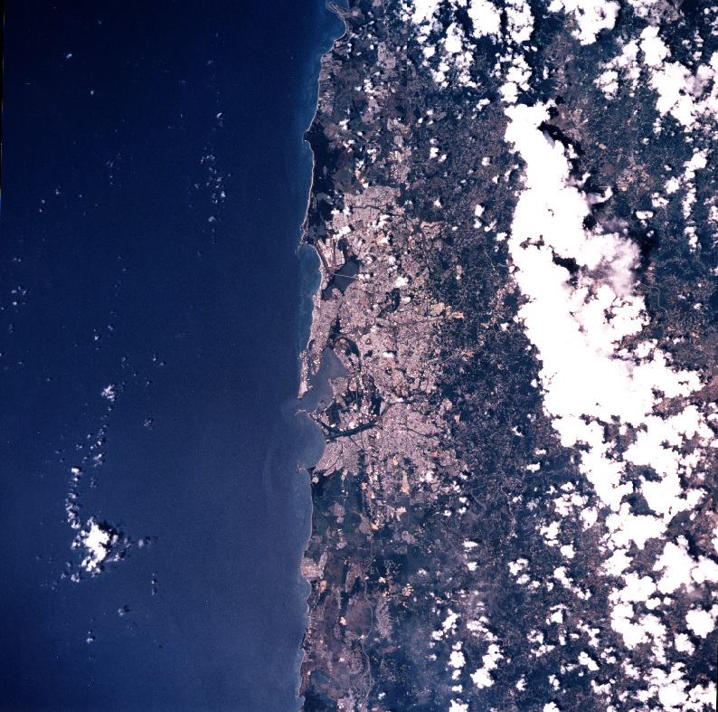
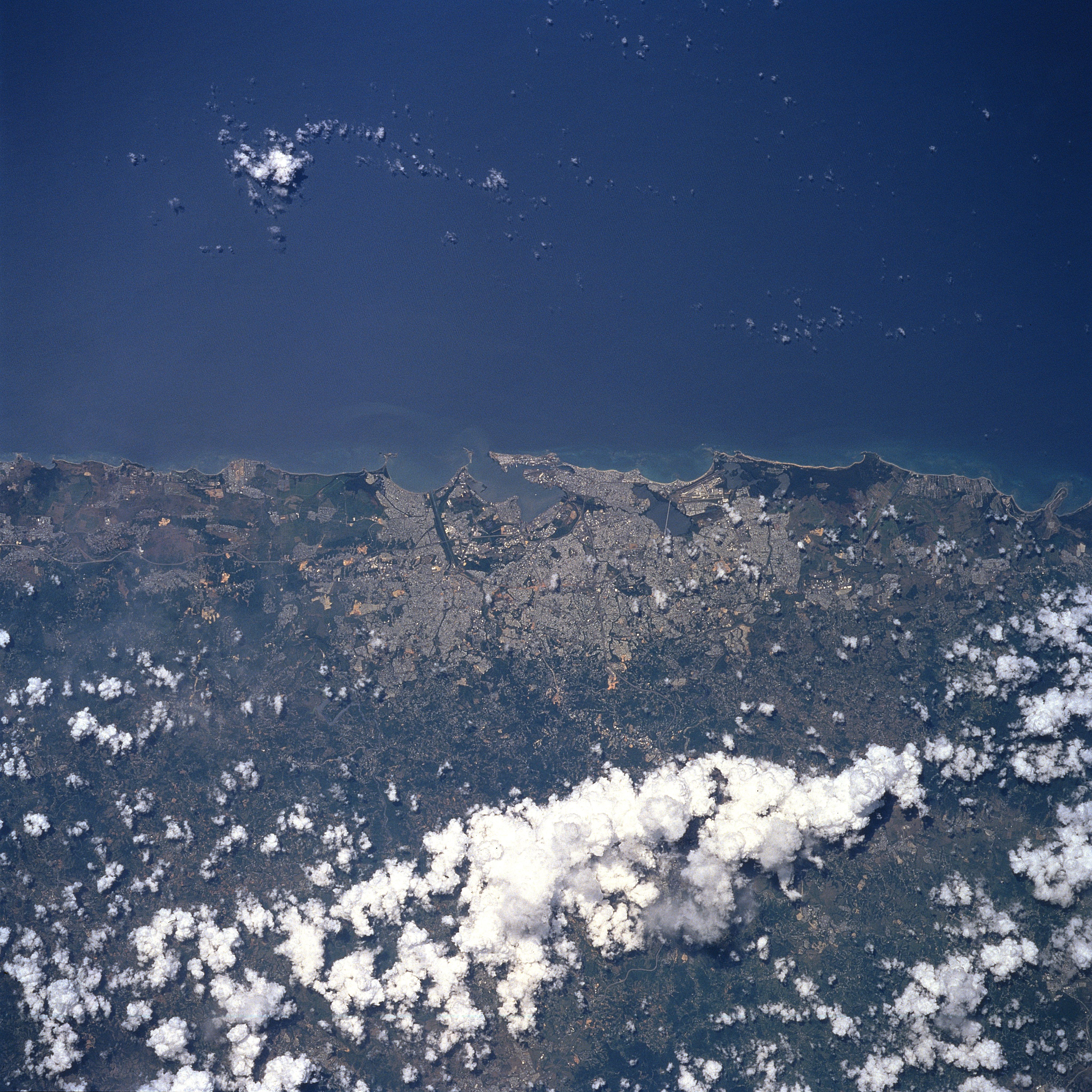
Image Caption: STS094-721-052 San Juan, Puerto Rico July 1997
The capital and largest city in Puerto Rico, San Juan, can be seen in this north-northeast-looking view. The city is located on the northern coast of the island on the Atlantic Ocean. San Juan, the chief commercial, industrial, shipping, and governmental center of Puerto Rico, is a very popular year around vacation resort. Manufactured products include rum and other beverages, pharmaceuticals, sugar, electronic equipment, chemicals, clothing, cement, publishing, and jewelry. San Juan's old colonial section is situated on two rocky inlets near the mouth of its harbor, and is linked by bridges with the mainland. The harbor facilities at San Juan are some of the best in the West Indies.
The capital and largest city in Puerto Rico, San Juan, can be seen in this north-northeast-looking view. The city is located on the northern coast of the island on the Atlantic Ocean. San Juan, the chief commercial, industrial, shipping, and governmental center of Puerto Rico, is a very popular year around vacation resort. Manufactured products include rum and other beverages, pharmaceuticals, sugar, electronic equipment, chemicals, clothing, cement, publishing, and jewelry. San Juan's old colonial section is situated on two rocky inlets near the mouth of its harbor, and is linked by bridges with the mainland. The harbor facilities at San Juan are some of the best in the West Indies.
