STS094-703-96
| NASA Photo ID | STS094-703-96 |
| Focal Length | 250mm |
| Date taken | 1997.07.12 |
| Time taken | 16:32:24 GMT |
Cloud masks available for this image:
Spacecraft nadir point: 5.1° S, 50.2° W
Photo center point: 7.0° S, 52.0° W
Photo center point by machine learning:
Photo center point: 7.0° S, 52.0° W
Photo center point by machine learning:
Nadir to Photo Center: Southwest
Spacecraft Altitude: 161 nautical miles (298km)
Country or Geographic Name: | BRAZIL |
Features: | RIO XINGU |
| Features Found Using Machine Learning: | |
Cloud Cover Percentage: | 0 (no clouds present) |
Sun Elevation Angle: | 59° |
Sun Azimuth: | 330° |
Camera: | Hasselblad |
Focal Length: | 250mm |
Camera Tilt: | 44 degrees |
Format: | 2443: Kodak Aerochrome 2443, color IR, thin base, EA-5 process thru June 1999, E-6 process afterward |
Film Exposure: | Normal |
| Additional Information | |
| Width | Height | Annotated | Cropped | Purpose | Links |
|---|---|---|---|---|---|
| 4096 pixels | 4096 pixels | No | No | Earth From Space collection | Download Image |
| 640 pixels | 640 pixels | No | No | Earth From Space collection | Download Image |
Download Packaged File
Download a Google Earth KML for this Image
View photo footprint information
Download a GeoTIFF for this photo
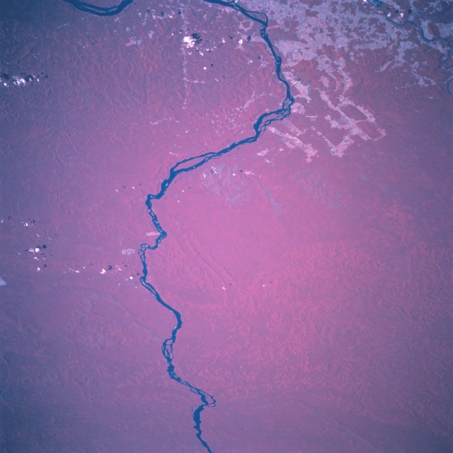
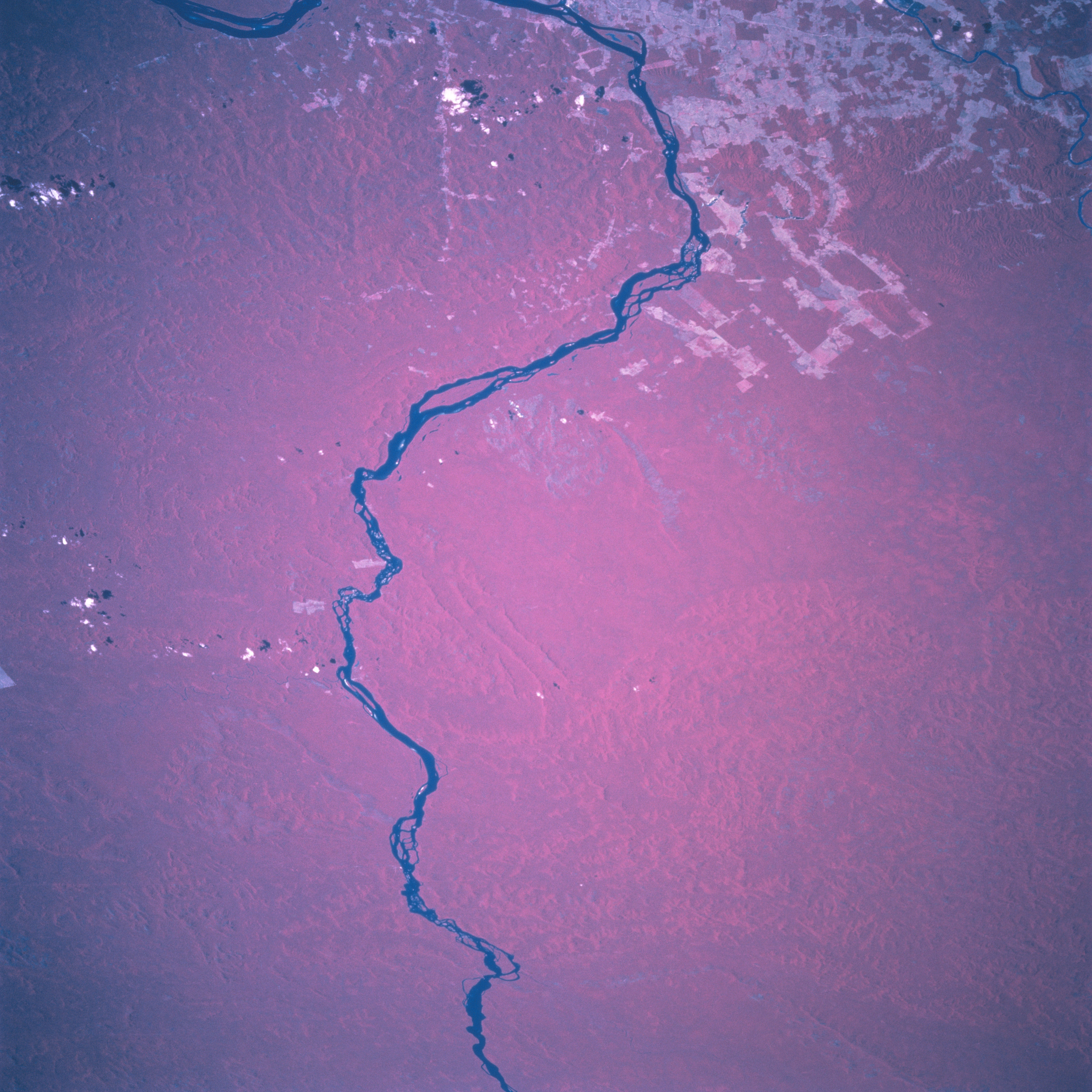
Image Caption: STS094-703-096 Rio Xingu, Para State, Brazil July 1997
The north flowing Rio Xingu makes a large loop to the east in this section of south central Para State. The color infrared picture (healthy, green vegetation is presented as a reddish hue) allows the viewer to differentiate the areas where clear cutting has occurred (lighter colors) versus the dense, solid canopy cover of the remaining Amazon Basin rainforest vegetation. Numerous waterfalls and rapids are found in the Rio Xingu (as well as many of the other rivers and streams in this part of Brazil), thereby hindering the use of the river for transportation and shipping.
The north flowing Rio Xingu makes a large loop to the east in this section of south central Para State. The color infrared picture (healthy, green vegetation is presented as a reddish hue) allows the viewer to differentiate the areas where clear cutting has occurred (lighter colors) versus the dense, solid canopy cover of the remaining Amazon Basin rainforest vegetation. Numerous waterfalls and rapids are found in the Rio Xingu (as well as many of the other rivers and streams in this part of Brazil), thereby hindering the use of the river for transportation and shipping.
