STS093-722-51
| NASA Photo ID | STS093-722-51 |
| Focal Length | 250mm |
| Date taken | 1999.07.24 |
| Time taken | 11:38:20 GMT |
Resolutions offered for this image:
1034 x 1024 pixels 2069 x 2048 pixels 4139 x 4096 pixels 2002 x 1999 pixels 517 x 512 pixels 2002 x 1999 pixels 640 x 639 pixels 2689 x 2772 pixels 640 x 639 pixels
1034 x 1024 pixels 2069 x 2048 pixels 4139 x 4096 pixels 2002 x 1999 pixels 517 x 512 pixels 2002 x 1999 pixels 640 x 639 pixels 2689 x 2772 pixels 640 x 639 pixels


Cloud masks available for this image:
Spacecraft nadir point: 12.0° S, 49.6° E
Photo center point: 12.0° S, 49.0° E
Photo center point by machine learning:
Photo center point: 12.0° S, 49.0° E
Photo center point by machine learning:
Nadir to Photo Center: West
Spacecraft Altitude: 157 nautical miles (291km)
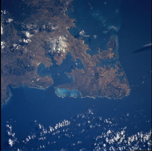
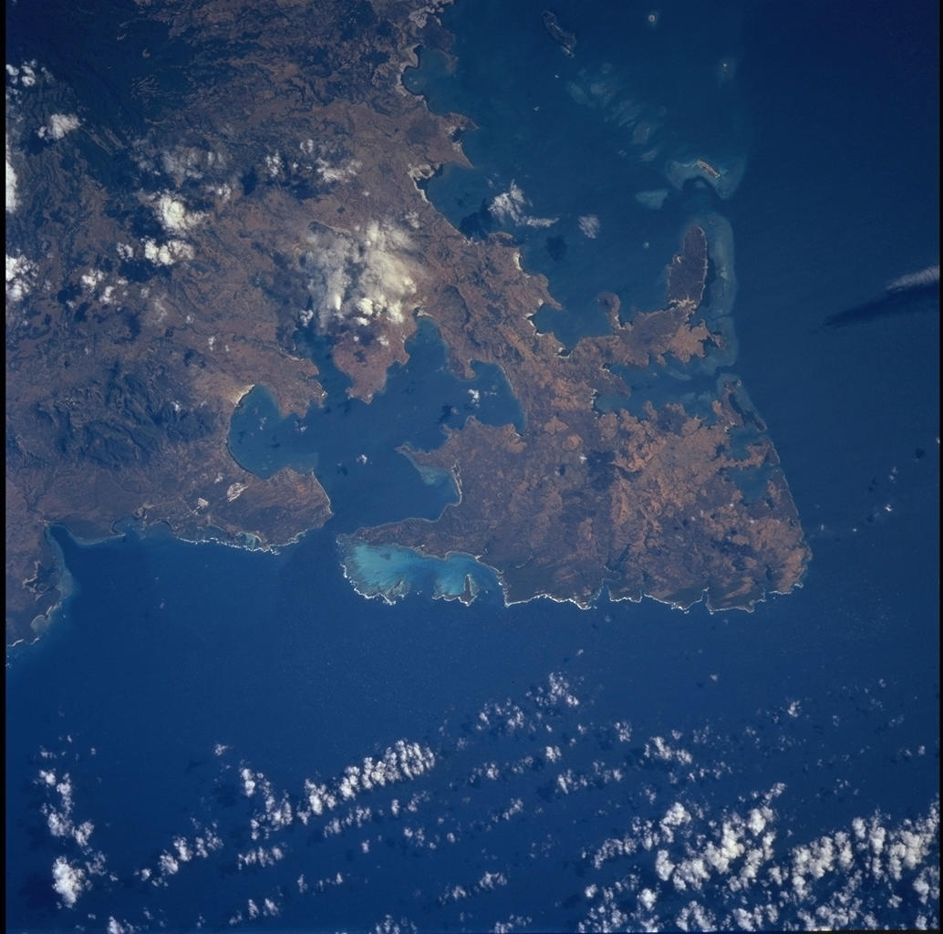
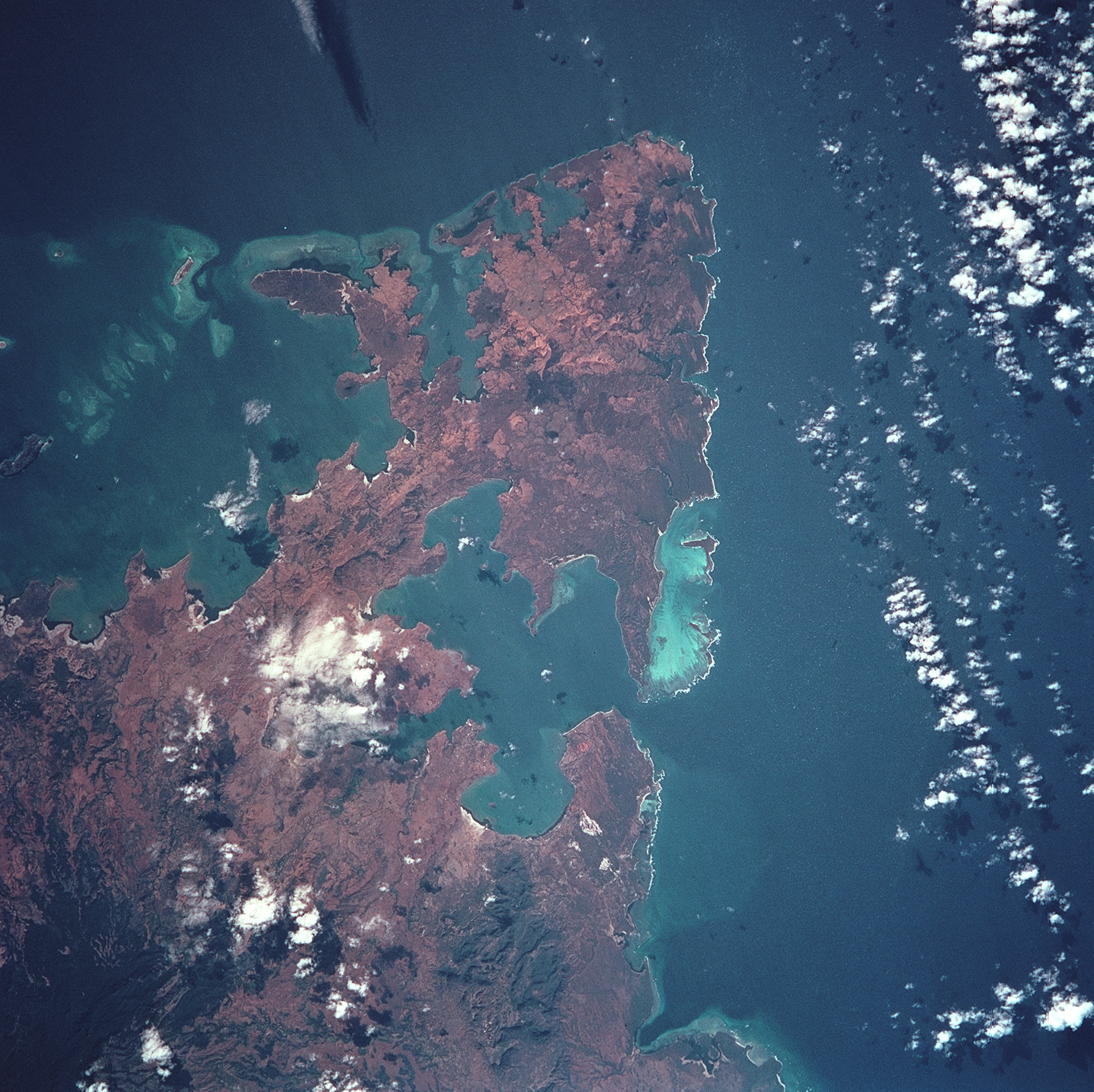
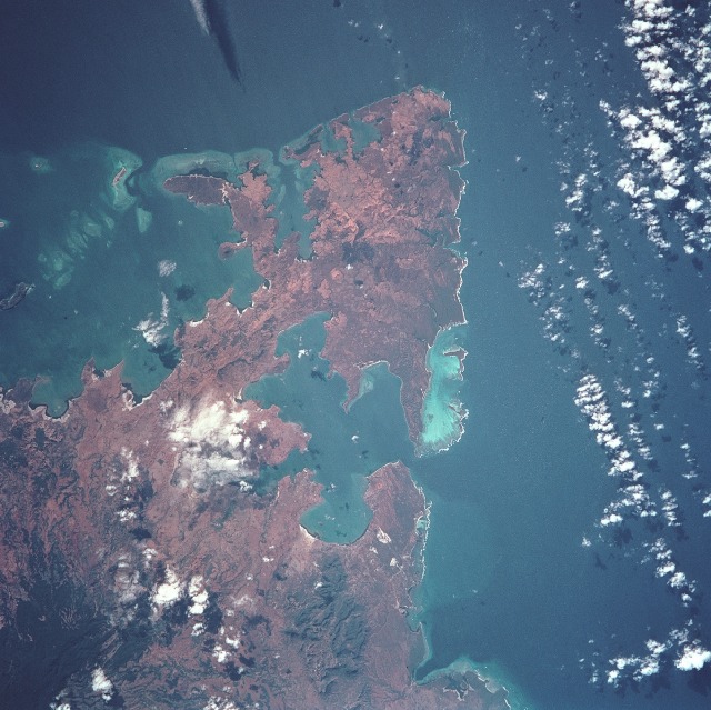
Country or Geographic Name: | MADAGASCAR |
Features: | CAPE AMBRE |
| Features Found Using Machine Learning: | |
Cloud Cover Percentage: | 25 (11-25)% |
Sun Elevation Angle: | 38° |
Sun Azimuth: | 308° |
Camera: | Hasselblad |
Focal Length: | 250mm |
Camera Tilt: | 12 degrees |
Format: | 5069: Kodak Elite 100S, E6 Reversal, Replaces Lumiere, Warmer in tone vs. Lumiere |
Film Exposure: | |
| Additional Information | |
| Width | Height | Annotated | Cropped | Purpose | Links |
|---|---|---|---|---|---|
| 1034 pixels | 1024 pixels | No | No | Download Image | |
| 2069 pixels | 2048 pixels | No | No | Download Image | |
| 4139 pixels | 4096 pixels | No | No | Download Image | |
| 2002 pixels | 1999 pixels | No | No | Download Image | |
| 517 pixels | 512 pixels | No | No | Download Image | |
| 2002 pixels | 1999 pixels | No | No | Public Affairs Office (PAO) | Download Image |
| 640 pixels | 639 pixels | No | No | Public Affairs Office (PAO) | Download Image |
| 2689 pixels | 2772 pixels | No | Yes | ReefBase 2 | Download Image |
| 640 pixels | 639 pixels | Download Image |
Download Packaged File
Download a Google Earth KML for this Image
View photo footprint information
Download a GeoTIFF for this photo
Image Caption: The distinctive arrowhead shape of the northern tip of the island of Madagascar is easily recognizable. Notice that the land appears red with patches of dark green on the upper slopes. The dark areas are the remnants of forests and the red areas are cleared land.
