STS093-717-66
| NASA Photo ID | STS093-717-66 |
| Focal Length | 250mm |
| Date taken | 1999.07.25 |
| Time taken | 23:36:16 GMT |
Resolutions offered for this image:
1034 x 1024 pixels 2069 x 2048 pixels 4139 x 4096 pixels 2091 x 2008 pixels 517 x 512 pixels 2091 x 2008 pixels 639 x 614 pixels 639 x 614 pixels
1034 x 1024 pixels 2069 x 2048 pixels 4139 x 4096 pixels 2091 x 2008 pixels 517 x 512 pixels 2091 x 2008 pixels 639 x 614 pixels 639 x 614 pixels


Cloud masks available for this image:
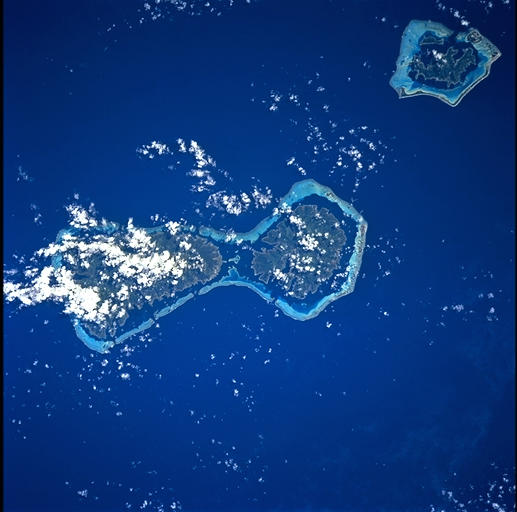
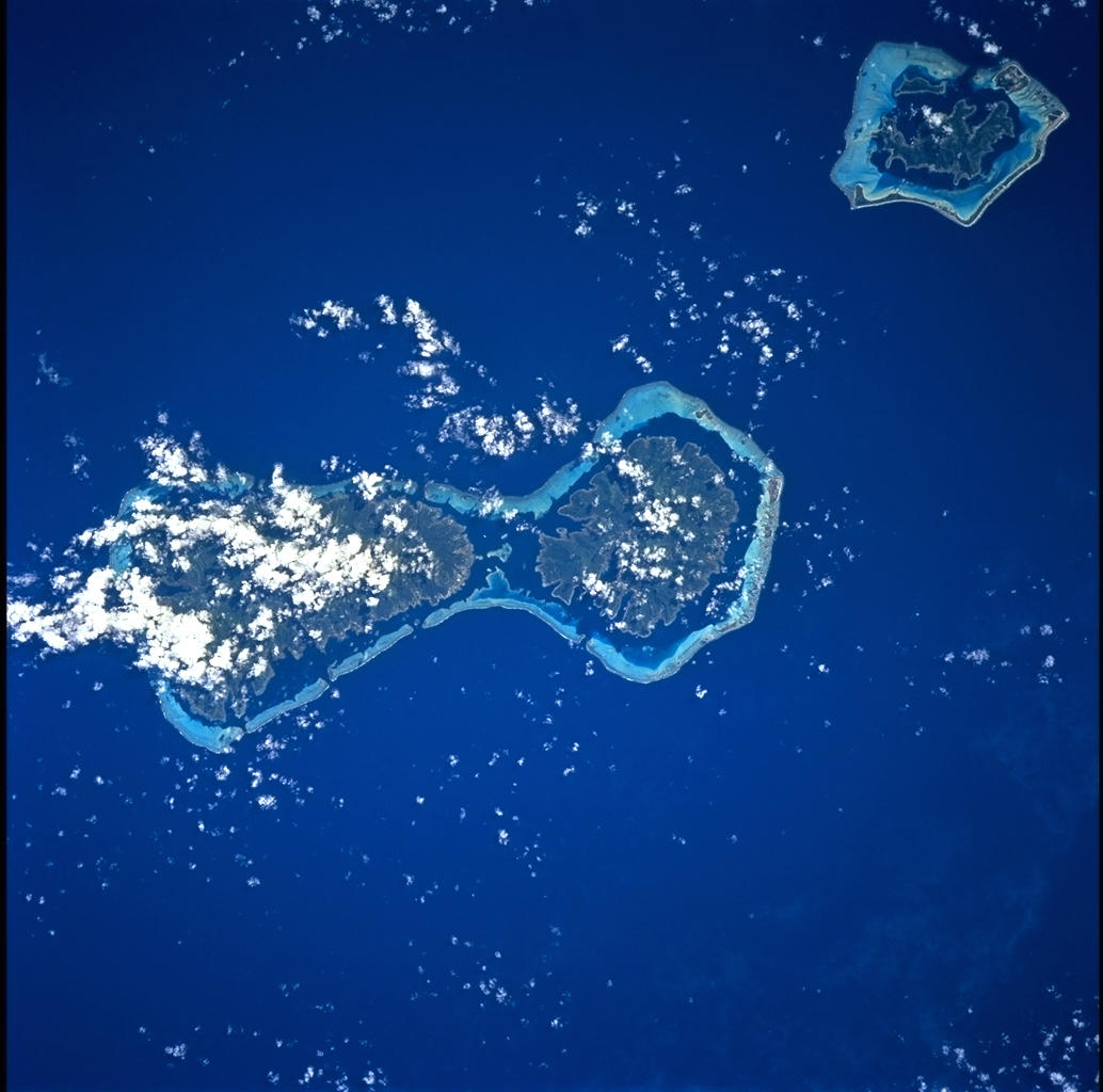
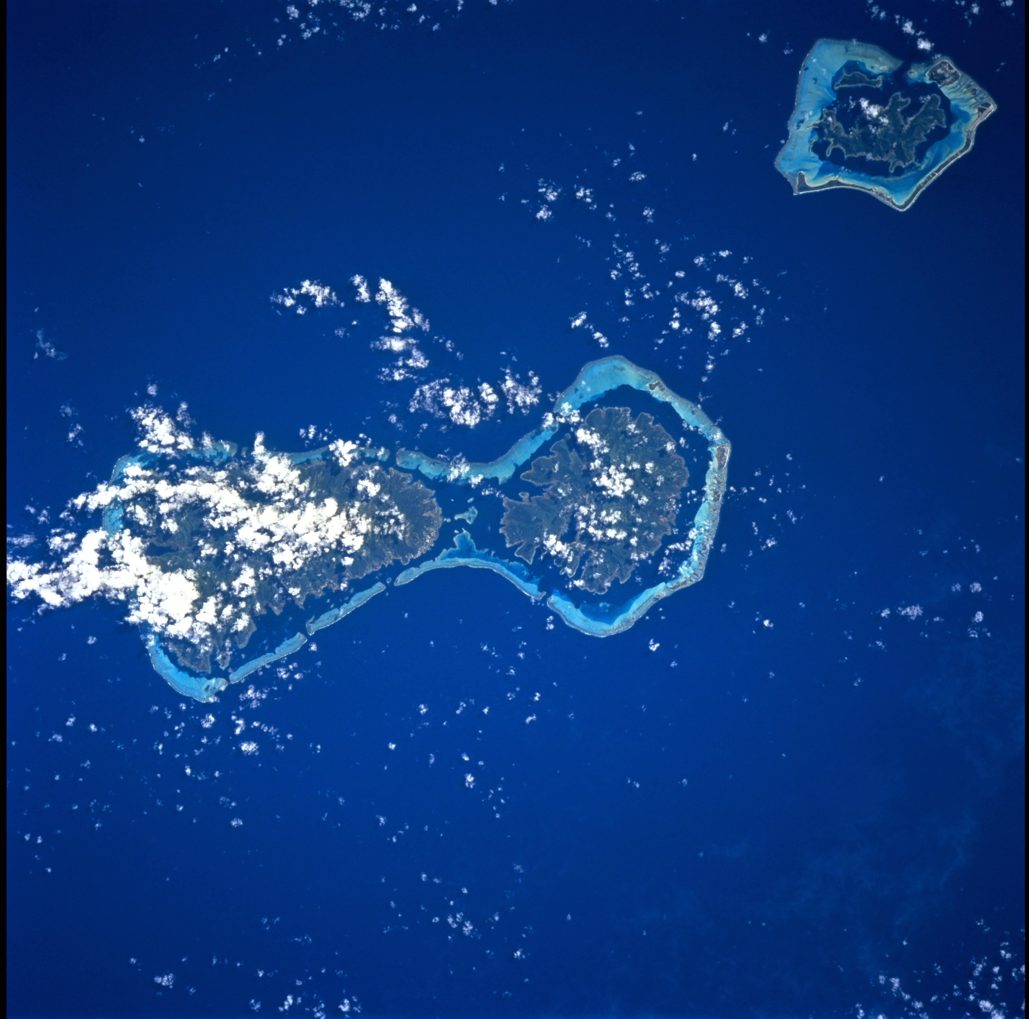
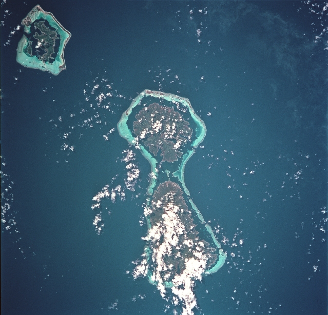
Spacecraft nadir point: 15.8° S, 151.0° W
Photo center point: 16.5° S, 151.5° W
Photo center point by machine learning:
Photo center point: 16.5° S, 151.5° W
Photo center point by machine learning:
Nadir to Photo Center: Southwest
Spacecraft Altitude: 155 nautical miles (287km)
Camera: | Hasselblad |
Focal Length: | 250mm |
Camera Tilt: | 18 degrees |
Format: | 5069: Kodak Elite 100S, E6 Reversal, Replaces Lumiere, Warmer in tone vs. Lumiere |
Film Exposure: | |
| Additional Information | |
| Width | Height | Annotated | Cropped | Purpose | Links |
|---|---|---|---|---|---|
| 1034 pixels | 1024 pixels | No | No | Download Image | |
| 2069 pixels | 2048 pixels | No | No | Download Image | |
| 4139 pixels | 4096 pixels | No | No | Download Image | |
| 2091 pixels | 2008 pixels | No | No | Download Image | |
| 517 pixels | 512 pixels | No | No | Download Image | |
| 2091 pixels | 2008 pixels | No | No | Public Affairs Office (PAO) | Download Image |
| 639 pixels | 614 pixels | No | No | Public Affairs Office (PAO) | Download Image |
| 639 pixels | 614 pixels | Download Image |
Download Packaged File
Download a Google Earth KML for this Image
View photo footprint information
Download a GeoTIFF for this photo
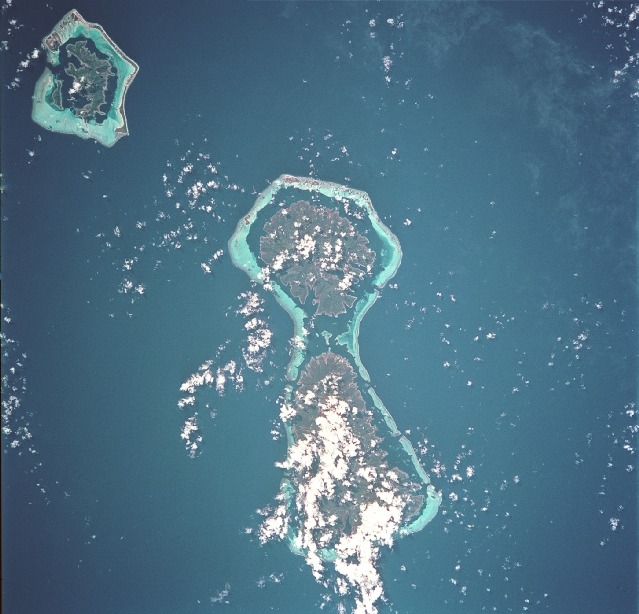
Image Caption: Delicate coral reefs ring the Society Islands of Bora Bora (top), Tahaa (center) and Raiatea (bottom). The Society Islands, which also include the island of Tahiti, are one of five archipelagoes that constitute French Polynesia in the central South Pacific.
