STS091-719-53

| NASA Photo ID | STS091-719-53 |
| Focal Length | 250mm |
| Date taken | 1998.06.12 |
| Time taken | 10:13:39 GMT |
Resolutions offered for this image:
4091 x 4013 pixels 640 x 627 pixels 1294 x 1286 pixels 518 x 515 pixels
4091 x 4013 pixels 640 x 627 pixels 1294 x 1286 pixels 518 x 515 pixels

Cloud masks available for this image:
Spacecraft nadir point: 35.8° N, 51.3° E
Photo center point: 37.5° N, 49.5° E
Photo center point by machine learning:
Photo center point: 37.5° N, 49.5° E
Photo center point by machine learning:
Nadir to Photo Center: Northwest
Spacecraft Altitude: 186 nautical miles (344km)
Country or Geographic Name: | IRAN |
Features: | RASHT, COAST, SEND R. DELTA |
| Features Found Using Machine Learning: | |
Cloud Cover Percentage: | 10 (1-10)% |
Sun Elevation Angle: | 65° |
Sun Azimuth: | 247° |
Camera: | Hasselblad |
Focal Length: | 250mm |
Camera Tilt: | 39 degrees |
Format: | 5069: Kodak Elite 100S, E6 Reversal, Replaces Lumiere, Warmer in tone vs. Lumiere |
Film Exposure: | Normal |
| Additional Information | |
| Width | Height | Annotated | Cropped | Purpose | Links |
|---|---|---|---|---|---|
| 4091 pixels | 4013 pixels | No | No | Earth From Space collection | Download Image |
| 640 pixels | 627 pixels | No | No | Earth From Space collection | Download Image |
| 1294 pixels | 1286 pixels | No | No | Download Image | |
| 518 pixels | 515 pixels | No | No | Download Image |
Download Packaged File
Download a Google Earth KML for this Image
View photo footprint information
Download a GeoTIFF for this photo
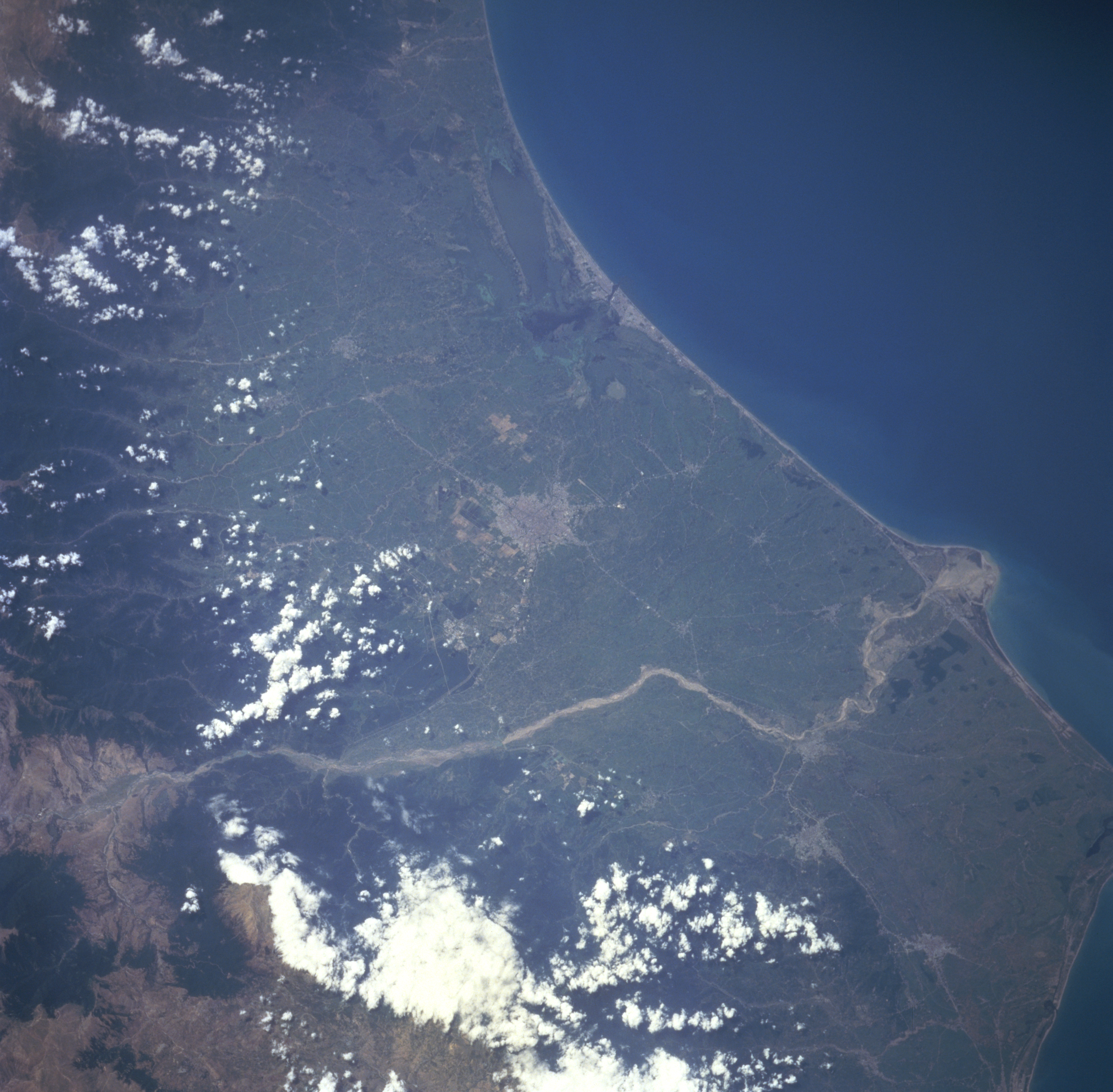
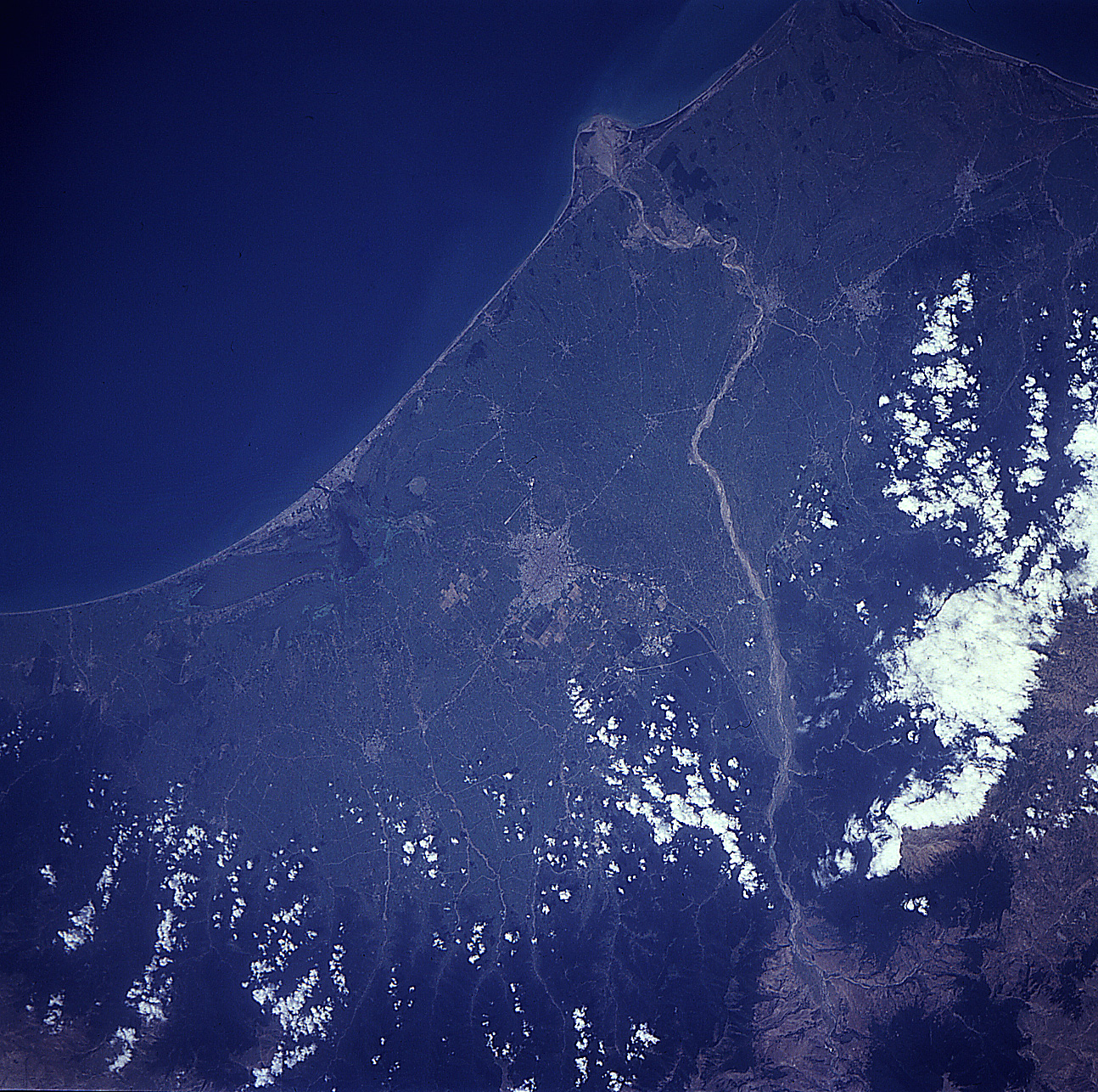
Image Caption: STS091-719-053 Safid River/Delta, Iran June 1998
The Safid River has created a sizeable, swampy delta (upper left corner) along the southwest coast of the Caspian Sea in northwest Iran. Notice the "new" delta (middle left) actively being created by the sediment that is being deposited at the mouth of the Safid River. The Safid River originates in the Elburz Mountains, a small section of which is visible in the upper right corner of the image. This river is the only one to cross the entire width of the Elburz Mountains. The densely forested mountain slopes (dark landscape) are visible along the right edge of the image. Rasht, a major Iranian city noted for its unique cusine and pleasant climate, can be identified (grayish-looking area) slightly below the center of the image. Several other smaller urban areas can also be located on the narrow coastal plain.
The Safid River has created a sizeable, swampy delta (upper left corner) along the southwest coast of the Caspian Sea in northwest Iran. Notice the "new" delta (middle left) actively being created by the sediment that is being deposited at the mouth of the Safid River. The Safid River originates in the Elburz Mountains, a small section of which is visible in the upper right corner of the image. This river is the only one to cross the entire width of the Elburz Mountains. The densely forested mountain slopes (dark landscape) are visible along the right edge of the image. Rasht, a major Iranian city noted for its unique cusine and pleasant climate, can be identified (grayish-looking area) slightly below the center of the image. Several other smaller urban areas can also be located on the narrow coastal plain.
