STS091-708-14
| NASA Photo ID | STS091-708-14 |
| Focal Length | 250mm |
| Date taken | 1998.06.05 |
| Time taken | 17:04:11 GMT |
Cloud masks available for this image:
Spacecraft nadir point: 16.0° S, 58.2° W
Photo center point: 16.5° S, 57.5° W
Photo center point by machine learning:
Photo center point: 16.5° S, 57.5° W
Photo center point by machine learning:
Nadir to Photo Center: Southeast
Spacecraft Altitude: 203 nautical miles (376km)
Country or Geographic Name: | BRAZIL |
Features: | MTS., R. PARAGUAI, CACERES |
| Features Found Using Machine Learning: | |
Cloud Cover Percentage: | 5 (1-10)% |
Sun Elevation Angle: | 48° |
Sun Azimuth: | 335° |
Camera: | Hasselblad |
Focal Length: | 250mm |
Camera Tilt: | 14 degrees |
Format: | 5069: Kodak Elite 100S, E6 Reversal, Replaces Lumiere, Warmer in tone vs. Lumiere |
Film Exposure: | Normal |
| Additional Information | |
| Width | Height | Annotated | Cropped | Purpose | Links |
|---|---|---|---|---|---|
| 4096 pixels | 4096 pixels | No | No | Earth From Space collection | Download Image |
| 640 pixels | 640 pixels | No | No | Earth From Space collection | Download Image |
Download Packaged File
Download a Google Earth KML for this Image
View photo footprint information
Download a GeoTIFF for this photo
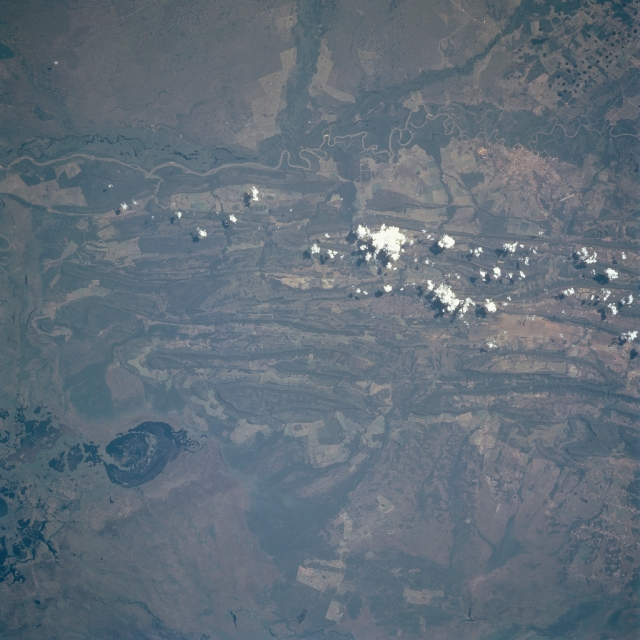
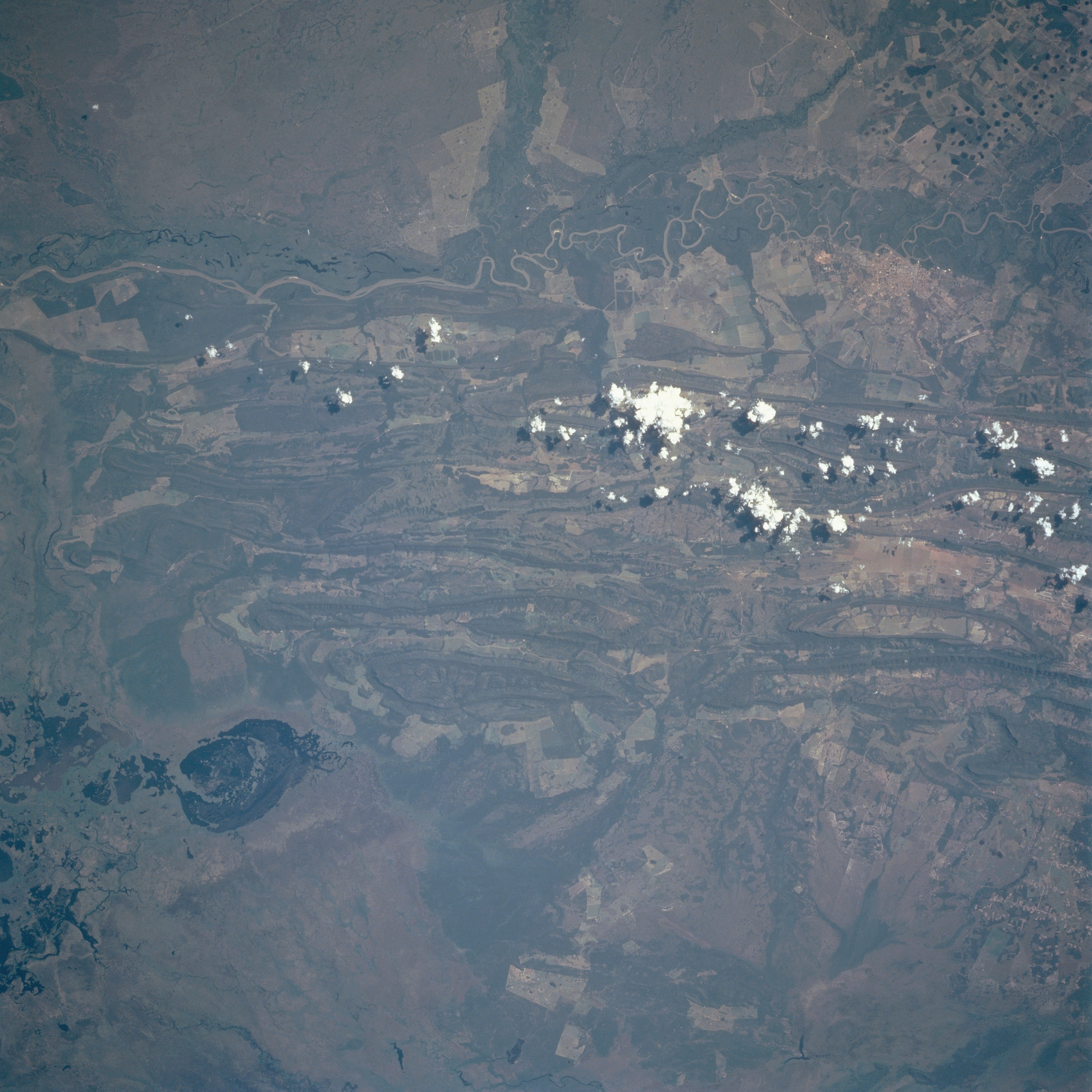
Image Caption: STS091-708-014 Rio Paraguai, Mato Grosso State, Brazil June 1998
The Rio Paraguai (top of picture) is part of a very large wetland ecosystem that exhibits a remarkable biodiversity known as the Pantanal. The Pantanal is located in west central Brazil and eastern Bolivia. This vast expanse of poorly drained wetlands experiences annual inundation. The terrain west of the river is flat savanna and wetlands; while east of the river a series of low, parallel, folded ridgelines are visible. The lighter colored landscape with angular-looking field patterns appears to be used for a variety of agricultural purposes, including crop production and cattle ranching. Mining activities and timber operations also contribute to the economy in this region that is faced with serious environmental issues. The city of Caceres can be identified along the east bank of the Rio Paraguai near the upper right corner of the picture. An airport runway (short, light colored, straight line) is visible northeast of Caceres. The roughly oval-shaped feature (dark area) in the southeast quadrant appears to be a lake.
The Rio Paraguai (top of picture) is part of a very large wetland ecosystem that exhibits a remarkable biodiversity known as the Pantanal. The Pantanal is located in west central Brazil and eastern Bolivia. This vast expanse of poorly drained wetlands experiences annual inundation. The terrain west of the river is flat savanna and wetlands; while east of the river a series of low, parallel, folded ridgelines are visible. The lighter colored landscape with angular-looking field patterns appears to be used for a variety of agricultural purposes, including crop production and cattle ranching. Mining activities and timber operations also contribute to the economy in this region that is faced with serious environmental issues. The city of Caceres can be identified along the east bank of the Rio Paraguai near the upper right corner of the picture. An airport runway (short, light colored, straight line) is visible northeast of Caceres. The roughly oval-shaped feature (dark area) in the southeast quadrant appears to be a lake.
