STS091-704-92

| NASA Photo ID | STS091-704-92 |
| Focal Length | 250mm |
| Date taken | 1998.06.06 |
| Time taken | 11:44:18 GMT |
Cloud masks available for this image:
Spacecraft nadir point: 33.1° N, 60.9° E
Photo center point: 34.5° N, 58.0° E
Photo center point by machine learning:
Photo center point: 34.5° N, 58.0° E
Photo center point by machine learning:
Nadir to Photo Center: West
Spacecraft Altitude: 198 nautical miles (367km)
Country or Geographic Name: | IRAN |
Features: | NAMAK SALT WASTE |
| Features Found Using Machine Learning: | |
Cloud Cover Percentage: | 0 (no clouds present) |
Sun Elevation Angle: | 39° |
Sun Azimuth: | 274° |
Camera: | Hasselblad |
Focal Length: | 250mm |
Camera Tilt: | 44 degrees |
Format: | 5069: Kodak Elite 100S, E6 Reversal, Replaces Lumiere, Warmer in tone vs. Lumiere |
Film Exposure: | Normal |
| Additional Information | |
| Width | Height | Annotated | Cropped | Purpose | Links |
|---|---|---|---|---|---|
| 3980 pixels | 4014 pixels | No | No | Earth From Space collection | Download Image |
| 634 pixels | 639 pixels | No | No | Earth From Space collection | Download Image |
| 507 pixels | 504 pixels | No | No | Download Image |
Download Packaged File
Download a Google Earth KML for this Image
View photo footprint information
Download a GeoTIFF for this photo
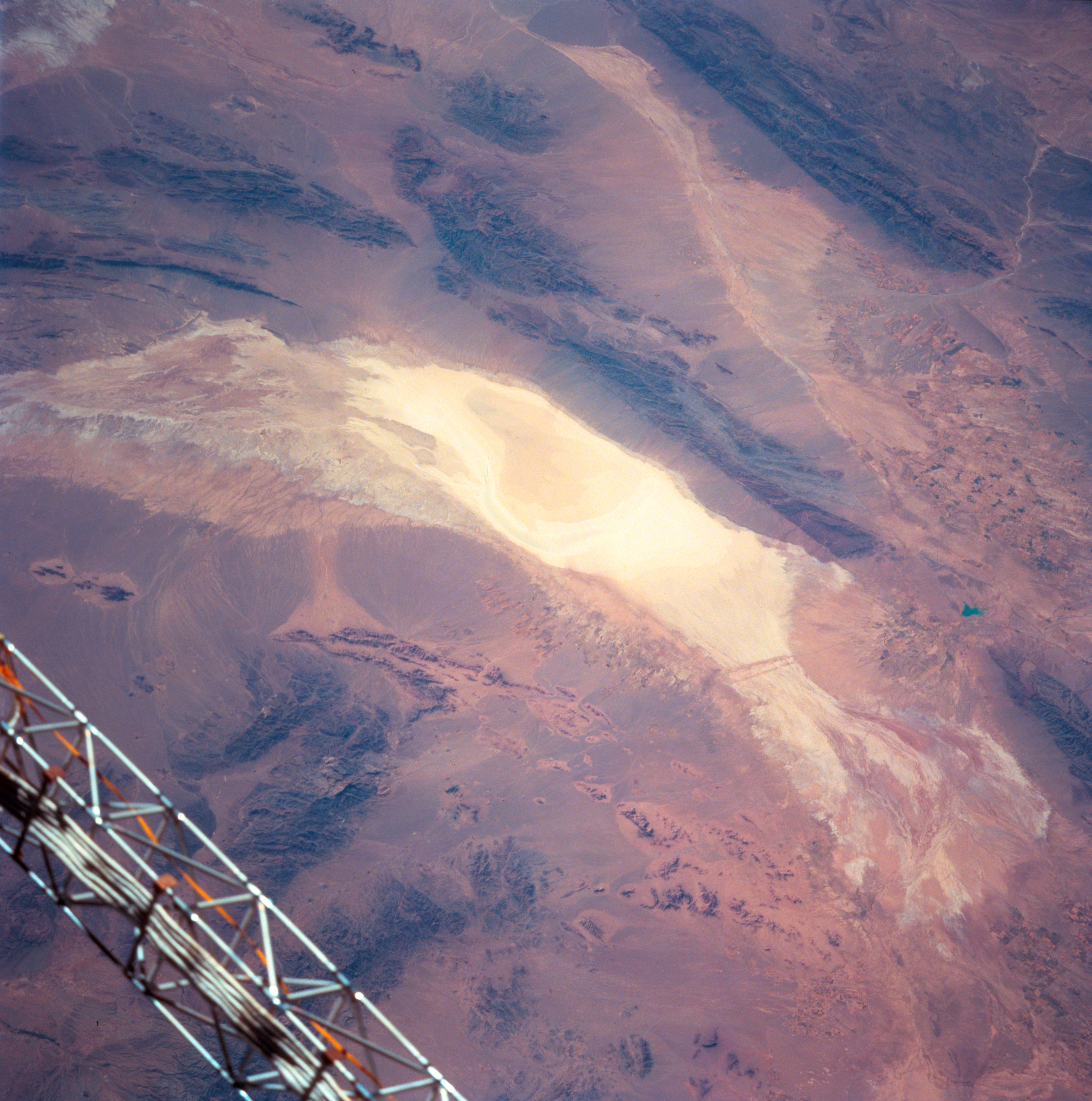
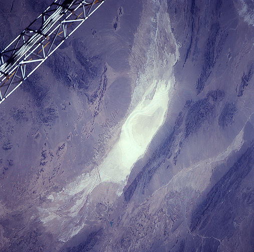
Image Caption: STS091-704-092 Namak Desert, Iran June 1998
Located in northeast Iran, the Namak Desert includes the extensive, highly reflective salt waste or dry lake (center image). Runoff from very limited precipitation that occurs in this arid region drains toward the dry lake. A westerly draining stream valley (light-colored linear feature) extends towards the top center as the intermittently flowing stream heads towards the Great Salt Desert (not in this view). The darker looking, generally elongated features are mountain ranges that enclose many of the arid valleys in northeastern Iran. Elevation differences or local relief between the valley floors and mountain peaks or ridgelines vary from less than 1000 feet (305 meters) to well over 3000 feet (914 meters). Large quantities of eroded materials (uniform-looking color) have formed piedmont alluvial plains around the base of the mountains. The object in the lower left corner of the image is part of the Space Shuttle.
Located in northeast Iran, the Namak Desert includes the extensive, highly reflective salt waste or dry lake (center image). Runoff from very limited precipitation that occurs in this arid region drains toward the dry lake. A westerly draining stream valley (light-colored linear feature) extends towards the top center as the intermittently flowing stream heads towards the Great Salt Desert (not in this view). The darker looking, generally elongated features are mountain ranges that enclose many of the arid valleys in northeastern Iran. Elevation differences or local relief between the valley floors and mountain peaks or ridgelines vary from less than 1000 feet (305 meters) to well over 3000 feet (914 meters). Large quantities of eroded materials (uniform-looking color) have formed piedmont alluvial plains around the base of the mountains. The object in the lower left corner of the image is part of the Space Shuttle.
