STS090-758-17

| NASA Photo ID | STS090-758-17 |
| Focal Length | 250mm |
| Date taken | 1998.04.20 |
| Time taken | 19:45:12 GMT |
Resolutions offered for this image:
4055 x 4055 pixels 639 x 639 pixels 510 x 500 pixels 479 x 479 pixels 500 x 510 pixels
4055 x 4055 pixels 639 x 639 pixels 510 x 500 pixels 479 x 479 pixels 500 x 510 pixels

Cloud masks available for this image:
Spacecraft nadir point: 31.7° N, 117.1° W
Photo center point: 32.5° N, 117.0° W
Photo center point by machine learning:
Photo center point: 32.5° N, 117.0° W
Photo center point by machine learning:
Nadir to Photo Center: North
Spacecraft Altitude: 136 nautical miles (252km)
Country or Geographic Name: | USA-CALIFORNIA |
Features: | SAN DIEGO |
| Features Found Using Machine Learning: | |
Cloud Cover Percentage: | 5 (1-10)% |
Sun Elevation Angle: | 70° |
Sun Azimuth: | 178° |
Camera: | Hasselblad |
Focal Length: | 250mm |
Camera Tilt: | 20 degrees |
Format: | 5069: Kodak Elite 100S, E6 Reversal, Replaces Lumiere, Warmer in tone vs. Lumiere |
Film Exposure: | Normal |
| Additional Information | |
| Width | Height | Annotated | Cropped | Purpose | Links |
|---|---|---|---|---|---|
| 4055 pixels | 4055 pixels | No | No | Earth From Space collection | Download Image |
| 639 pixels | 639 pixels | No | No | Earth From Space collection | Download Image |
| 510 pixels | 500 pixels | Earth From Space phase 2 | Download Image | ||
| 479 pixels | 479 pixels | Download Image | |||
| 500 pixels | 510 pixels | No | No | Download Image |
Download Packaged File
Download a Google Earth KML for this Image
View photo footprint information
Download a GeoTIFF for this photo
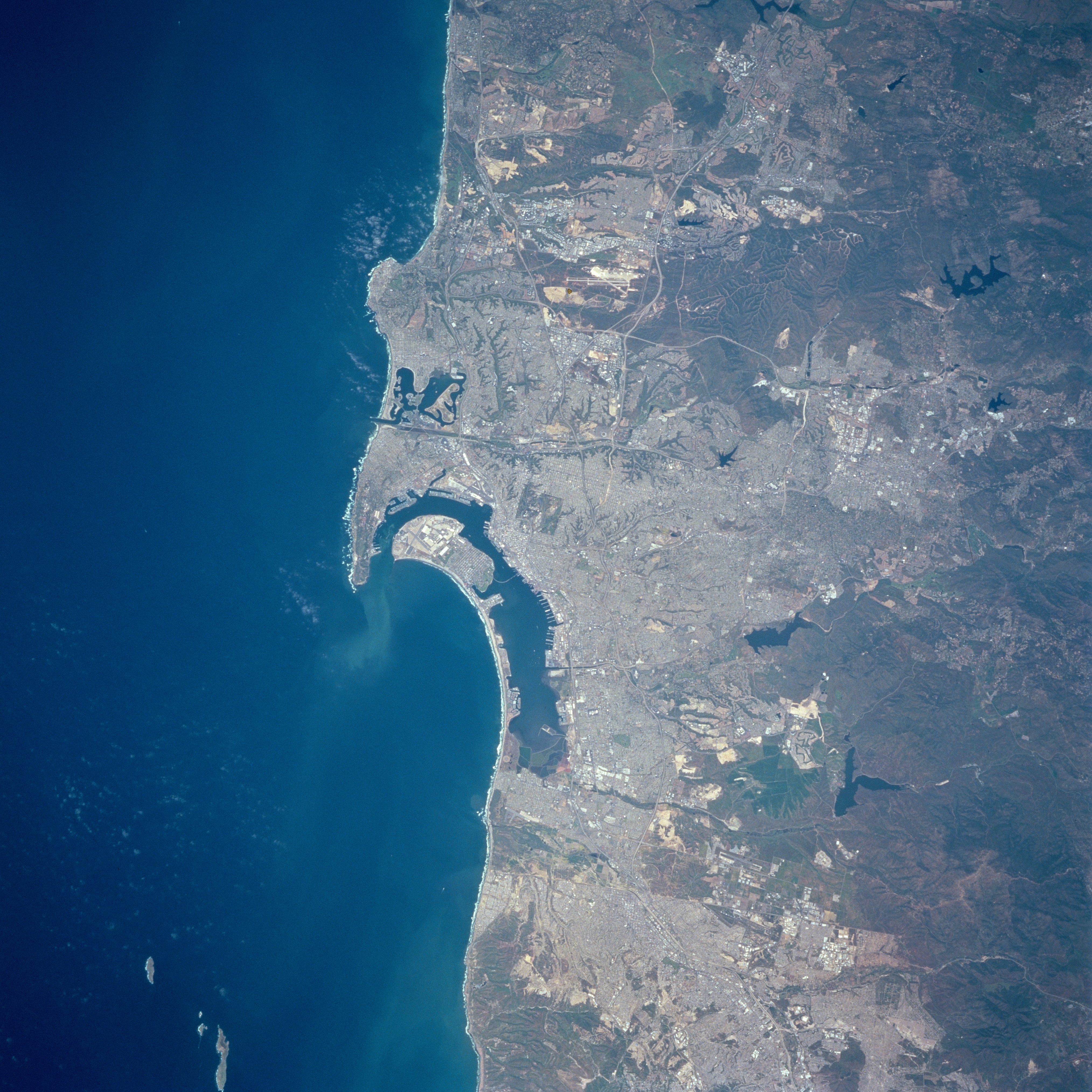
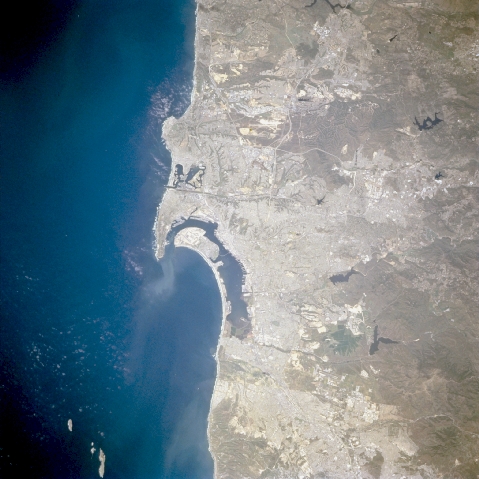
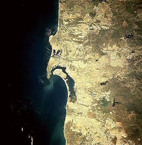
Image Caption: STS090-758-017 San Diego Area, California, USA April 1998
Three major features dominate this image of the southwest coast of California: the deep blue (dark) waters of the Pacific Ocean; the highly reflective, man-made urban and suburban environment along the coast; and the rugged, natural terrain of low mountains east of the urban development. The greater metropolitan area of San Diego (CA) and Tijuana (Mexico) with a combined population of approximately four million people can be identified as the lighter colored, highly reflective area on the image. Several types of infrastructure associated with the developed urban area are visible on this small-scale image. Reservoirs, including the lower Otay, Sweetwater, and St. Vicente Reservoirs, are the irregularly shaped, dark blue areas. The light-colored linear runways of Miramar Naval Air Station lie north of the densely populated area of San Diego. Interstate Highways 5 and 15 (light colored, linear features) radiate northward away from San Diego. The small square-shaped features along the edges of the bay are the many piers that jut into San Diego Bay. Mission Bay Harbor and Marina (dark area) is found along the coast north of the entrance to San Diego Bay.
Three major features dominate this image of the southwest coast of California: the deep blue (dark) waters of the Pacific Ocean; the highly reflective, man-made urban and suburban environment along the coast; and the rugged, natural terrain of low mountains east of the urban development. The greater metropolitan area of San Diego (CA) and Tijuana (Mexico) with a combined population of approximately four million people can be identified as the lighter colored, highly reflective area on the image. Several types of infrastructure associated with the developed urban area are visible on this small-scale image. Reservoirs, including the lower Otay, Sweetwater, and St. Vicente Reservoirs, are the irregularly shaped, dark blue areas. The light-colored linear runways of Miramar Naval Air Station lie north of the densely populated area of San Diego. Interstate Highways 5 and 15 (light colored, linear features) radiate northward away from San Diego. The small square-shaped features along the edges of the bay are the many piers that jut into San Diego Bay. Mission Bay Harbor and Marina (dark area) is found along the coast north of the entrance to San Diego Bay.
