STS090-751-45
| NASA Photo ID | STS090-751-45 |
| Focal Length | 250mm |
| Date taken | 1998.05.02 |
| Time taken | 17:35:57 GMT |
Resolutions offered for this image:
4055 x 4062 pixels 638 x 640 pixels 512 x 518 pixels 478 x 479 pixels
4055 x 4062 pixels 638 x 640 pixels 512 x 518 pixels 478 x 479 pixels

Cloud masks available for this image:
Spacecraft nadir point: 26.4° N, 83.2° W
Photo center point: 26.5° N, 80.0° W
Photo center point by machine learning:
Photo center point: 26.5° N, 80.0° W
Photo center point by machine learning:
Nadir to Photo Center: East
Spacecraft Altitude: 131 nautical miles (243km)
Country or Geographic Name: | USA-FLORIDA |
Features: | BOCA RATON, EVERGLADES |
| Features Found Using Machine Learning: | |
Cloud Cover Percentage: | 0 (no clouds present) |
Sun Elevation Angle: | 79° |
Sun Azimuth: | 188° |
Camera: | Hasselblad |
Focal Length: | 250mm |
Camera Tilt: | Low Oblique |
Format: | 5069: Kodak Elite 100S, E6 Reversal, Replaces Lumiere, Warmer in tone vs. Lumiere |
Film Exposure: | Normal |
| Additional Information | |
| Width | Height | Annotated | Cropped | Purpose | Links |
|---|---|---|---|---|---|
| 4055 pixels | 4062 pixels | No | No | Earth From Space collection | Download Image |
| 638 pixels | 640 pixels | No | No | Earth From Space collection | Download Image |
| 512 pixels | 518 pixels | No | No | Download Image | |
| 478 pixels | 479 pixels | Download Image |
Download Packaged File
Download a Google Earth KML for this Image
View photo footprint information
Download a GeoTIFF for this photo
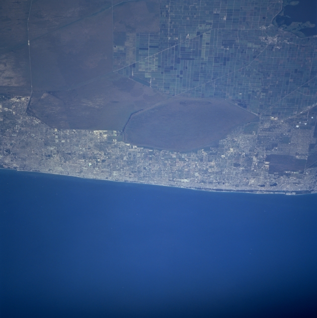
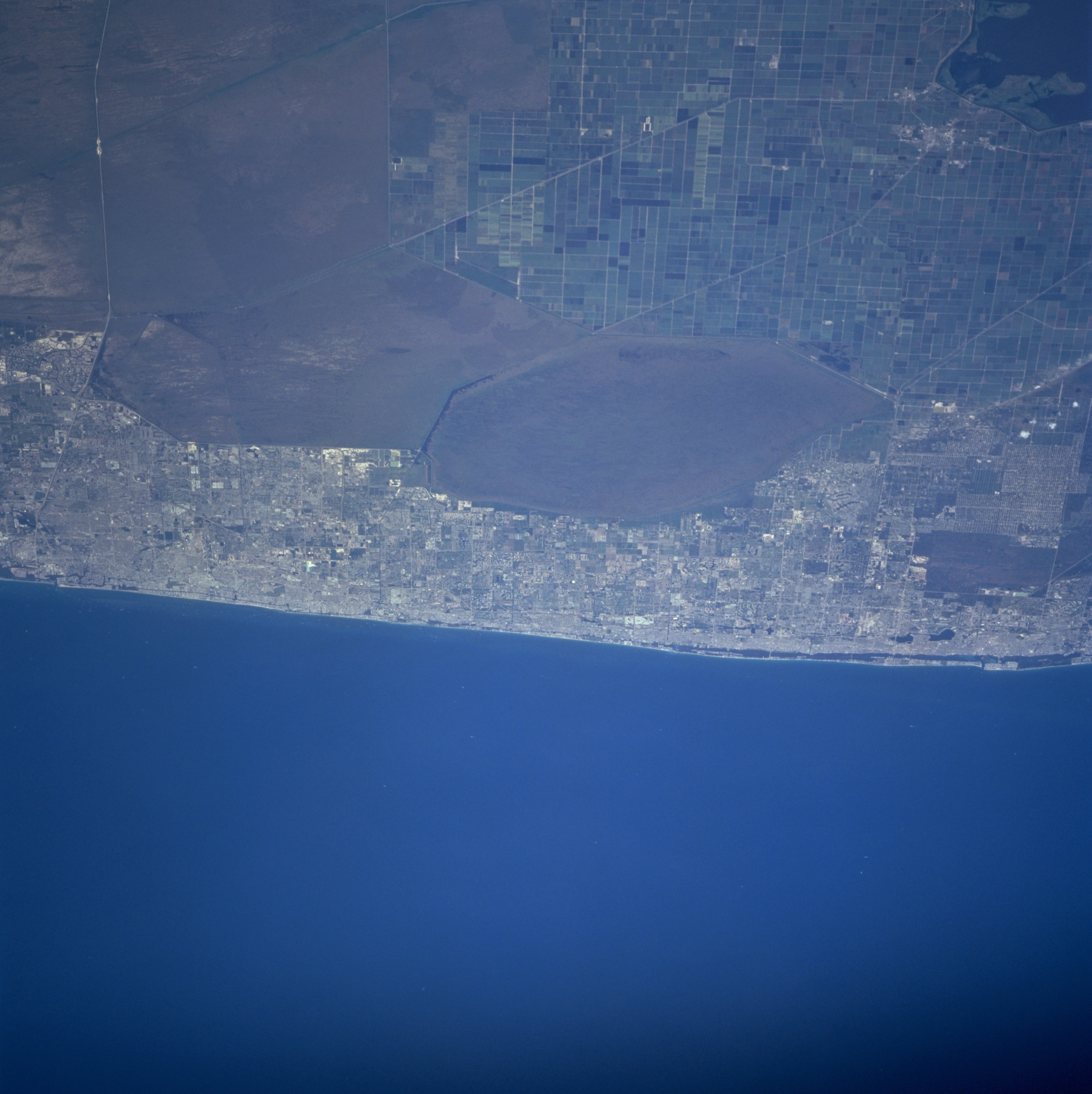
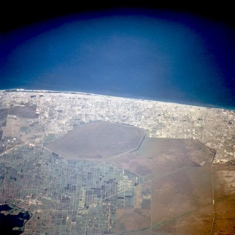
Image Caption: STS090-751-045 Southeast Coast, Florida, USA April 1998
Four distinct features are evident in this shot of the southeast coast of Florida: cultivated field patterns (northwest); poorly drained swamplands (center, southwest); urban sprawl (north-south corridor along coast); and the Atlantic Ocean. The large fields of sugarcane (southeast of Lake Okeechobee, lower left corner) are gridded by canals and roads (linear, northwest-southeast diagonal lines). The muddy looking, uniform area south, southeast of the agricultural land are wetlands upstream from the Everglades. The most northeasterly wetland polygon is Arthur R. Mitchell National Wildlife Refuge. The very light areas along the east coast of Florida are the urban areas that extend from West Palm Beach (north) to Fort Lauderdale (south). The white line running east-west near the southern edge of the image is Interstate Highway 75, otherwise known as Alligator Alley (Everglades Parkway).
Four distinct features are evident in this shot of the southeast coast of Florida: cultivated field patterns (northwest); poorly drained swamplands (center, southwest); urban sprawl (north-south corridor along coast); and the Atlantic Ocean. The large fields of sugarcane (southeast of Lake Okeechobee, lower left corner) are gridded by canals and roads (linear, northwest-southeast diagonal lines). The muddy looking, uniform area south, southeast of the agricultural land are wetlands upstream from the Everglades. The most northeasterly wetland polygon is Arthur R. Mitchell National Wildlife Refuge. The very light areas along the east coast of Florida are the urban areas that extend from West Palm Beach (north) to Fort Lauderdale (south). The white line running east-west near the southern edge of the image is Interstate Highway 75, otherwise known as Alligator Alley (Everglades Parkway).
