STS090-750-62
| NASA Photo ID | STS090-750-62 |
| Focal Length | 250mm |
| Date taken | 1998.05.02 |
| Time taken | 15:56:38 GMT |
Resolutions offered for this image:
4055 x 4091 pixels 634 x 640 pixels 512 x 512 pixels 479 x 479 pixels
4055 x 4091 pixels 634 x 640 pixels 512 x 512 pixels 479 x 479 pixels
Cloud masks available for this image:
Spacecraft nadir point: 39.0° N, 103.5° W
Photo center point: 40.0° N, 104.5° W
Photo center point by machine learning:
Photo center point: 40.0° N, 104.5° W
Photo center point by machine learning:
Nadir to Photo Center: Northwest
Spacecraft Altitude: 132 nautical miles (244km)
Camera: | Hasselblad |
Focal Length: | 250mm |
Camera Tilt: | Near Vertical |
Format: | 5069: Kodak Elite 100S, E6 Reversal, Replaces Lumiere, Warmer in tone vs. Lumiere |
Film Exposure: | Normal |
| Additional Information | |
| Width | Height | Annotated | Cropped | Purpose | Links |
|---|---|---|---|---|---|
| 4055 pixels | 4091 pixels | No | No | Earth From Space collection | Download Image |
| 634 pixels | 640 pixels | No | No | Earth From Space collection | Download Image |
| 512 pixels | 512 pixels | No | No | Download Image | |
| 479 pixels | 479 pixels | Download Image |
Download Packaged File
Download a Google Earth KML for this Image
View photo footprint information
Download a GeoTIFF for this photo
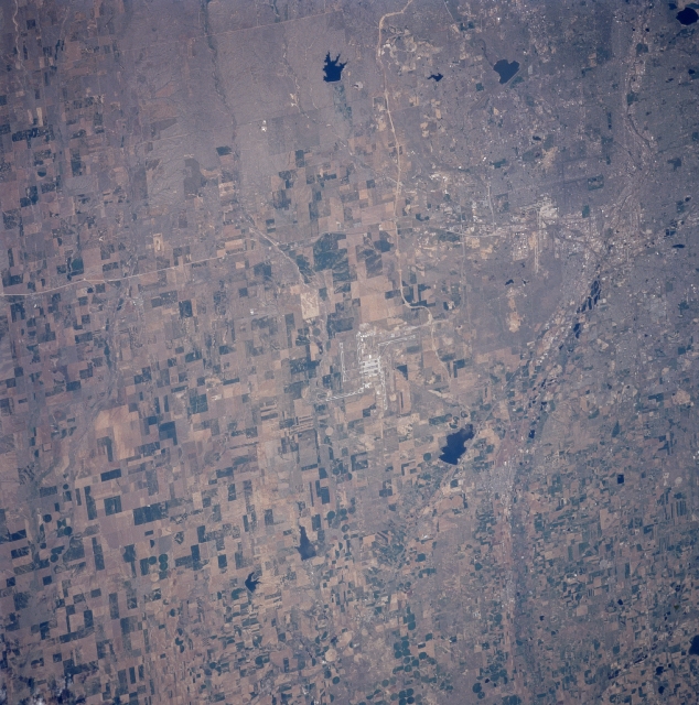
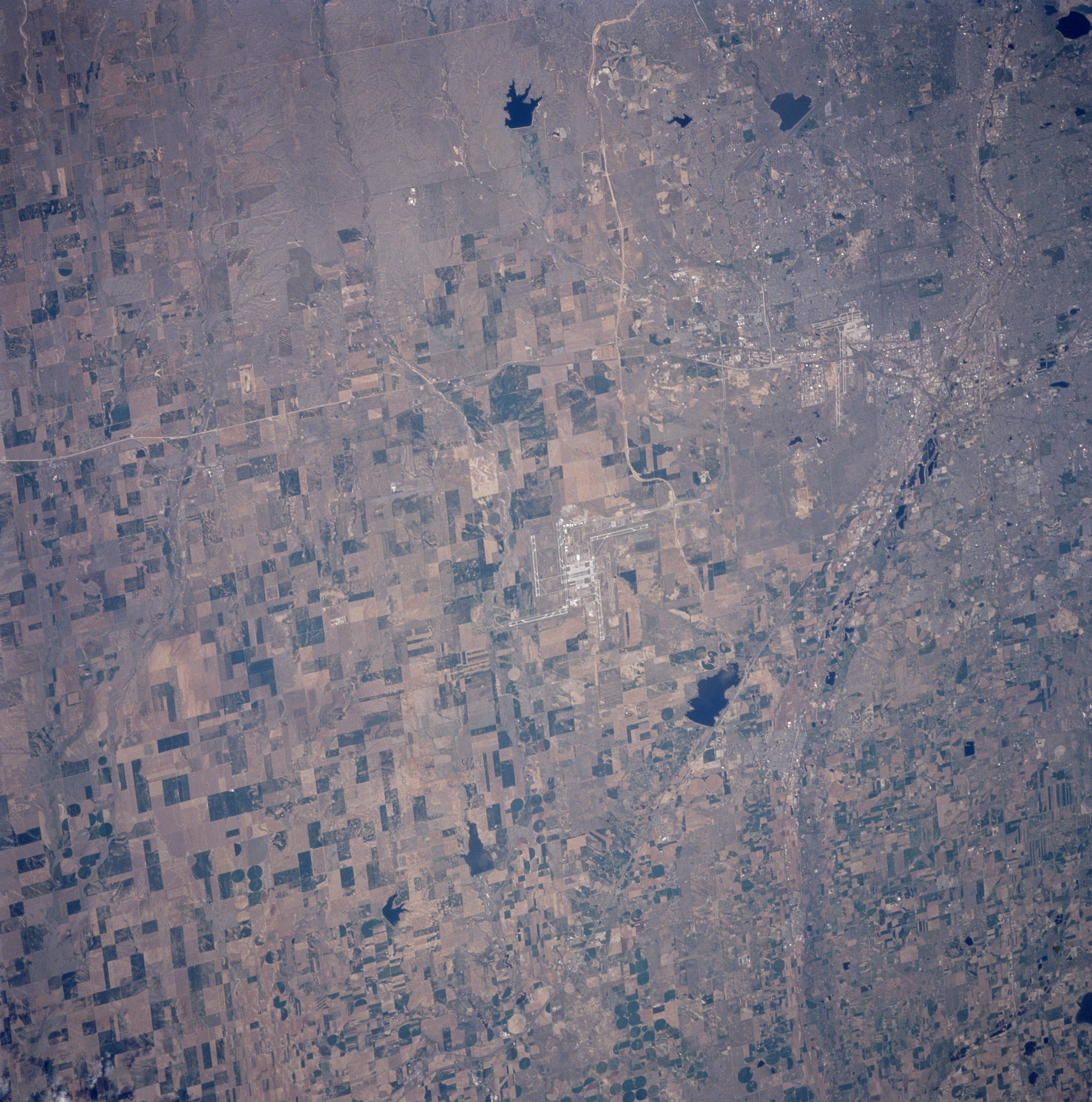
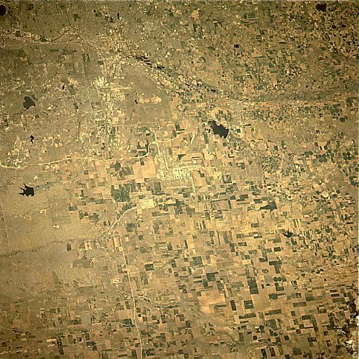
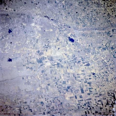
Image Caption: STS090-750-062 Denver International Airport, Colorado, USA April 1998
The multiple runways of the Denver International Airport can be seen in the center of the image. The light colored, linear features that are located south and west of the airport are Interstate Highway 70 (east-west)and Interstate Highway 76 (northeast- southwest), respectively. Most of the rural land in the scene of the western High Plains shows a variety of cultivated field patterns of varying sizes, shapes (rectangular), and colors, where irrigation and dry land farming is practiced. The region receives an average 15 inches (38 cm) of precipitation per year, producing a semi arid climate. A few circular fields indicate that the center pivot irrigation technique is being used on a limited basis in the region. Barr Lake, a state park (dark feature northwest of the airport), is located on the Beebe Seep Canal. Immediately west of this feature, the gently curving floodplain of the South Platte River is barely visible as it heads northward. Most of the southwestern quadrant of the picture consists of urban development, as the cities of Denver and Aurora expand eastward. Cherry Creek Lake (dark feature with a smooth-looking shoreline southwest of the airport) is gradually being encircled by urban growth. This image is oriented with north at the bottom.
The multiple runways of the Denver International Airport can be seen in the center of the image. The light colored, linear features that are located south and west of the airport are Interstate Highway 70 (east-west)and Interstate Highway 76 (northeast- southwest), respectively. Most of the rural land in the scene of the western High Plains shows a variety of cultivated field patterns of varying sizes, shapes (rectangular), and colors, where irrigation and dry land farming is practiced. The region receives an average 15 inches (38 cm) of precipitation per year, producing a semi arid climate. A few circular fields indicate that the center pivot irrigation technique is being used on a limited basis in the region. Barr Lake, a state park (dark feature northwest of the airport), is located on the Beebe Seep Canal. Immediately west of this feature, the gently curving floodplain of the South Platte River is barely visible as it heads northward. Most of the southwestern quadrant of the picture consists of urban development, as the cities of Denver and Aurora expand eastward. Cherry Creek Lake (dark feature with a smooth-looking shoreline southwest of the airport) is gradually being encircled by urban growth. This image is oriented with north at the bottom.
