STS090-726-47
| NASA Photo ID | STS090-726-47 |
| Focal Length | 250mm |
| Date taken | 1998.04.24 |
| Time taken | 21:17:13 GMT |
Resolutions offered for this image:
4067 x 4091 pixels 636 x 640 pixels 514 x 510 pixels 479 x 479 pixels
4067 x 4091 pixels 636 x 640 pixels 514 x 510 pixels 479 x 479 pixels
Cloud masks available for this image:
Spacecraft nadir point: 28.4° N, 82.2° W
Photo center point: 28.0° N, 82.5° W
Photo center point by machine learning:
Photo center point: 28.0° N, 82.5° W
Photo center point by machine learning:
Nadir to Photo Center: Southwest
Spacecraft Altitude: 138 nautical miles (256km)
Country or Geographic Name: | USA-FLORIDA |
Features: | TAMPA BAY, ST. PETERSBURG |
| Features Found Using Machine Learning: | |
Cloud Cover Percentage: | 0 (no clouds present) |
Sun Elevation Angle: | 34° |
Sun Azimuth: | 267° |
Camera: | Hasselblad |
Focal Length: | 250mm |
Camera Tilt: | 12 degrees |
Format: | 5069: Kodak Elite 100S, E6 Reversal, Replaces Lumiere, Warmer in tone vs. Lumiere |
Film Exposure: | Out of Focus |
| Additional Information | |
| Width | Height | Annotated | Cropped | Purpose | Links |
|---|---|---|---|---|---|
| 4067 pixels | 4091 pixels | No | No | Earth From Space collection | Download Image |
| 636 pixels | 640 pixels | No | No | Earth From Space collection | Download Image |
| 514 pixels | 510 pixels | No | No | Download Image | |
| 479 pixels | 479 pixels | Download Image |
Download Packaged File
Download a Google Earth KML for this Image
View photo footprint information
Download a GeoTIFF for this photo
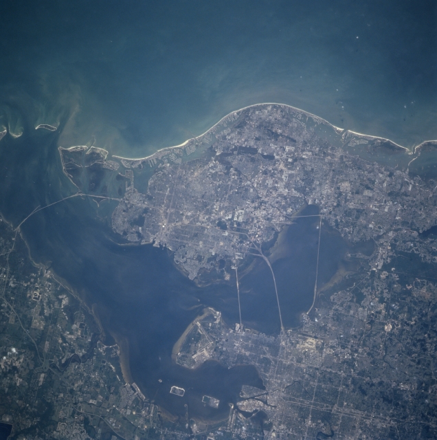
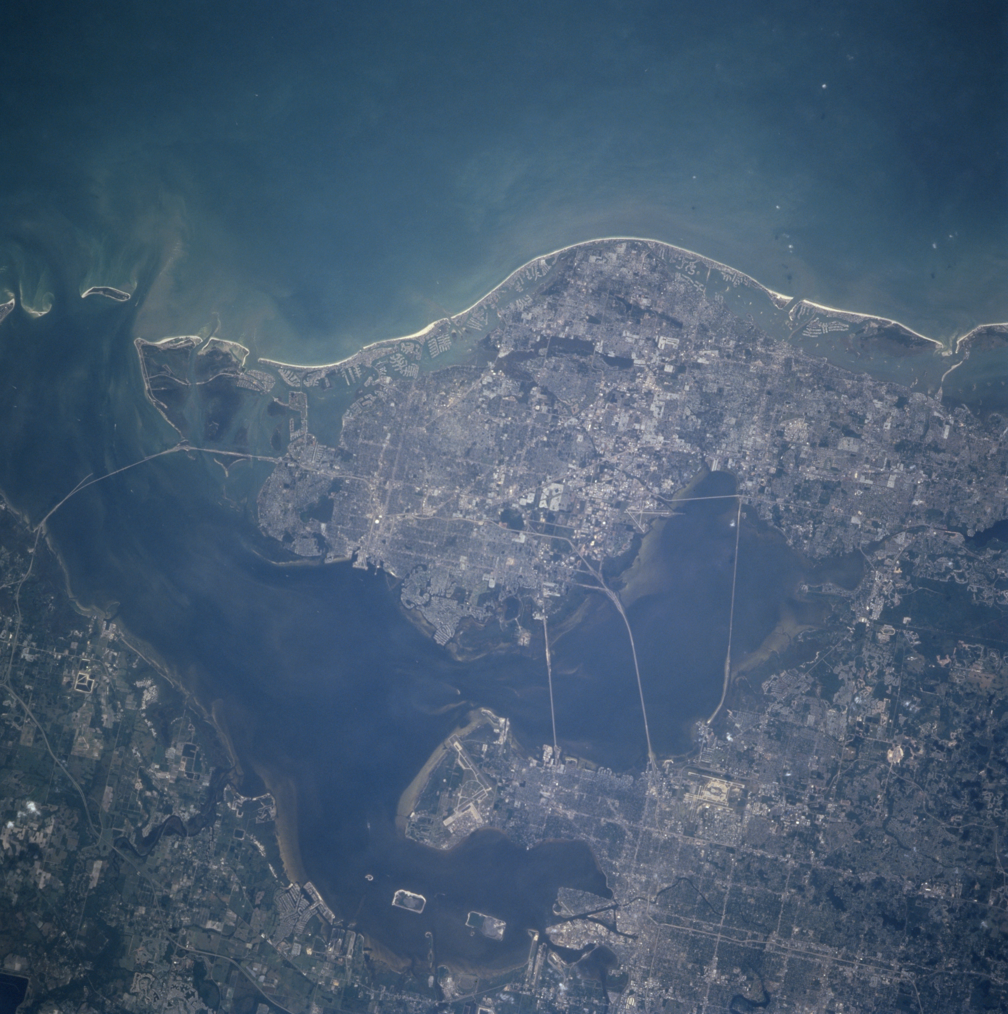
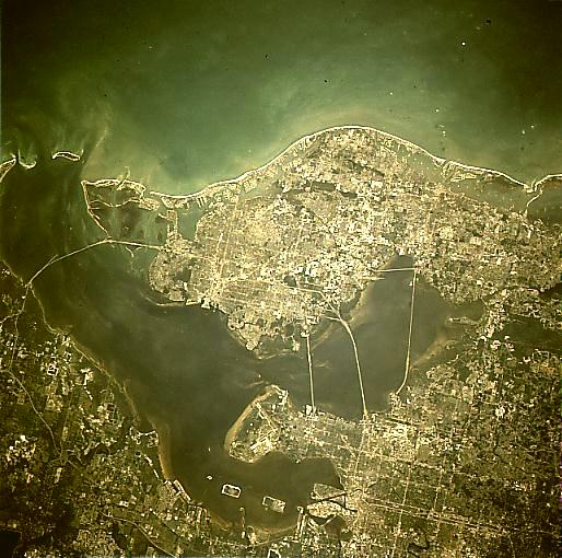
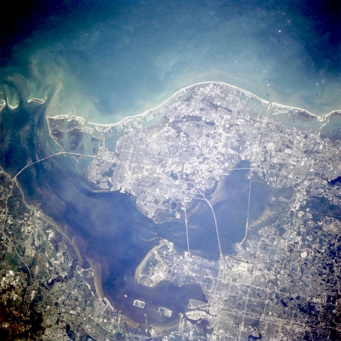
Image Caption: STS090-726-047 Tampa Bay Area, Florida, USA April 1998
The intensively urbanized land that surrounds Tampa Bay stands out in this STS-90 photograph of the west central coast of Florida. The two bays north and northeast of Tampa Bay are Old Tampa Bay and Hillsborough Bay respectively. Several bridges (linear, light colored features) are visible connecting the three major cities of Clearwater (west side of photograph, adjacent to the Gulf of Mexico); St. Petersburg (southernmost city on the large peninsula); and Tampa (northeast quadrant of the picture). From north to south bridges in Tampa Bay include Courtney Campbell Causeway, Howard Franklin Bridge, Gandy Bridge, and the Sunshine Skyway Bridge. The runways of Macdill Air Force Base south of Tampa; Tampa International Airport along the east side of Old Tampa Bay and St. Petersburg-Clearwater International Airport along the west side of Old Tampa Bay, are discernible.
The intensively urbanized land that surrounds Tampa Bay stands out in this STS-90 photograph of the west central coast of Florida. The two bays north and northeast of Tampa Bay are Old Tampa Bay and Hillsborough Bay respectively. Several bridges (linear, light colored features) are visible connecting the three major cities of Clearwater (west side of photograph, adjacent to the Gulf of Mexico); St. Petersburg (southernmost city on the large peninsula); and Tampa (northeast quadrant of the picture). From north to south bridges in Tampa Bay include Courtney Campbell Causeway, Howard Franklin Bridge, Gandy Bridge, and the Sunshine Skyway Bridge. The runways of Macdill Air Force Base south of Tampa; Tampa International Airport along the east side of Old Tampa Bay and St. Petersburg-Clearwater International Airport along the west side of Old Tampa Bay, are discernible.
