STS090-712-43
| NASA Photo ID | STS090-712-43 |
| Focal Length | 250mm |
| Date taken | 1998.04.25 |
| Time taken | 16:31:06 GMT |
Resolutions offered for this image:
4000 x 4000 pixels 639 x 639 pixels 511 x 510 pixels 479 x 472 pixels
4000 x 4000 pixels 639 x 639 pixels 511 x 510 pixels 479 x 472 pixels

Cloud masks available for this image:
Spacecraft nadir point: 38.6° N, 76.4° W
Photo center point: 39.5° N, 76.5° W
Photo center point by machine learning:
Photo center point: 39.5° N, 76.5° W
Photo center point by machine learning:
Nadir to Photo Center: North
Spacecraft Altitude: 133 nautical miles (246km)
Country or Geographic Name: | USA-MARYLAND |
Features: | BALTIMORE, CHESAPEAKE BAY |
| Features Found Using Machine Learning: | |
Cloud Cover Percentage: | 0 (no clouds present) |
Sun Elevation Angle: | 64° |
Sun Azimuth: | 162° |
Camera: | Hasselblad |
Focal Length: | 250mm |
Camera Tilt: | 22 degrees |
Format: | 5069: Kodak Elite 100S, E6 Reversal, Replaces Lumiere, Warmer in tone vs. Lumiere |
Film Exposure: | Out of Focus |
| Additional Information | |
| Width | Height | Annotated | Cropped | Purpose | Links |
|---|---|---|---|---|---|
| 4000 pixels | 4000 pixels | No | No | Earth From Space collection | Download Image |
| 639 pixels | 639 pixels | No | No | Earth From Space collection | Download Image |
| 511 pixels | 510 pixels | No | No | Download Image | |
| 479 pixels | 472 pixels | Download Image |
Download Packaged File
Download a Google Earth KML for this Image
View photo footprint information
Download a GeoTIFF for this photo
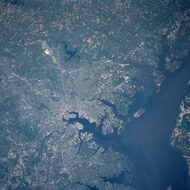
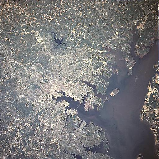
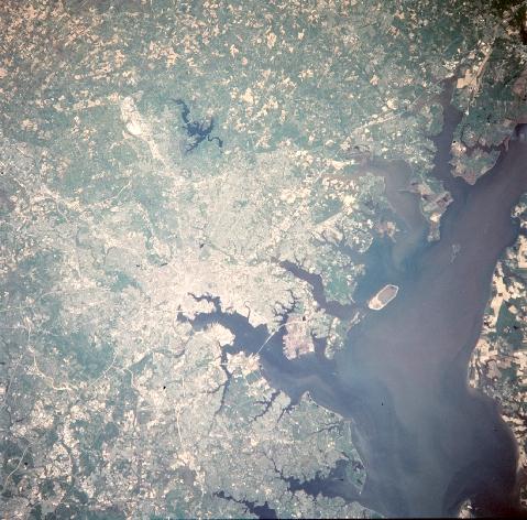
Image Caption: STS090-712-043 Baltimore, Maryland April 1998
Baltimore, the 12th largest city in the United States and the largest city in the state of Maryland, can be seen in this north-looking view. Named "Charm City" for its residents well-established concern for the quality of life, Baltimore owes much of its growth and prosperity to its location. The city is farther west than any other major Atlantic Ocean port while being strategically located in the mid-Atlantic region of the United States. As the United States fifth largest port, Baltimore's location makes it the closest Atlantic Ocean port to major mid-western population and manufacturing centers. The Chesapeake Bay can be seen to the east (right) of the city. The Loch Raven Reservoir is discernible north of the city.
Baltimore, the 12th largest city in the United States and the largest city in the state of Maryland, can be seen in this north-looking view. Named "Charm City" for its residents well-established concern for the quality of life, Baltimore owes much of its growth and prosperity to its location. The city is farther west than any other major Atlantic Ocean port while being strategically located in the mid-Atlantic region of the United States. As the United States fifth largest port, Baltimore's location makes it the closest Atlantic Ocean port to major mid-western population and manufacturing centers. The Chesapeake Bay can be seen to the east (right) of the city. The Loch Raven Reservoir is discernible north of the city.
