STS090-712-40

| NASA Photo ID | STS090-712-40 |
| Focal Length | 250mm |
| Date taken | 1998.04.25 |
| Time taken | 16:31:00 GMT |
Resolutions offered for this image:
3060 x 3065 pixels 1198 x 1200 pixels 3994 x 4000 pixels 639 x 639 pixels 507 x 515 pixels 478 x 479 pixels
3060 x 3065 pixels 1198 x 1200 pixels 3994 x 4000 pixels 639 x 639 pixels 507 x 515 pixels 478 x 479 pixels


Cloud masks available for this image:
Spacecraft nadir point: 38.6° N, 76.9° W
Photo center point: 39.0° N, 77.0° W
Photo center point by machine learning:
Photo center point: 39.0° N, 77.0° W
Photo center point by machine learning:
Nadir to Photo Center: North
Spacecraft Altitude: 133 nautical miles (246km)
Camera: | Hasselblad |
Focal Length: | 250mm |
Camera Tilt: | 11 degrees |
Format: | 5069: Kodak Elite 100S, E6 Reversal, Replaces Lumiere, Warmer in tone vs. Lumiere |
Film Exposure: | Normal |
| Additional Information | |
| Width | Height | Annotated | Cropped | Purpose | Links |
|---|---|---|---|---|---|
| 3060 pixels | 3065 pixels | No | No | Cities collection | Download Image |
| 1198 pixels | 1200 pixels | No | No | Cities collection | Download Image |
| 3994 pixels | 4000 pixels | No | No | Earth From Space collection | Download Image |
| 639 pixels | 639 pixels | No | No | Earth From Space collection | Download Image |
| 507 pixels | 515 pixels | No | No | Download Image | |
| 478 pixels | 479 pixels | Download Image |
Download Packaged File
Download a Google Earth KML for this Image
View photo footprint information
Download a GeoTIFF for this photo
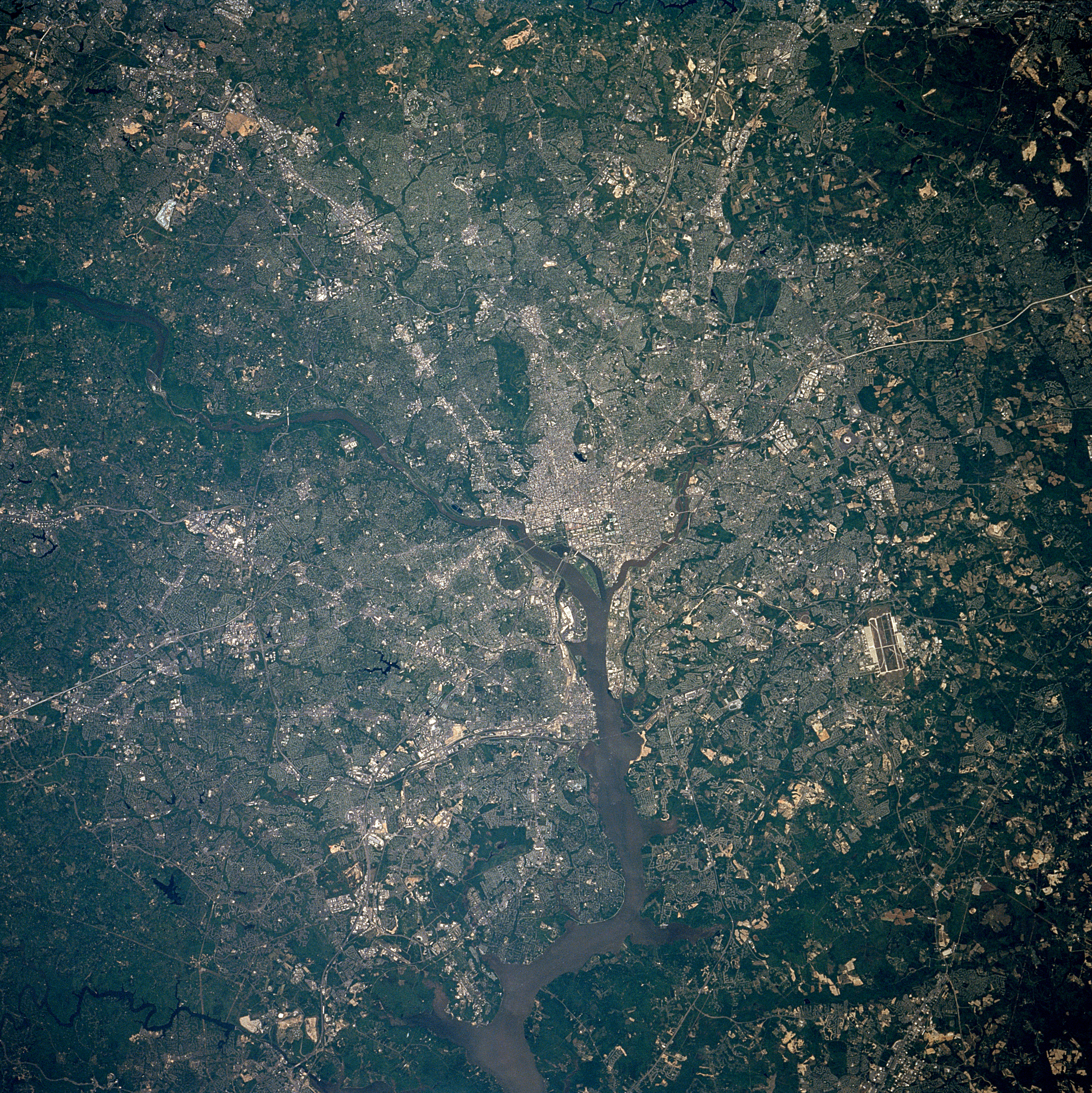
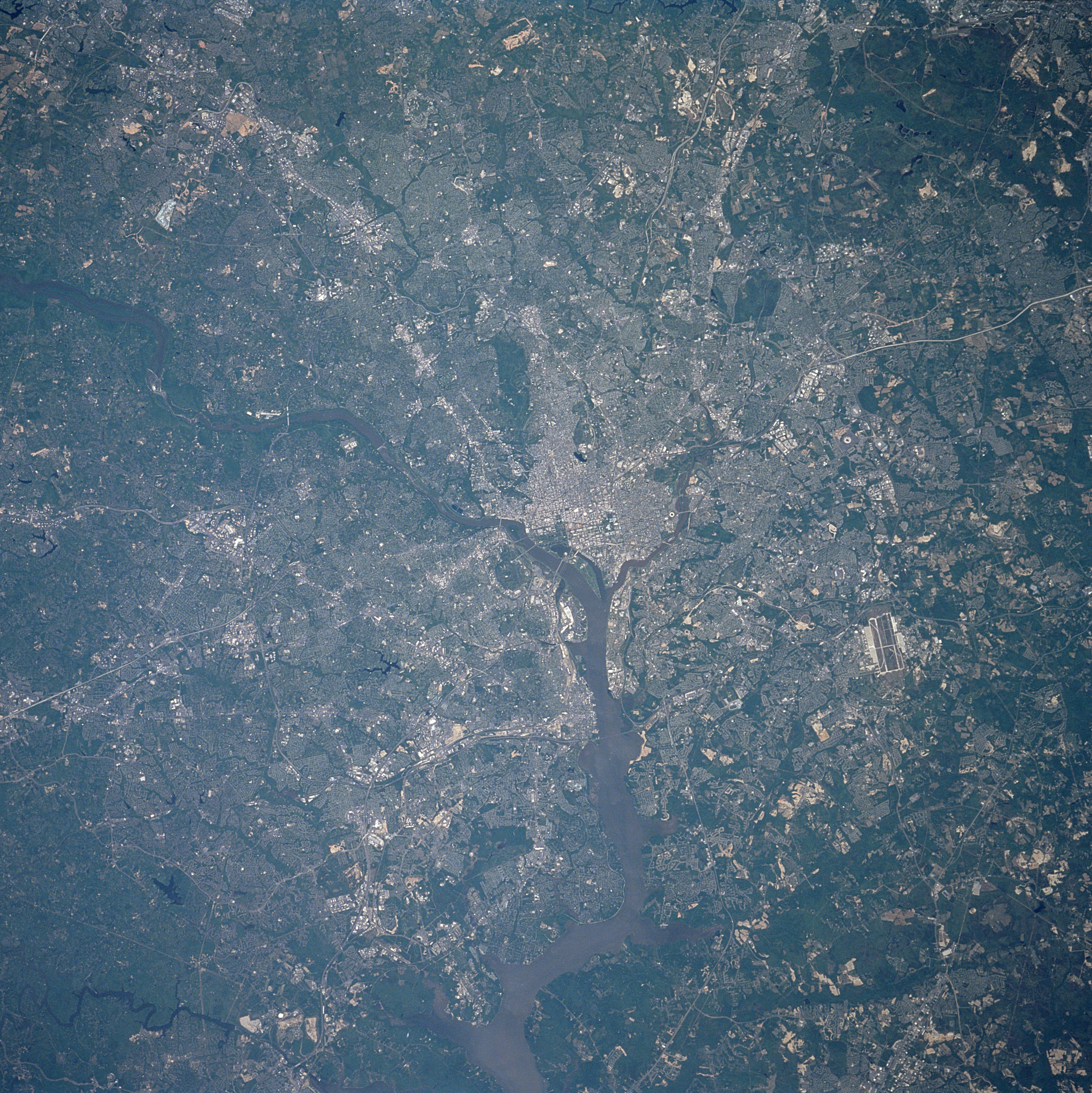
Image Caption: STS090-712-040 Washington District of Columbia April 1998
Washington D.C., the capital of the United States, is located on the Potomac and Anacostia Rivers. The Potomac River enters the scene midway between the left center and upper left of the image and exits the scene at the bottom center of the image. The state of Virginia lies to the west of the Potomac River, the state of Maryland to the north and east of the Potomac River. The runways of Andrews Air Force Base are visible east-southeast of Washington D. C. near the right center of the image.
Washington D.C., the capital of the United States, is located on the Potomac and Anacostia Rivers. The Potomac River enters the scene midway between the left center and upper left of the image and exits the scene at the bottom center of the image. The state of Virginia lies to the west of the Potomac River, the state of Maryland to the north and east of the Potomac River. The runways of Andrews Air Force Base are visible east-southeast of Washington D. C. near the right center of the image.
