STS089-710-11
| NASA Photo ID | STS089-710-11 |
| Focal Length | 100mm |
| Date taken | 1998.01.30 |
| Time taken | 18:34:11 GMT |
Cloud masks available for this image:
Spacecraft nadir point: 22.2° S, 46.1° W
Photo center point: 23.0° S, 42.0° W
Photo center point by machine learning:
Photo center point: 23.0° S, 42.0° W
Photo center point by machine learning:
Nadir to Photo Center: East
Spacecraft Altitude: 195 nautical miles (361km)
Country or Geographic Name: | BRAZIL |
Features: | CAPE FRIO |
| Features Found Using Machine Learning: | |
Cloud Cover Percentage: | 20 (11-25)% |
Sun Elevation Angle: | 44° |
Sun Azimuth: | 266° |
Camera: | Hasselblad |
Focal Length: | 100mm |
Camera Tilt: | 52 degrees |
Format: | 5069: Kodak Elite 100S, E6 Reversal, Replaces Lumiere, Warmer in tone vs. Lumiere |
Film Exposure: | Normal |
| Additional Information | |
| Width | Height | Annotated | Cropped | Purpose | Links |
|---|---|---|---|---|---|
| 4096 pixels | 4057 pixels | No | No | Earth From Space collection | Download Image |
| 640 pixels | 633 pixels | No | No | Earth From Space collection | Download Image |
Download Packaged File
Download a Google Earth KML for this Image
View photo footprint information
Download a GeoTIFF for this photo
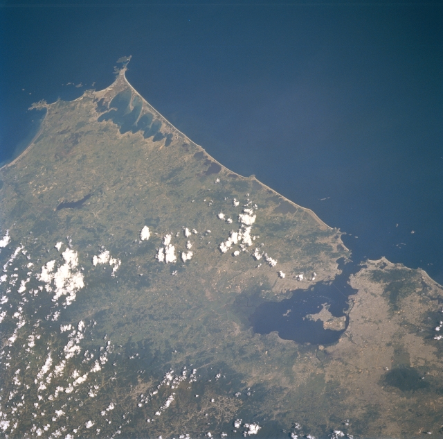
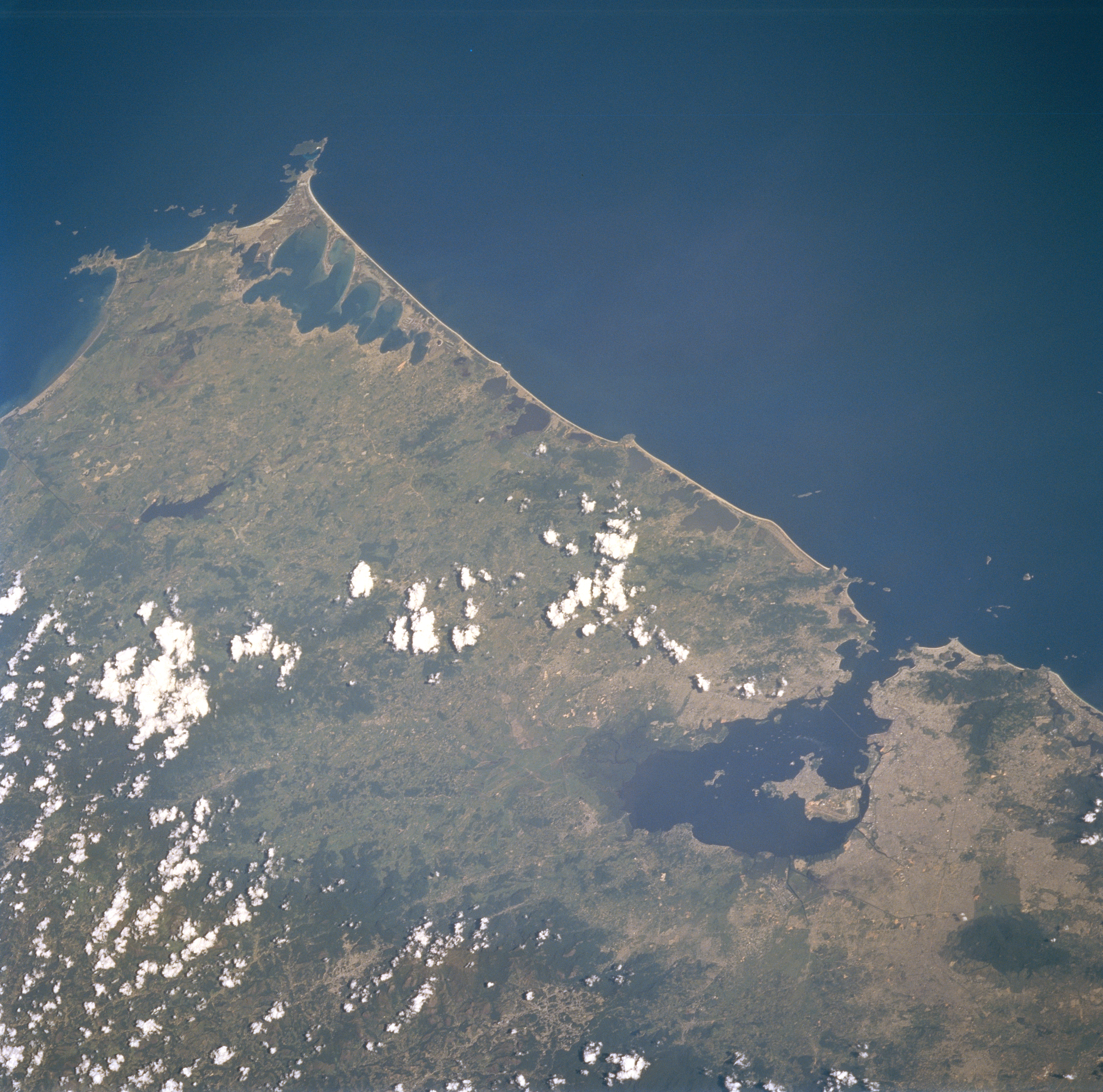
Image Caption: STS089-710-011 Rio De Janeiro State, Brazil January 1998
The large embayment (dark feature) towards the west side (lower right quadrant) of the image is Guanabara Bay. The large island along the western side of Guanabara Bay is Governor's Island. The extensive urban area (gray colored landscape) of the greater Rio de Janeiro metropolitan region can be seen on both sides of the bay. Eastward from Rio de Janeiro, a series of shallow lagoons or lakes are visible adjacent to the coastal beaches. The topography of eastern Brazil changes from deltas and floodplains along the coast to hilly lowlands and low mountains towards the interior. The darker terrain further inland (mostly obscured by clouds) is part of an extension of forested mountains.
The large embayment (dark feature) towards the west side (lower right quadrant) of the image is Guanabara Bay. The large island along the western side of Guanabara Bay is Governor's Island. The extensive urban area (gray colored landscape) of the greater Rio de Janeiro metropolitan region can be seen on both sides of the bay. Eastward from Rio de Janeiro, a series of shallow lagoons or lakes are visible adjacent to the coastal beaches. The topography of eastern Brazil changes from deltas and floodplains along the coast to hilly lowlands and low mountains towards the interior. The darker terrain further inland (mostly obscured by clouds) is part of an extension of forested mountains.
