STS088-723-1
| NASA Photo ID | STS088-723-1 |
| Focal Length | 250mm |
| Date taken | 1998.12.14 |
| Time taken | 01:29:55 GMT |
Resolutions offered for this image:
1027 x 1024 pixels 2050 x 2048 pixels 4100 x 4096 pixels 514 x 512 pixels 2262 x 2155 pixels 2631 x 2583 pixels
1027 x 1024 pixels 2050 x 2048 pixels 4100 x 4096 pixels 514 x 512 pixels 2262 x 2155 pixels 2631 x 2583 pixels


Cloud masks available for this image:
Spacecraft nadir point: 9.3° N, 115.5° E
Photo center point: 8.0° N, 117.0° E
Photo center point by machine learning:
Photo center point: 8.0° N, 117.0° E
Photo center point by machine learning:
Nadir to Photo Center: Southeast
Spacecraft Altitude: 209 nautical miles (387km)
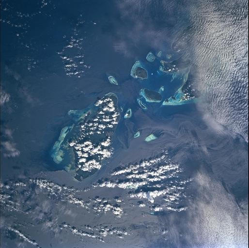
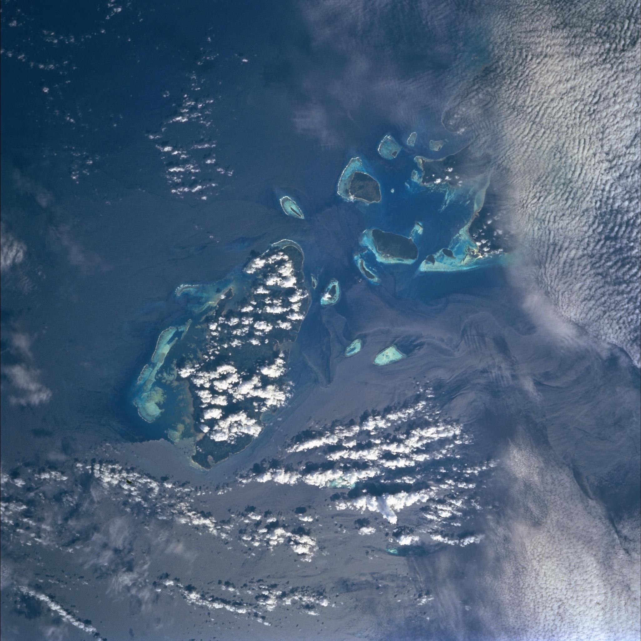
Country or Geographic Name: | PHILIPPINES |
Features: | BALABAC ISLAND, SUNGLINT |
| Features Found Using Machine Learning: | |
Cloud Cover Percentage: | 15 (11-25)% |
Sun Elevation Angle: | 39° |
Sun Azimuth: | 130° |
Camera: | Hasselblad |
Focal Length: | 250mm |
Camera Tilt: | 30 degrees |
Format: | 5069: Kodak Elite 100S, E6 Reversal, Replaces Lumiere, Warmer in tone vs. Lumiere |
Film Exposure: | Normal |
| Additional Information | |
| Width | Height | Annotated | Cropped | Purpose | Links |
|---|---|---|---|---|---|
| 1027 pixels | 1024 pixels | No | No | Download Image | |
| 2050 pixels | 2048 pixels | No | No | Download Image | |
| 4100 pixels | 4096 pixels | No | No | Download Image | |
| 514 pixels | 512 pixels | No | No | Download Image | |
| 2262 pixels | 2155 pixels | No | Yes | ReefBase 1 | Download Image |
| 2631 pixels | 2583 pixels | No | No | ReefBase 1 | Download Image |
Download Packaged File
Download a Google Earth KML for this Image
View photo footprint information
Download a GeoTIFF for this photo
Image Caption: Slicks around Balabac Island, Philippines (just north of Borneo)
