STS088-705-62
| NASA Photo ID | STS088-705-62 |
| Focal Length | 250mm |
| Date taken | 1998.12.05 |
| Time taken | 19:47:40 GMT |
Resolutions offered for this image:
1062 x 999 pixels 1057 x 1024 pixels 2080 x 2048 pixels 4128 x 4096 pixels 537 x 512 pixels
1062 x 999 pixels 1057 x 1024 pixels 2080 x 2048 pixels 4128 x 4096 pixels 537 x 512 pixels
Cloud masks available for this image:
Spacecraft nadir point: 34.6° S, 68.8° W
Photo center point: 33.5° S, 70.5° W
Photo center point by machine learning:
Photo center point: 33.5° S, 70.5° W
Photo center point by machine learning:
Nadir to Photo Center: Northwest
Spacecraft Altitude: 170 nautical miles (315km)
Camera: | Hasselblad |
Focal Length: | 250mm |
Camera Tilt: | 36 degrees |
Format: | 5069: Kodak Elite 100S, E6 Reversal, Replaces Lumiere, Warmer in tone vs. Lumiere |
Film Exposure: | Normal |
| Additional Information | |
| Width | Height | Annotated | Cropped | Purpose | Links |
|---|---|---|---|---|---|
| 1062 pixels | 999 pixels | No | No | Cities collection | Download Image |
| 1057 pixels | 1024 pixels | No | No | Download Image | |
| 2080 pixels | 2048 pixels | No | No | Download Image | |
| 4128 pixels | 4096 pixels | No | No | Download Image | |
| 537 pixels | 512 pixels | No | No | Download Image |
Download Packaged File
Download a Google Earth KML for this Image
View photo footprint information
Download a GeoTIFF for this photo
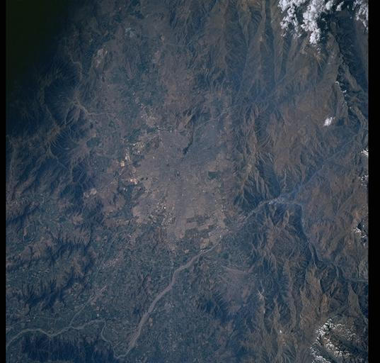
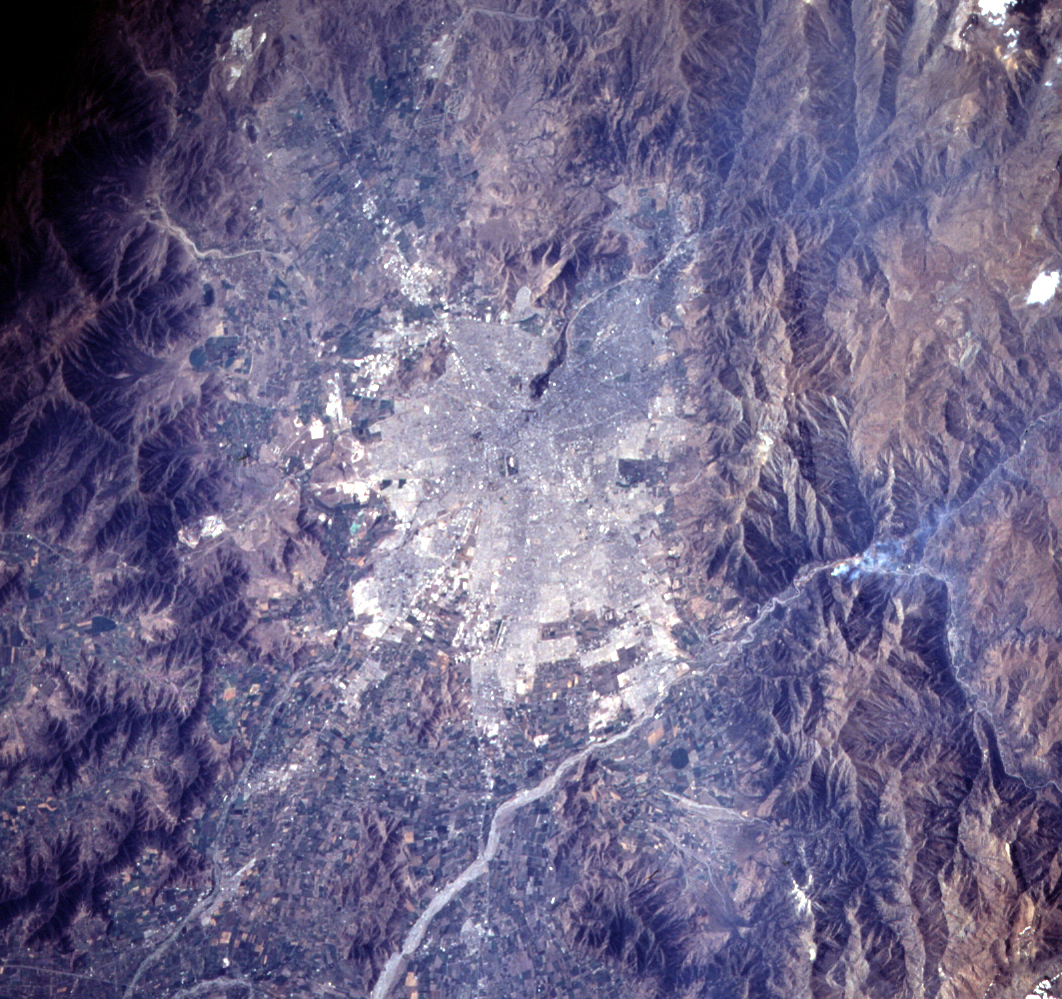
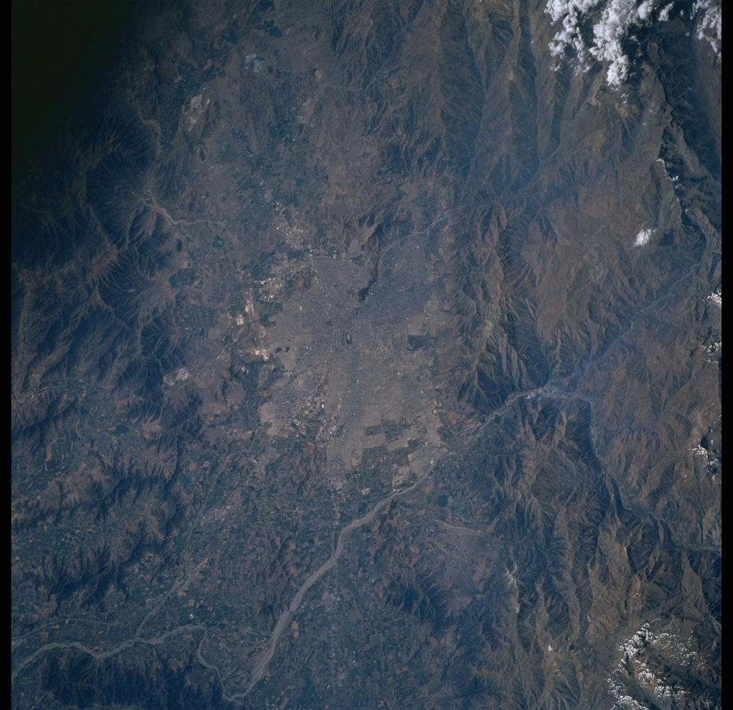
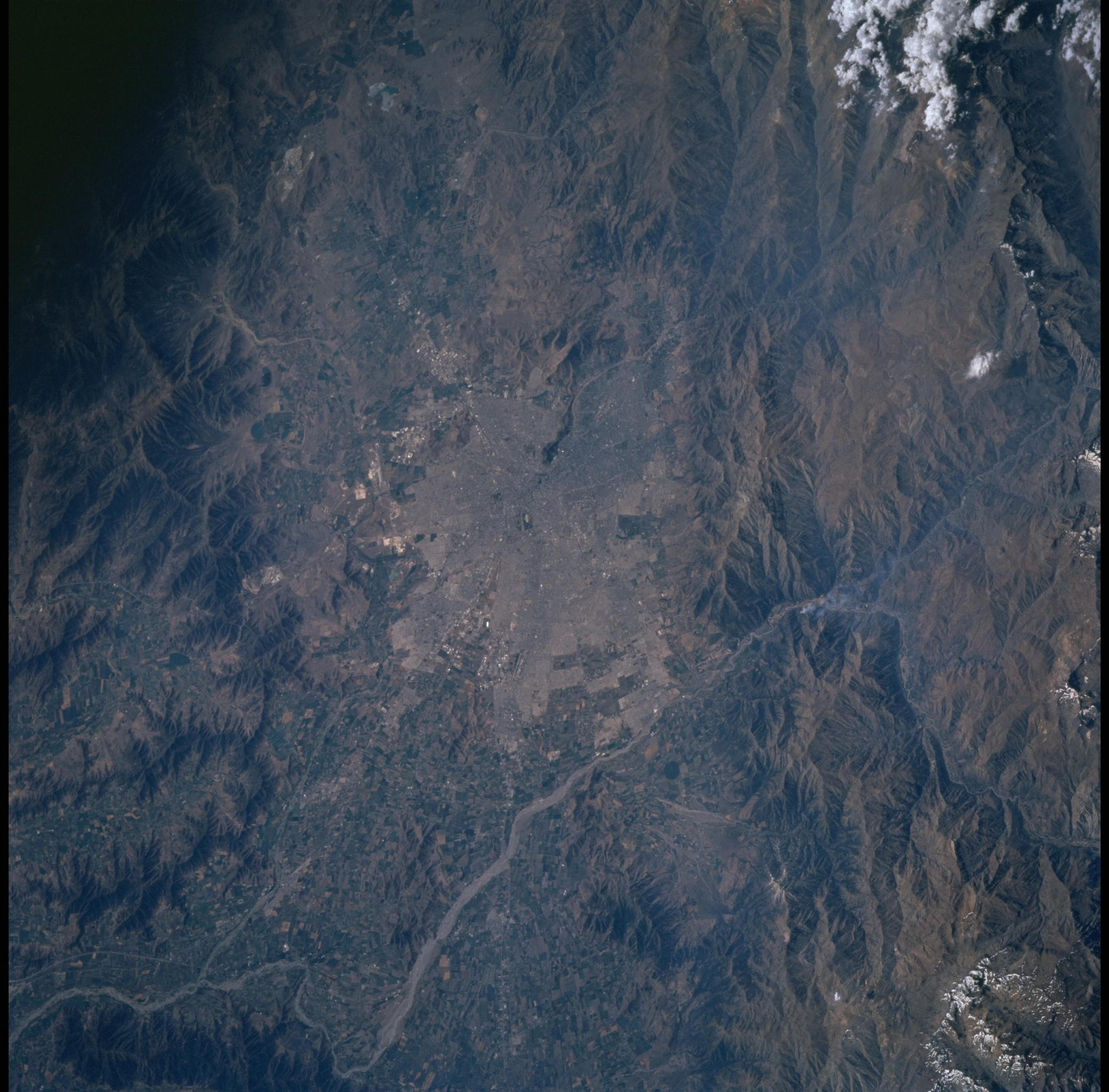
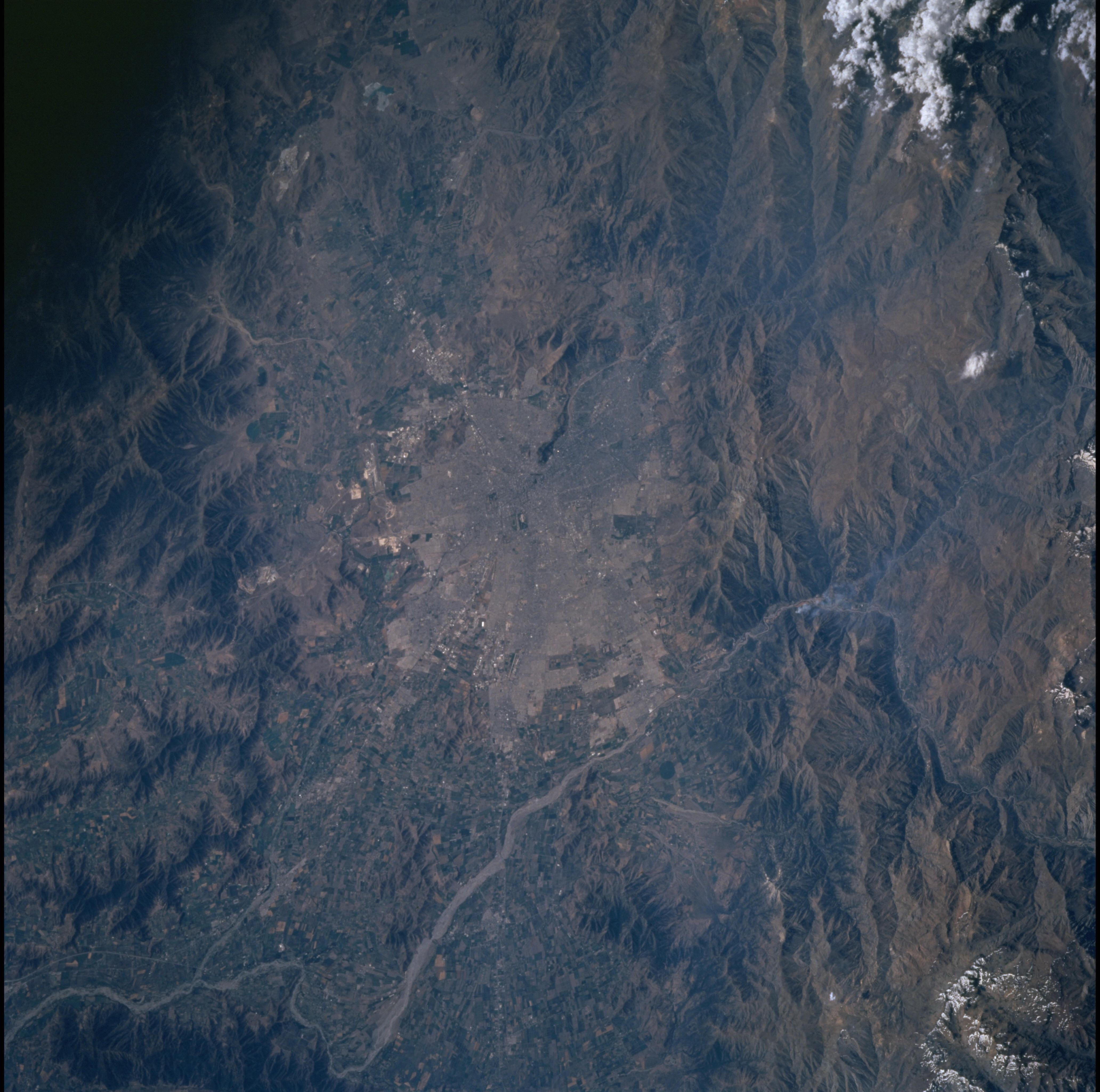
Image Caption: Chile's capital city stands in excellent detail in the middle of this view. An airport
appears on the northwest margin of the built-up area and numerous small farms appear as
green rectangles around the city on the left (west) side of the view. The right side of the
view is dominated by the steep slopes and peaks of the Andes Mountains. Snow can be
seen on highest peaks all down the right (east) side of the view although the photo was
taken in the summer of the southern hemisphere. Santiago routinely appears partly
obscured under industrial haze on Shuttle photographs. Haze accumulates partly because
the city lies in a basin at the foot of the Andes Mountains (protected from wind), and
partly because the city has grown to a huge size (more than 5.3 million-1991 statistics).
