STS087-701-53
| NASA Photo ID | STS087-701-53 |
| Focal Length | 100mm |
| Date taken | 1997.11.21 |
| Time taken | 03:08:55 GMT |
Cloud masks available for this image:
Spacecraft nadir point: 19.1° N, 108.1° E
Photo center point: 19.0° N, 108.5° E
Photo center point by machine learning:
Photo center point: 19.0° N, 108.5° E
Photo center point by machine learning:
Nadir to Photo Center: East
Spacecraft Altitude: 150 nautical miles (278km)
Country or Geographic Name: | CHINA |
Features: | YU-LIN POINT |
| Features Found Using Machine Learning: | |
Cloud Cover Percentage: | 10 (1-10)% |
Sun Elevation Angle: | 46° |
Sun Azimuth: | 151° |
Camera: | Hasselblad |
Focal Length: | 100mm |
Camera Tilt: | 9 degrees |
Format: | 5069: Kodak Elite 100S, E6 Reversal, Replaces Lumiere, Warmer in tone vs. Lumiere |
Film Exposure: | Normal |
| Additional Information | |
| Width | Height | Annotated | Cropped | Purpose | Links |
|---|---|---|---|---|---|
| 4096 pixels | 4096 pixels | No | No | Earth From Space collection | Download Image |
| 640 pixels | 640 pixels | No | No | Earth From Space collection | Download Image |
| 518 pixels | 507 pixels | No | No | Download Image |
Download Packaged File
Download a Google Earth KML for this Image
View photo footprint information
Download a GeoTIFF for this photo
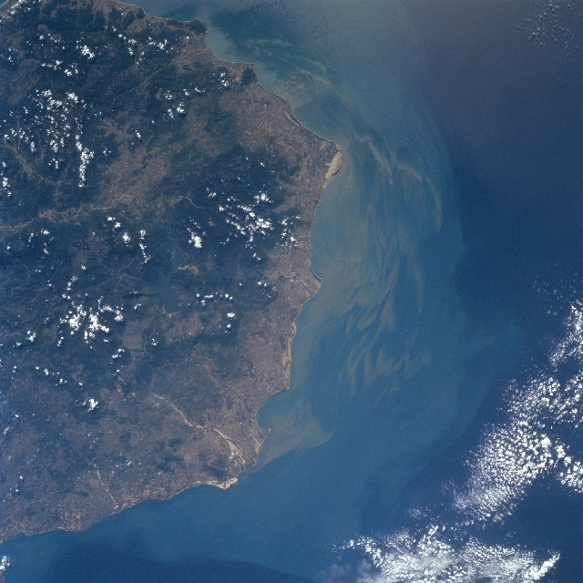
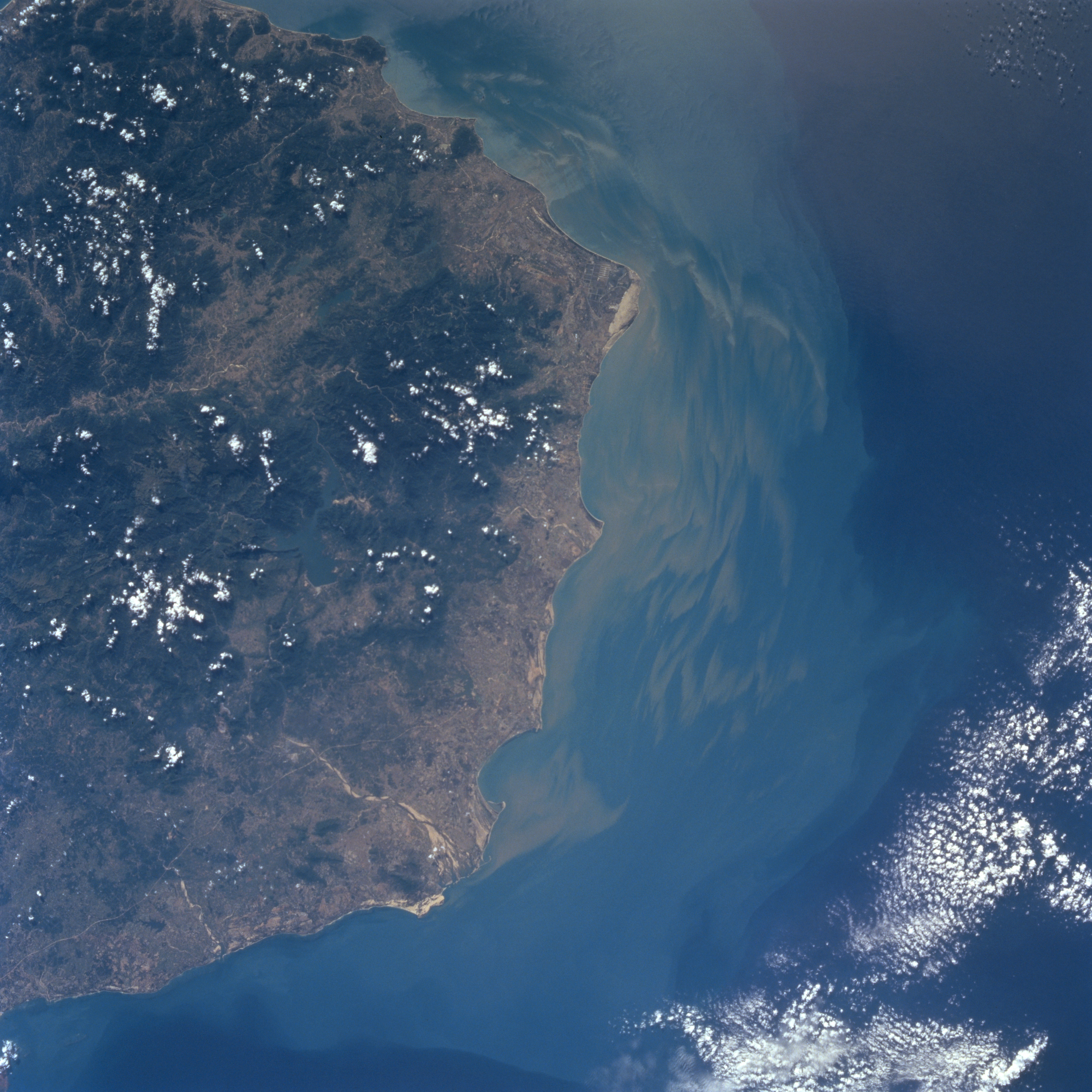
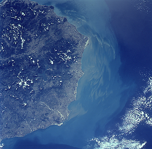
Image Caption: STS087-701-053 Hainan Island, China November 1997
The southwest coast of Hainan Island, China's second largest island has a variety of landforms. Scattered clouds cover many of the higher mountainous features. Maximum elevations in the densely vegetated (dark terrain) mountains range from 2000 feet (610 m) to over 4000 feet (1220 m) above sea level. Numerous short flowing rivers including the Changhua River (light-colored, linear feature near bottom center) drain into the Gulf of Tonkin. Based on the sediment (plume) pattern and distribution along the coast, current flow is towards the south, southeast. The lighter-colored land areas show where a variety of agricultural activities are taking place on the coastal plains and in some of the river valleys.
The southwest coast of Hainan Island, China's second largest island has a variety of landforms. Scattered clouds cover many of the higher mountainous features. Maximum elevations in the densely vegetated (dark terrain) mountains range from 2000 feet (610 m) to over 4000 feet (1220 m) above sea level. Numerous short flowing rivers including the Changhua River (light-colored, linear feature near bottom center) drain into the Gulf of Tonkin. Based on the sediment (plume) pattern and distribution along the coast, current flow is towards the south, southeast. The lighter-colored land areas show where a variety of agricultural activities are taking place on the coastal plains and in some of the river valleys.
