STS085-750-4
| NASA Photo ID | STS085-750-4 |
| Focal Length | 250mm |
| Date taken | 1997.08.__ |
| Time taken | GMT |
Resolutions offered for this image:
4031 x 4091 pixels 630 x 640 pixels 502 x 493 pixels 479 x 479 pixels
4031 x 4091 pixels 630 x 640 pixels 502 x 493 pixels 479 x 479 pixels


Cloud masks available for this image:
Spacecraft nadir point:
Photo center point: 50.0° N, 97.0° W
Photo center point by machine learning:
Photo center point: 50.0° N, 97.0° W
Photo center point by machine learning:
Nadir to Photo Center:
Spacecraft Altitude: nautical miles (0km)
Country or Geographic Name: | CANADA-M |
Features: | WINNIPEG |
| Features Found Using Machine Learning: | |
Cloud Cover Percentage: | 5 (1-10)% |
Sun Elevation Angle: | ° |
Sun Azimuth: | ° |
Camera: | Hasselblad |
Focal Length: | 250mm |
Camera Tilt: | Low Oblique |
Format: | 5069: Kodak Elite 100S, E6 Reversal, Replaces Lumiere, Warmer in tone vs. Lumiere |
Film Exposure: | Normal |
| Additional Information | |
| Width | Height | Annotated | Cropped | Purpose | Links |
|---|---|---|---|---|---|
| 4031 pixels | 4091 pixels | No | No | Earth From Space collection | Download Image |
| 630 pixels | 640 pixels | No | No | Earth From Space collection | Download Image |
| 502 pixels | 493 pixels | No | No | Download Image | |
| 479 pixels | 479 pixels | Download Image |
Download Packaged File
Download a Google Earth KML for this Image
View photo footprint information
Download a GeoTIFF for this photo
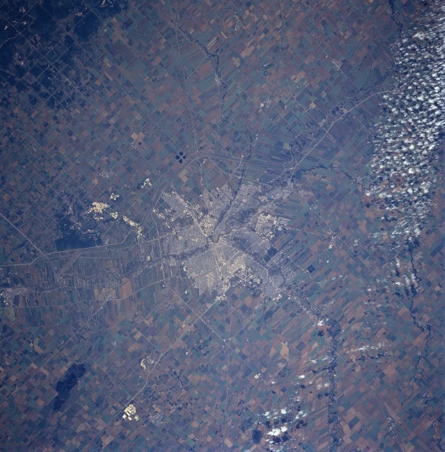
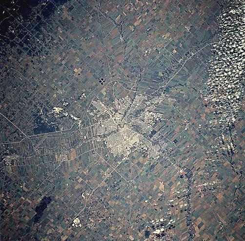
Image Caption: STS085-750-004 Winnipeg, Manitoba, Canada August 1997 Winnipeg, the capitol of Manitoba with a population of over 600,000, stands out in dramatic fashion in comparison with the extensive agriculture in the surrounding rural landscape. Some street patterns are discernible within the city and several highways, such as the Perimeter Highway 101 are visible. Part of the Trans-Canada Highway #1 is also visible, as it extends generally east-west through downtown Winnipeg. Even the intersecting runways of Winnipeg International Airport in west Winnipeg can be seen. The easterly-flowing Assiniboine River merges with the northward-flowing Red River in downtown Winnipeg. The thin, elongated field patterns at right angles to the Red River show the influence of French ownership patterns carried over from Colonial days. Also see image and comments for STS059-226-012 for this same area. Agriculturally, most of the large fields produce wheat, as this region is part of the large Spring Wheat Belt of North America. A band of scattered clouds are visible along the southern edge of the picture.
