STS085-716-9
| NASA Photo ID | STS085-716-9 |
| Focal Length | 100mm |
| Date taken | 1997.08.11 |
| Time taken | 15:15:59 GMT |
Resolutions offered for this image:
4055 x 4085 pixels 635 x 640 pixels 5700 x 5900 pixels 483 x 500 pixels 504 x 521 pixels 479 x 479 pixels
4055 x 4085 pixels 635 x 640 pixels 5700 x 5900 pixels 483 x 500 pixels 504 x 521 pixels 479 x 479 pixels

Cloud masks available for this image:
Spacecraft nadir point: 46.3° N, 88.7° W
Photo center point: 46.5° N, 87.5° W
Photo center point by machine learning:
Photo center point: 46.5° N, 87.5° W
Photo center point by machine learning:
Nadir to Photo Center: East
Spacecraft Altitude: 156 nautical miles (289km)
Country or Geographic Name: | USA-MICHIGAN |
Features: | MARQUETTE |
| Features Found Using Machine Learning: | |
Cloud Cover Percentage: | 5 (1-10)% |
Sun Elevation Angle: | 44° |
Sun Azimuth: | 118° |
Camera: | Hasselblad |
Focal Length: | 100mm |
Camera Tilt: | 25 degrees |
Format: | 5069: Kodak Elite 100S, E6 Reversal, Replaces Lumiere, Warmer in tone vs. Lumiere |
Film Exposure: | Normal |
| Additional Information | |
| Width | Height | Annotated | Cropped | Purpose | Links |
|---|---|---|---|---|---|
| 4055 pixels | 4085 pixels | No | No | Earth From Space collection | Download Image |
| 635 pixels | 640 pixels | No | No | Earth From Space collection | Download Image |
| 5700 pixels | 5900 pixels | No | No | Download Image | |
| 483 pixels | 500 pixels | No | No | Download Image | |
| 504 pixels | 521 pixels | No | No | Download Image | |
| 479 pixels | 479 pixels | Download Image |
Download Packaged File
Download a Google Earth KML for this Image
View photo footprint information
Download a GeoTIFF for this photo
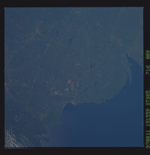
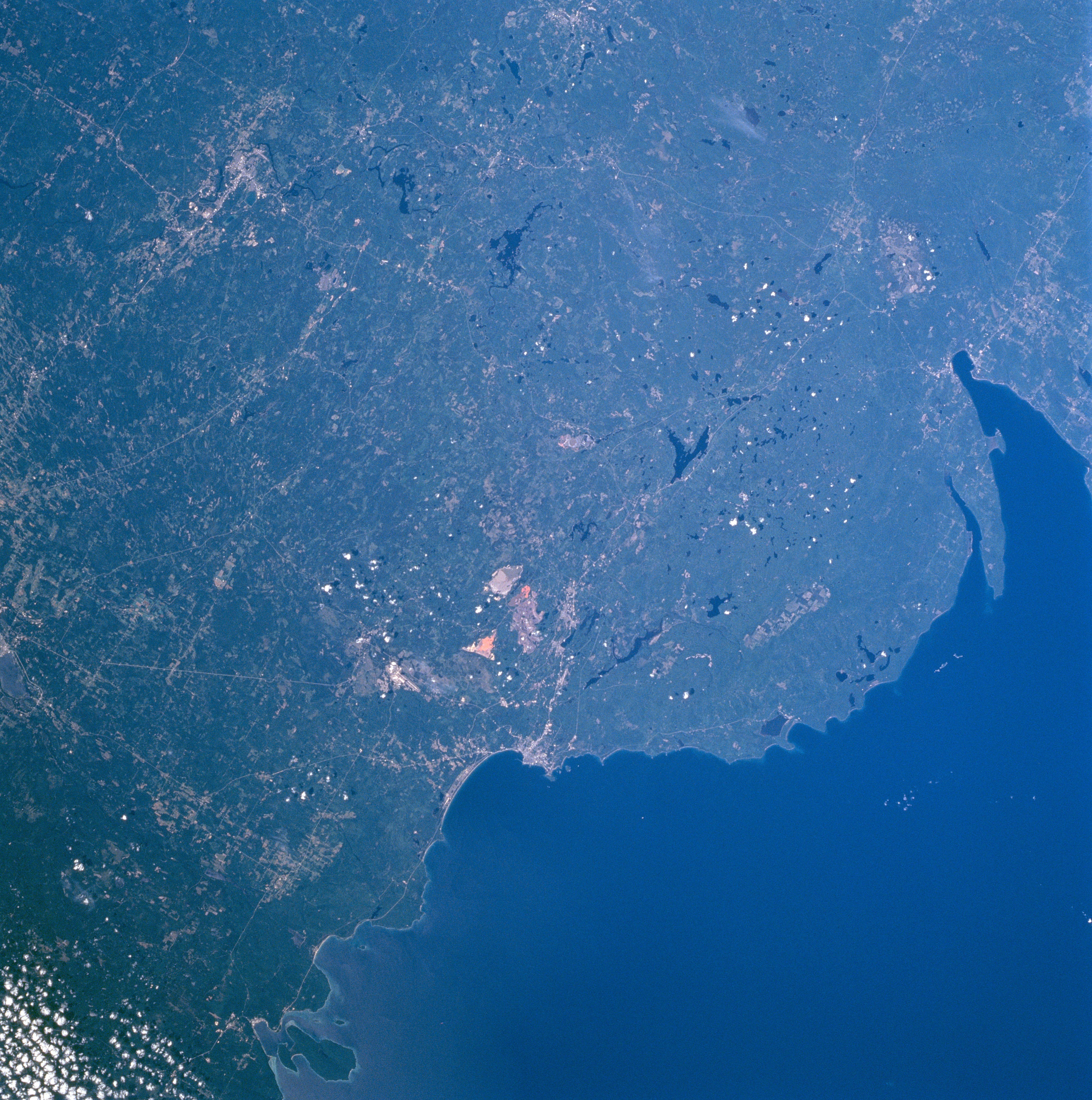
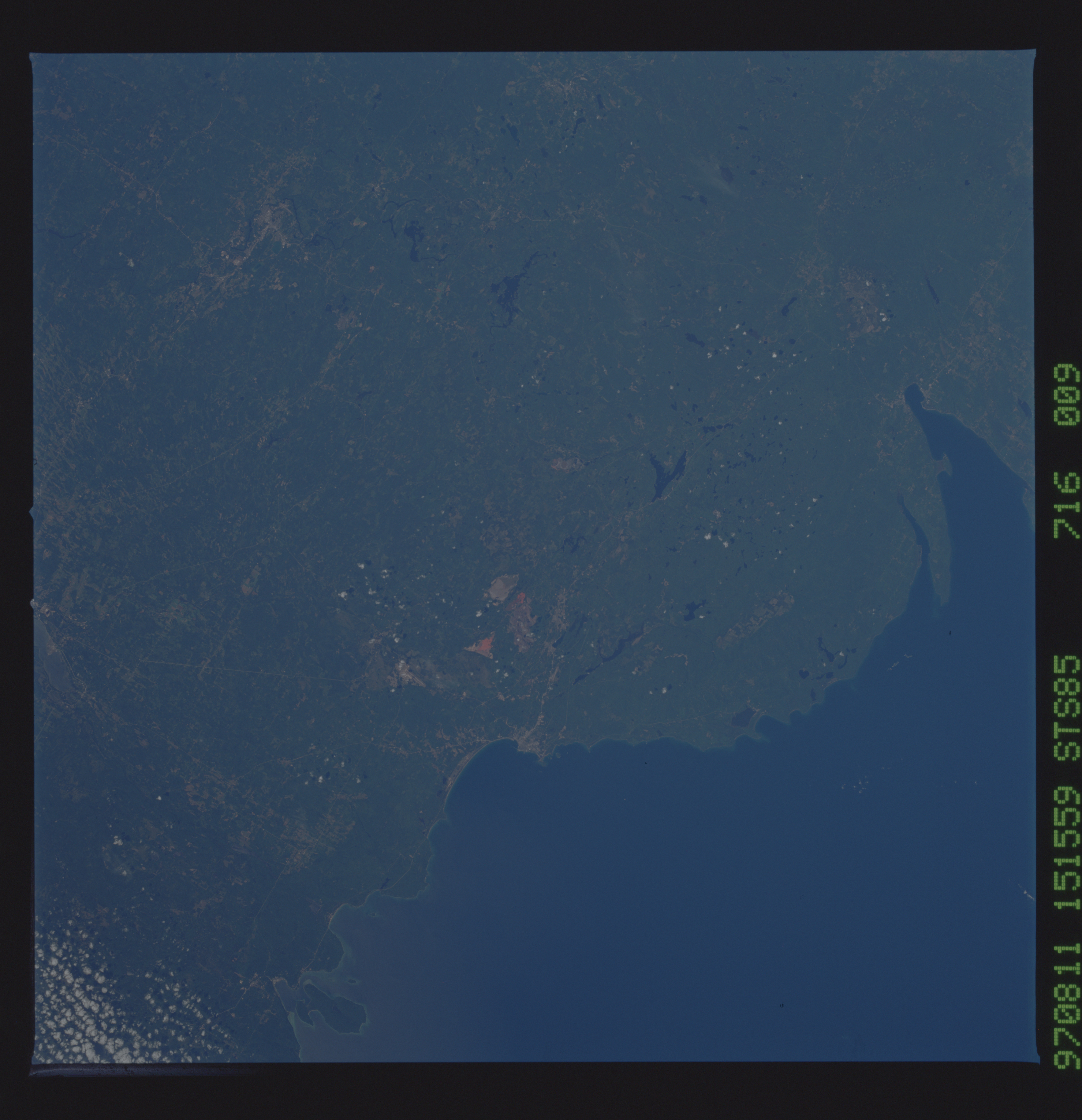
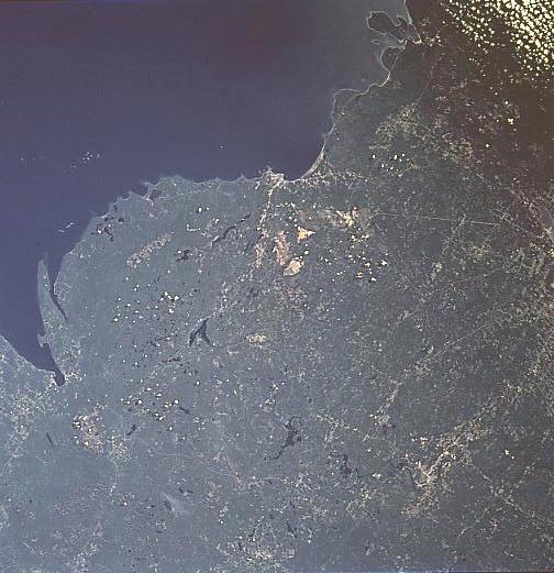
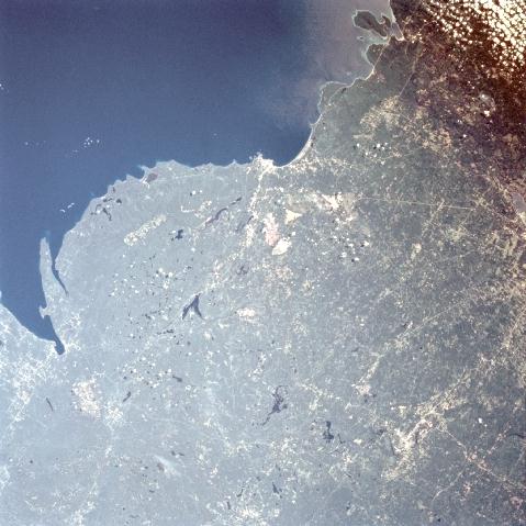
Image Caption: STS085-716-009 Huron Mountains, Marquette, Michigan August, 1997
The forested Huron Mountains lie between Keeweenaw Bay and Marquette, Michigan in this southwest-looking low-oblique view. Extensive mining of iron ore and marble plus lumbering are major industries in this region. With the dense forests of pine and deciduous trees, the region is also a recreational area year around. Lake Superior, one of the largest lakes in the world covers the upper left portion of the image. Near the center of the image, open-pit mines and quarries can be seen. Northeast of the quarries along the shore of Lake Superior is the city of Marquette, the largest city in the Upper Peninsula. The city has docks and facilities to transport iron ore by ship to steel mills in Indiana, Ohio, and Pennsylvania. Marquette is also the home of the United States Olympic Education Center at Northern Michigan University where athletes train for the Winter Olympic Games. Near the upper right of the image is Grand Island, a National Recreation Area.
The forested Huron Mountains lie between Keeweenaw Bay and Marquette, Michigan in this southwest-looking low-oblique view. Extensive mining of iron ore and marble plus lumbering are major industries in this region. With the dense forests of pine and deciduous trees, the region is also a recreational area year around. Lake Superior, one of the largest lakes in the world covers the upper left portion of the image. Near the center of the image, open-pit mines and quarries can be seen. Northeast of the quarries along the shore of Lake Superior is the city of Marquette, the largest city in the Upper Peninsula. The city has docks and facilities to transport iron ore by ship to steel mills in Indiana, Ohio, and Pennsylvania. Marquette is also the home of the United States Olympic Education Center at Northern Michigan University where athletes train for the Winter Olympic Games. Near the upper right of the image is Grand Island, a National Recreation Area.
