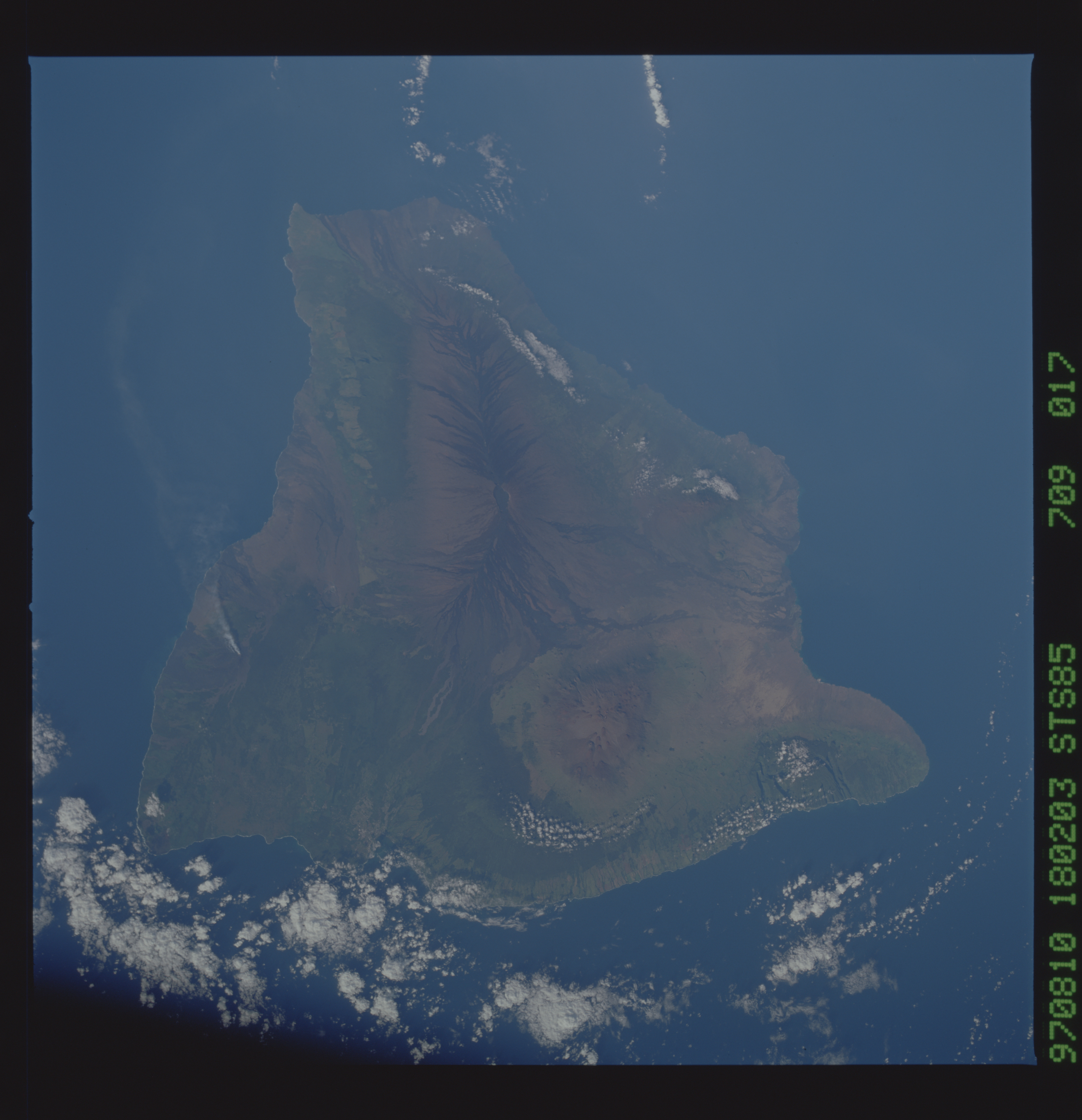
STS085-709-17

| NASA Photo ID | STS085-709-17 |
| Focal Length | 100mm |
| Date taken | 1997.08.10 |
| Time taken | 18:02:03 GMT |
Resolutions offered for this image:
4007 x 4096 pixels 640 x 654 pixels 5700 x 5900 pixels 483 x 500 pixels 512 x 514 pixels 479 x 480 pixels
4007 x 4096 pixels 640 x 654 pixels 5700 x 5900 pixels 483 x 500 pixels 512 x 514 pixels 479 x 480 pixels
Cloud masks available for this image:
Spacecraft nadir point: 19.5° N, 154.5° W
Photo center point: 19.5° N, 155.5° W
Photo center point by machine learning:
Photo center point: 19.5° N, 155.5° W
Photo center point by machine learning:
Nadir to Photo Center: West
Spacecraft Altitude: 157 nautical miles (291km)
Country or Geographic Name: | USA-HAWAII |
Features: | HAWAII |
| Features Found Using Machine Learning: | |
Cloud Cover Percentage: | 15 (11-25)% |
Sun Elevation Angle: | 28° |
Sun Azimuth: | 82° |
Camera: | Hasselblad |
Focal Length: | 100mm |
Camera Tilt: | 21 degrees |
Format: | 5069: Kodak Elite 100S, E6 Reversal, Replaces Lumiere, Warmer in tone vs. Lumiere |
Film Exposure: | Normal |
| Additional Information | |
| Width | Height | Annotated | Cropped | Purpose | Links |
|---|---|---|---|---|---|
| 4007 pixels | 4096 pixels | No | No | Earth From Space collection | Download Image |
| 640 pixels | 654 pixels | No | No | Earth From Space collection | Download Image |
| 5700 pixels | 5900 pixels | No | No | Download Image | |
| 483 pixels | 500 pixels | No | No | Download Image | |
| 512 pixels | 514 pixels | No | No | Download Image | |
| 479 pixels | 480 pixels | Download Image |
Download Packaged File
Download a Google Earth KML for this Image
View photo footprint information
Download a GeoTIFF for this photo
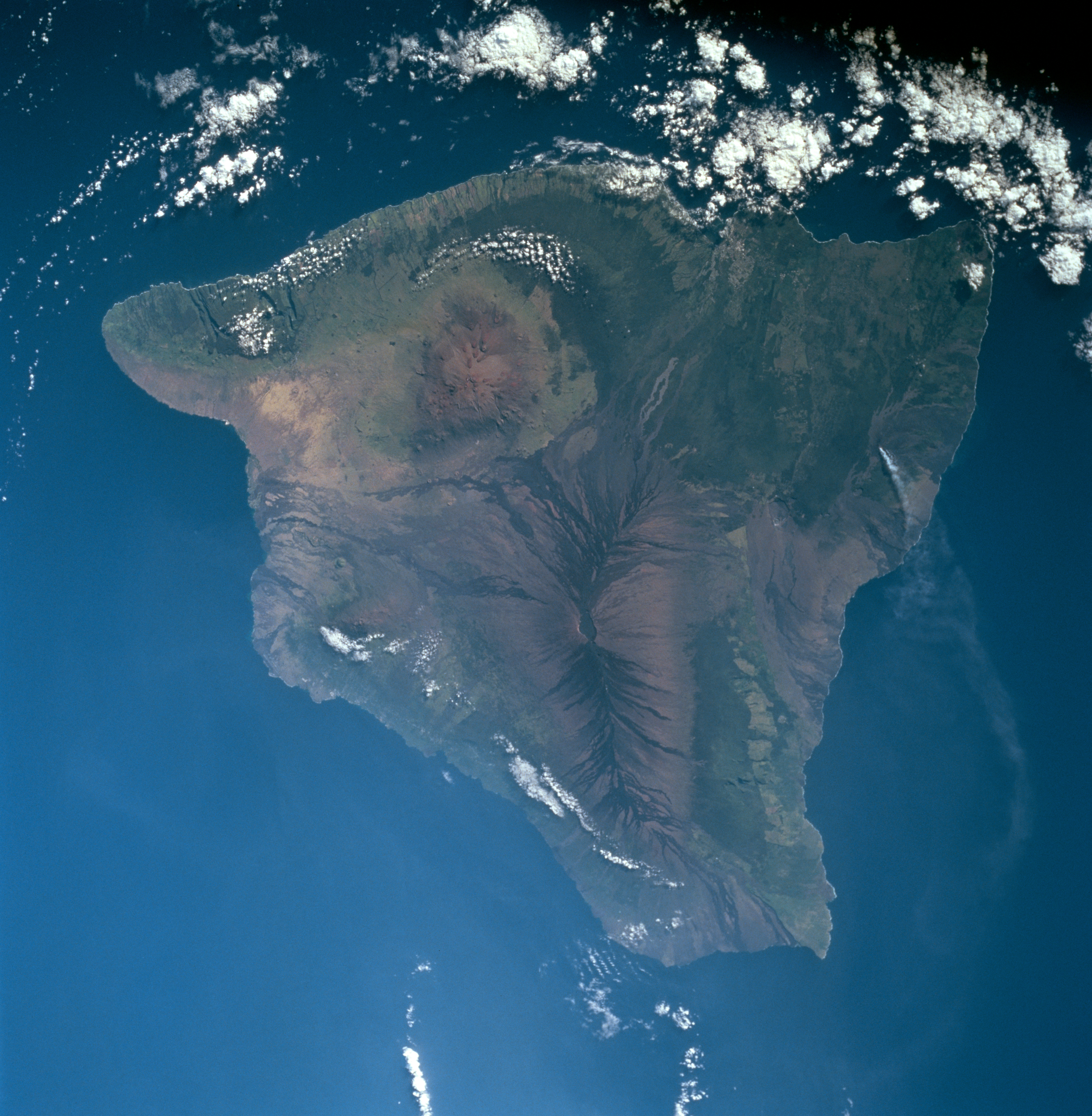
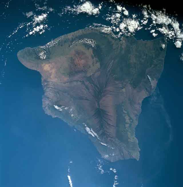
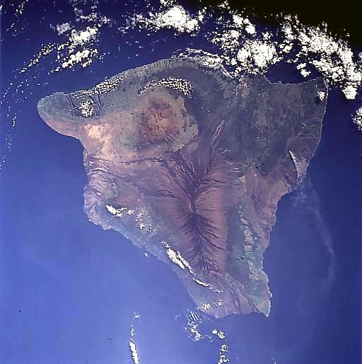
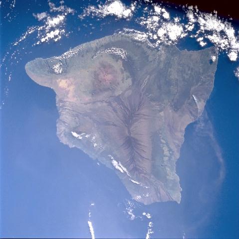
Image Caption: STS085-709-017 The Island of Hawaii, Hawaiian Island Chain August, 1997
Hawaii, geologically the youngest of the Hawaiian Islands, can be seen in this near-vertical view. The Big Island is as large as all the other Hawaiian Islands combined. It covers an area the size of the state of Connecticut, spanning 90 miles (144 km) from north to south, and 80 miles (129 km) from east to west. Five large volcanoes coalesce to make the visible part of Hawaii; a sixth lies beneath the sea off the south-southeast coast (Loihi). The southern part of the island is still volcanically active (Mauna Loa and Kilauea), while the northern part of the island is in the waning stages of activity (Mauna Kea, Hualalai, and Kohala). Near the center of the image, Mauna Loa can be seen. Kilauea, southeast of Mauna Loa, is the most active and youngest volcano. Mauna Kea to the north of Mauna Loa is the highest of the Hawaiian volcanoes and from its base to its summit is over 33000 feet (10650 meters) in elevation. To the left (northwest) on the image from Mauna Loa and barely discernible due to some clouds is Hualalai, the third oldest volcano on the Big Island. It is located on the central Kona Coast. Kohala is the big Island's oldest volcano and it forms a large peninsula extending north from Mauna Kea.
Hawaii, geologically the youngest of the Hawaiian Islands, can be seen in this near-vertical view. The Big Island is as large as all the other Hawaiian Islands combined. It covers an area the size of the state of Connecticut, spanning 90 miles (144 km) from north to south, and 80 miles (129 km) from east to west. Five large volcanoes coalesce to make the visible part of Hawaii; a sixth lies beneath the sea off the south-southeast coast (Loihi). The southern part of the island is still volcanically active (Mauna Loa and Kilauea), while the northern part of the island is in the waning stages of activity (Mauna Kea, Hualalai, and Kohala). Near the center of the image, Mauna Loa can be seen. Kilauea, southeast of Mauna Loa, is the most active and youngest volcano. Mauna Kea to the north of Mauna Loa is the highest of the Hawaiian volcanoes and from its base to its summit is over 33000 feet (10650 meters) in elevation. To the left (northwest) on the image from Mauna Loa and barely discernible due to some clouds is Hualalai, the third oldest volcano on the Big Island. It is located on the central Kona Coast. Kohala is the big Island's oldest volcano and it forms a large peninsula extending north from Mauna Kea.
