STS085-707-61
| NASA Photo ID | STS085-707-61 |
| Focal Length | 100mm |
| Date taken | 1997.08.10 |
| Time taken | 18:14:09 GMT |
Resolutions offered for this image:
794 x 787 pixels 4096 x 4096 pixels 640 x 640 pixels 5700 x 5900 pixels 483 x 500 pixels 504 x 514 pixels 480 x 480 pixels
794 x 787 pixels 4096 x 4096 pixels 640 x 640 pixels 5700 x 5900 pixels 483 x 500 pixels 504 x 514 pixels 480 x 480 pixels


Cloud masks available for this image:
Spacecraft nadir point: 52.8° N, 112.5° W
Photo center point: 51.0° N, 114.0° W
Photo center point by machine learning:
Photo center point: 51.0° N, 114.0° W
Photo center point by machine learning:
Nadir to Photo Center: Southwest
Spacecraft Altitude: 157 nautical miles (291km)
Country or Geographic Name: | CANADA-A |
Features: | CALGARY |
| Features Found Using Machine Learning: | |
Cloud Cover Percentage: | 0 (no clouds present) |
Sun Elevation Angle: | 49° |
Sun Azimuth: | 149° |
Camera: | Hasselblad |
Focal Length: | 100mm |
Camera Tilt: | 42 degrees |
Format: | 5069: Kodak Elite 100S, E6 Reversal, Replaces Lumiere, Warmer in tone vs. Lumiere |
Film Exposure: | Normal |
| Additional Information | |
| Width | Height | Annotated | Cropped | Purpose | Links |
|---|---|---|---|---|---|
| 794 pixels | 787 pixels | No | No | Cities collection | Download Image |
| 4096 pixels | 4096 pixels | No | No | Earth From Space collection | Download Image |
| 640 pixels | 640 pixels | No | No | Earth From Space collection | Download Image |
| 5700 pixels | 5900 pixels | No | No | Download Image | |
| 483 pixels | 500 pixels | No | No | Download Image | |
| 504 pixels | 514 pixels | No | No | Download Image | |
| 480 pixels | 480 pixels | Download Image |
Download Packaged File
Download a Google Earth KML for this Image
View photo footprint information
Download a GeoTIFF for this photo
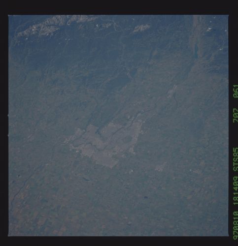
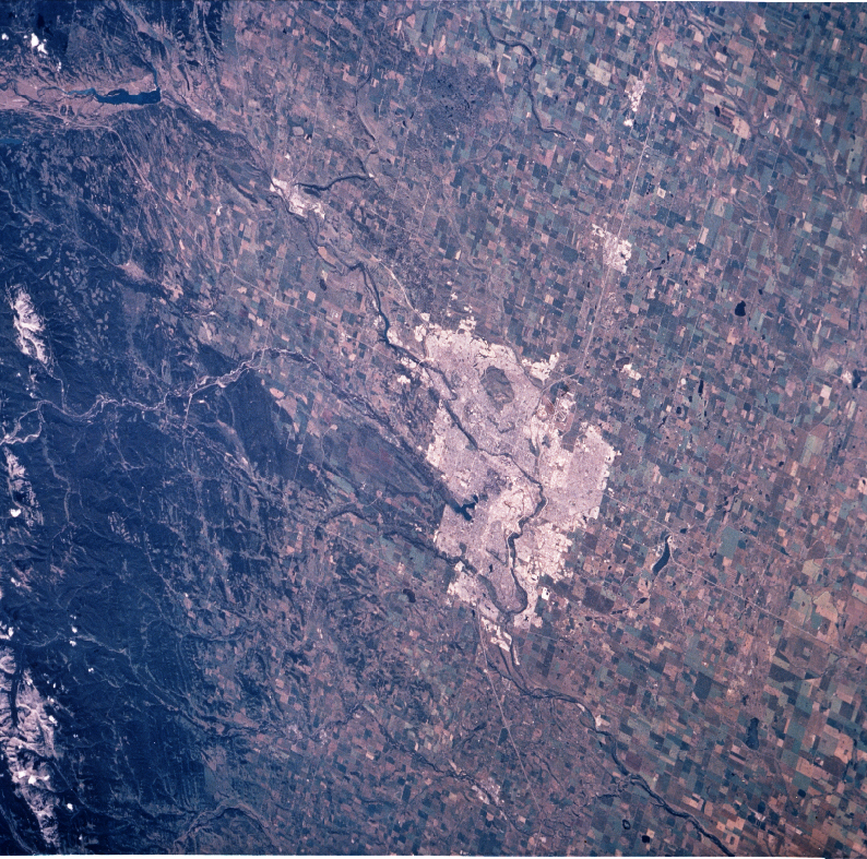
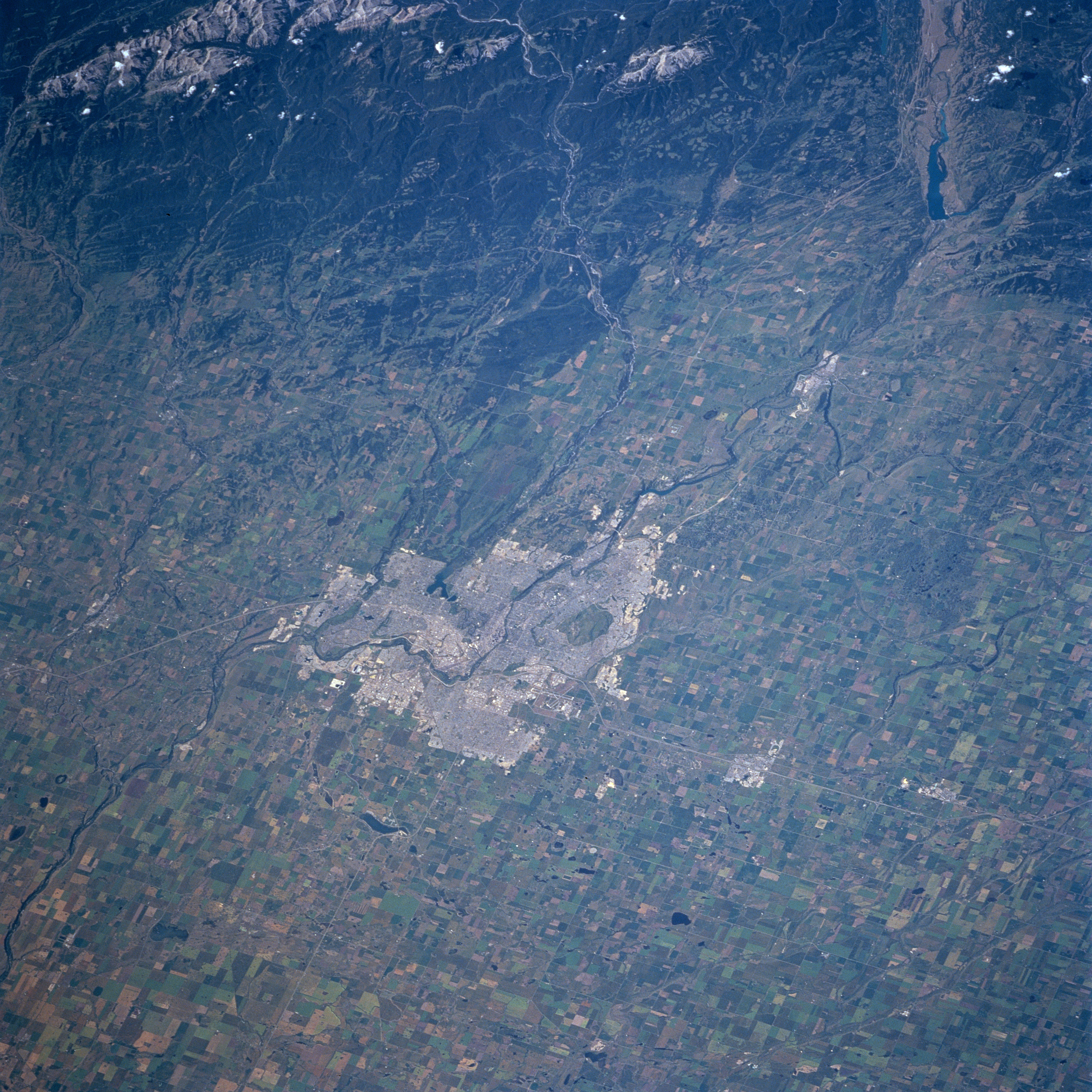
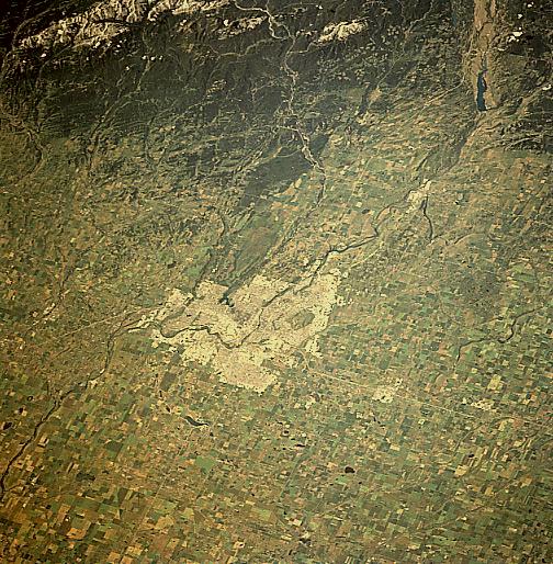
Image Caption: STS085-707-061 Calgary, Alberta, Canada August 1997
This westerly looking view of Calgary and its environs provides a unique opportunity to look at the details of the urban region and the physical setting of this dynamic Canadian city. The large gray, rectangular region in the middle of the image is the city of Calgary. It is expanding northward, evidenced by the commuter city of Airdrie (the light area north of Calgary along Highway 2). Within the city is a darker, oval-shaped park, Nose Hill. West of Calgary, two rivers (the Bow and the Elbow Rivers) that have their headwaters in the Canadian Rocky Mountains flow generally eastward and then merge in south Calgary to become just the Bow River. The dark areas of the Rocky Mountains show forested slopes. The patchwork of lighter-colored sites in the forest between the two rivers shows sizable areas of forest clear cuts. The hilly landscape west of Calgary is used primarily as prairie ranch lands, while the extensive agricultural lands east of the city are used for growing wheat and other cereal grains.
This westerly looking view of Calgary and its environs provides a unique opportunity to look at the details of the urban region and the physical setting of this dynamic Canadian city. The large gray, rectangular region in the middle of the image is the city of Calgary. It is expanding northward, evidenced by the commuter city of Airdrie (the light area north of Calgary along Highway 2). Within the city is a darker, oval-shaped park, Nose Hill. West of Calgary, two rivers (the Bow and the Elbow Rivers) that have their headwaters in the Canadian Rocky Mountains flow generally eastward and then merge in south Calgary to become just the Bow River. The dark areas of the Rocky Mountains show forested slopes. The patchwork of lighter-colored sites in the forest between the two rivers shows sizable areas of forest clear cuts. The hilly landscape west of Calgary is used primarily as prairie ranch lands, while the extensive agricultural lands east of the city are used for growing wheat and other cereal grains.
