STS085-707-58

| NASA Photo ID | STS085-707-58 |
| Focal Length | 100mm |
| Date taken | 1997.08.10 |
| Time taken | 18:13:30 GMT |
Resolutions offered for this image:
4061 x 4085 pixels 636 x 640 pixels 5700 x 5900 pixels 483 x 500 pixels 503 x 511 pixels 479 x 479 pixels
4061 x 4085 pixels 636 x 640 pixels 5700 x 5900 pixels 483 x 500 pixels 503 x 511 pixels 479 x 479 pixels


Cloud masks available for this image:
Spacecraft nadir point: 51.6° N, 116.1° W
Photo center point: 49.5° N, 119.5° W
Photo center point by machine learning:
Photo center point: 49.5° N, 119.5° W
Photo center point by machine learning:
Nadir to Photo Center: Southwest
Spacecraft Altitude: 157 nautical miles (291km)
Country or Geographic Name: | CANADA-BC |
Features: | OKANAGAN LAKE |
| Features Found Using Machine Learning: | |
Cloud Cover Percentage: | 5 (1-10)% |
Sun Elevation Angle: | 49° |
Sun Azimuth: | 143° |
Camera: | Hasselblad |
Focal Length: | 100mm |
Camera Tilt: | High Oblique |
Format: | 5069: Kodak Elite 100S, E6 Reversal, Replaces Lumiere, Warmer in tone vs. Lumiere |
Film Exposure: | Normal |
| Additional Information | |
| Width | Height | Annotated | Cropped | Purpose | Links |
|---|---|---|---|---|---|
| 4061 pixels | 4085 pixels | No | No | Earth From Space collection | Download Image |
| 636 pixels | 640 pixels | No | No | Earth From Space collection | Download Image |
| 5700 pixels | 5900 pixels | No | No | Download Image | |
| 483 pixels | 500 pixels | No | No | Download Image | |
| 503 pixels | 511 pixels | No | No | Download Image | |
| 479 pixels | 479 pixels | Download Image |
Download Packaged File
Download a Google Earth KML for this Image
View photo footprint information
Download a GeoTIFF for this photo
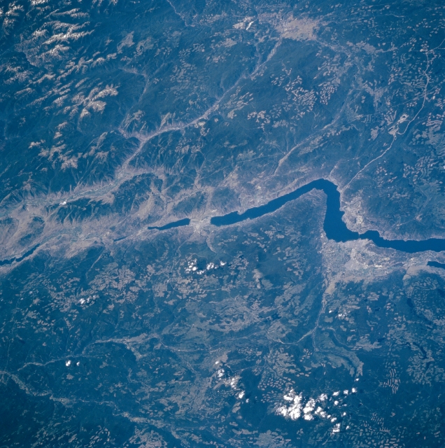
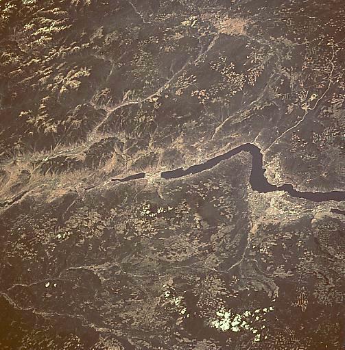
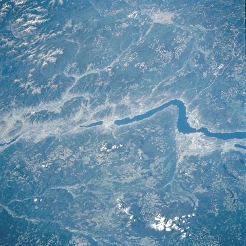
Image Caption: STS085-707-058 Okanagan Lake, British Columbia, Canada August, 1997
The southern portion of Okanagan Lake can be seen in this west-looking view. Located in a prosperous fruit-growing region of Southern British Columbia, Okanagan Lake is 69 miles (111 km) long and from 2 to 4 miles (3 to 6 km) wide. The lake is fed by and its outlet is the Okanagan River, which flows southward and joins the Columbia River in the state of Washington. The lake is a popular all-season resort region for fishing and camping in the summer and skiing and cross-country skiing during the winter.
The southern portion of Okanagan Lake can be seen in this west-looking view. Located in a prosperous fruit-growing region of Southern British Columbia, Okanagan Lake is 69 miles (111 km) long and from 2 to 4 miles (3 to 6 km) wide. The lake is fed by and its outlet is the Okanagan River, which flows southward and joins the Columbia River in the state of Washington. The lake is a popular all-season resort region for fishing and camping in the summer and skiing and cross-country skiing during the winter.
