STS085-501-114
| NASA Photo ID | STS085-501-114 |
| Focal Length | 250mm |
| Date taken | 1997.08.__ |
| Time taken | GMT |
Resolutions offered for this image:
5231 x 4085 pixels 639 x 499 pixels 1098 x 890 pixels 1098 x 890 pixels 480 x 380 pixels
5231 x 4085 pixels 639 x 499 pixels 1098 x 890 pixels 1098 x 890 pixels 480 x 380 pixels

Cloud masks available for this image:
Spacecraft nadir point:
Photo center point: 34.5° N, 117.5° W
Photo center point by machine learning:
Photo center point: 34.5° N, 117.5° W
Photo center point by machine learning:
Nadir to Photo Center:
Spacecraft Altitude: nautical miles (0km)
Country or Geographic Name: | USA-CALIFORNIA |
Features: | EDWARDS AFB, MOUNTAINS |
| Features Found Using Machine Learning: | |
Cloud Cover Percentage: | 0 (no clouds present) |
Sun Elevation Angle: | ° |
Sun Azimuth: | ° |
Camera: | Linhof |
Focal Length: | 250mm |
Camera Tilt: | Low Oblique |
Format: | 5046: Kodak, natural color positive, Lumiere 100/5046, ASA 100, standard base |
Film Exposure: | Normal |
| Additional Information | |
| Width | Height | Annotated | Cropped | Purpose | Links |
|---|---|---|---|---|---|
| 5231 pixels | 4085 pixels | No | No | Earth From Space collection | Download Image |
| 639 pixels | 499 pixels | No | No | Earth From Space collection | Download Image |
| 1098 pixels | 890 pixels | No | No | Earth From Space phase 2 | Download Image |
| 1098 pixels | 890 pixels | No | No | Download Image | |
| 480 pixels | 380 pixels | Download Image |
Download Packaged File
Download a Google Earth KML for this Image
View photo footprint information
Download a GeoTIFF for this photo
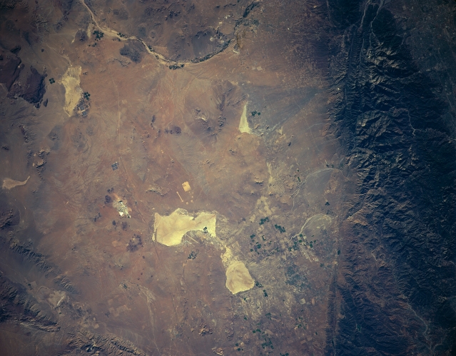
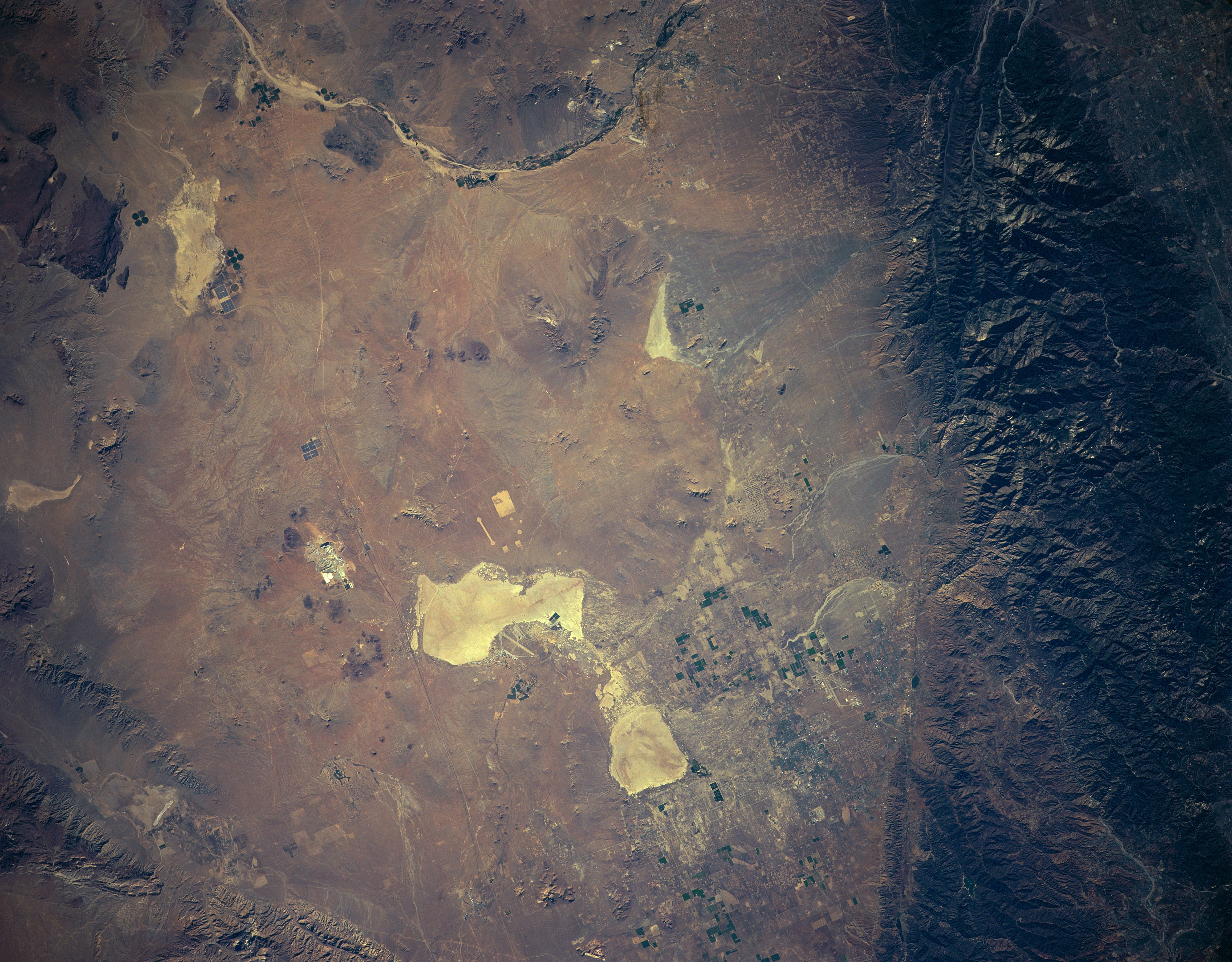
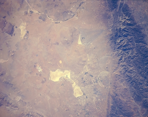
Image Caption: STS085-501-114 Mojave Desert, California, USA August 1997
Rogers Dry Lake and Rosamond Dry Lake (extensive, light colored feature) are located toward the center of the Mojave Desert near the western apex of the desert. Both dry lakes are part of Edwards Air Force Base that includes an alternate landing site for NASA's Space Shuttle. The Mojave River is the dark and light, gently curving linear feature at the top of the image. The dark-looking feature along the southwest side of the picture is part of the northeast flank of the San Gabriel Mountains. A section of the San Andreas fault (linear structure) can also be detected. A very small section of the Garlock fault (not as obvious as the San Andreas fault) can be traced across the landscape along the northwest side of the valley. This frame of photography overlaps with STS085-501-116.
Rogers Dry Lake and Rosamond Dry Lake (extensive, light colored feature) are located toward the center of the Mojave Desert near the western apex of the desert. Both dry lakes are part of Edwards Air Force Base that includes an alternate landing site for NASA's Space Shuttle. The Mojave River is the dark and light, gently curving linear feature at the top of the image. The dark-looking feature along the southwest side of the picture is part of the northeast flank of the San Gabriel Mountains. A section of the San Andreas fault (linear structure) can also be detected. A very small section of the Garlock fault (not as obvious as the San Andreas fault) can be traced across the landscape along the northwest side of the valley. This frame of photography overlaps with STS085-501-116.
