STS084-714-4
| NASA Photo ID | STS084-714-4 |
| Focal Length | 100mm |
| Date taken | 1997.05.23 |
| Time taken | 06:27:20 GMT |
Resolutions offered for this image:
4025 x 4025 pixels 639 x 639 pixels 5700 x 5900 pixels 483 x 500 pixels
4025 x 4025 pixels 639 x 639 pixels 5700 x 5900 pixels 483 x 500 pixels
Cloud masks available for this image:
Spacecraft nadir point: 41.3° N, 9.6° E
Photo center point: 43.0° N, 9.0° E
Photo center point by machine learning:
Photo center point: 43.0° N, 9.0° E
Photo center point by machine learning:
Nadir to Photo Center: North
Spacecraft Altitude: 202 nautical miles (374km)
Country or Geographic Name: | FRANCE |
Features: | CORSICA |
| Features Found Using Machine Learning: | |
Cloud Cover Percentage: | 5 (1-10)% |
Sun Elevation Angle: | 26° |
Sun Azimuth: | 85° |
Camera: | Hasselblad |
Focal Length: | 100mm |
Camera Tilt: | 28 degrees |
Format: | 5069: Kodak Elite 100S, E6 Reversal, Replaces Lumiere, Warmer in tone vs. Lumiere |
Film Exposure: | Normal |
| Additional Information | |
| Width | Height | Annotated | Cropped | Purpose | Links |
|---|---|---|---|---|---|
| 4025 pixels | 4025 pixels | No | No | Earth From Space collection | Download Image |
| 639 pixels | 639 pixels | No | No | Earth From Space collection | Download Image |
| 5700 pixels | 5900 pixels | No | No | Download Image | |
| 483 pixels | 500 pixels | No | No | Download Image |
Download Packaged File
Download a Google Earth KML for this Image
View photo footprint information
Download a GeoTIFF for this photo
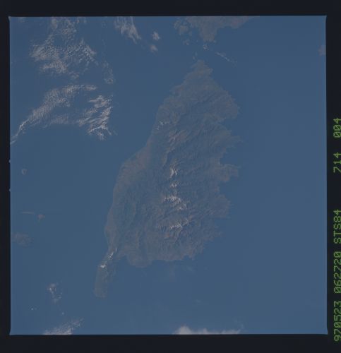
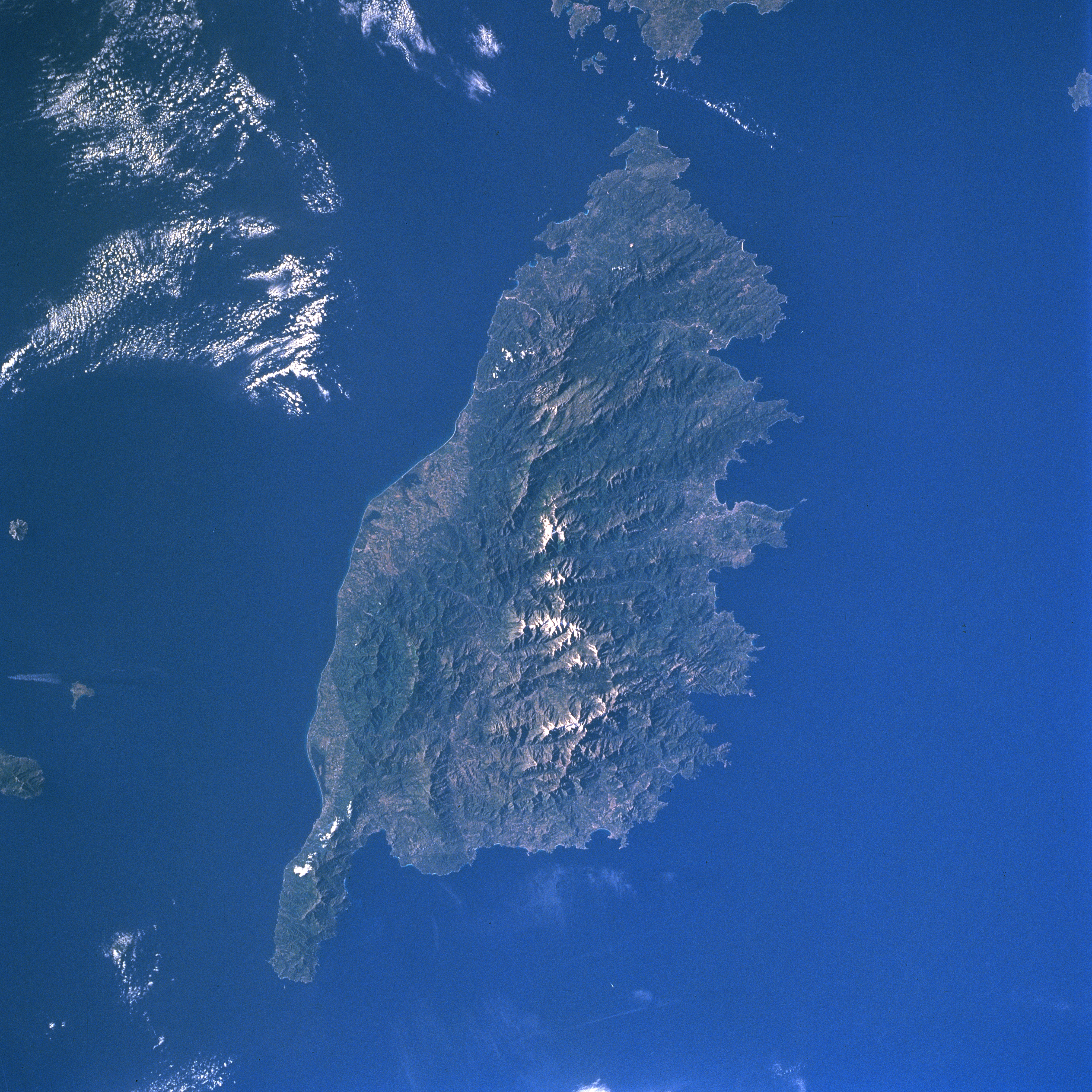
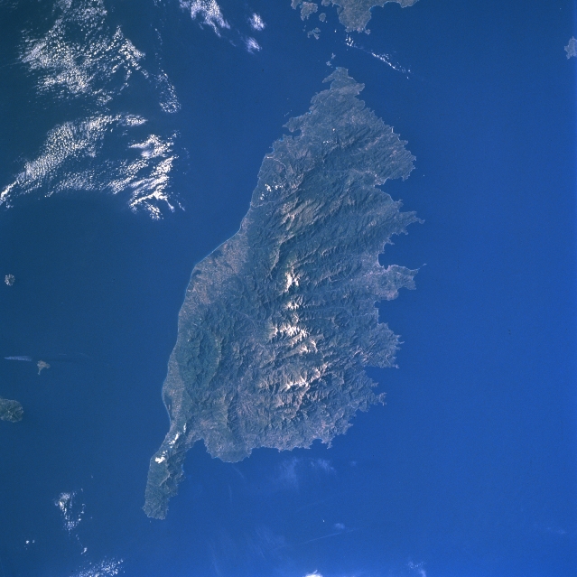
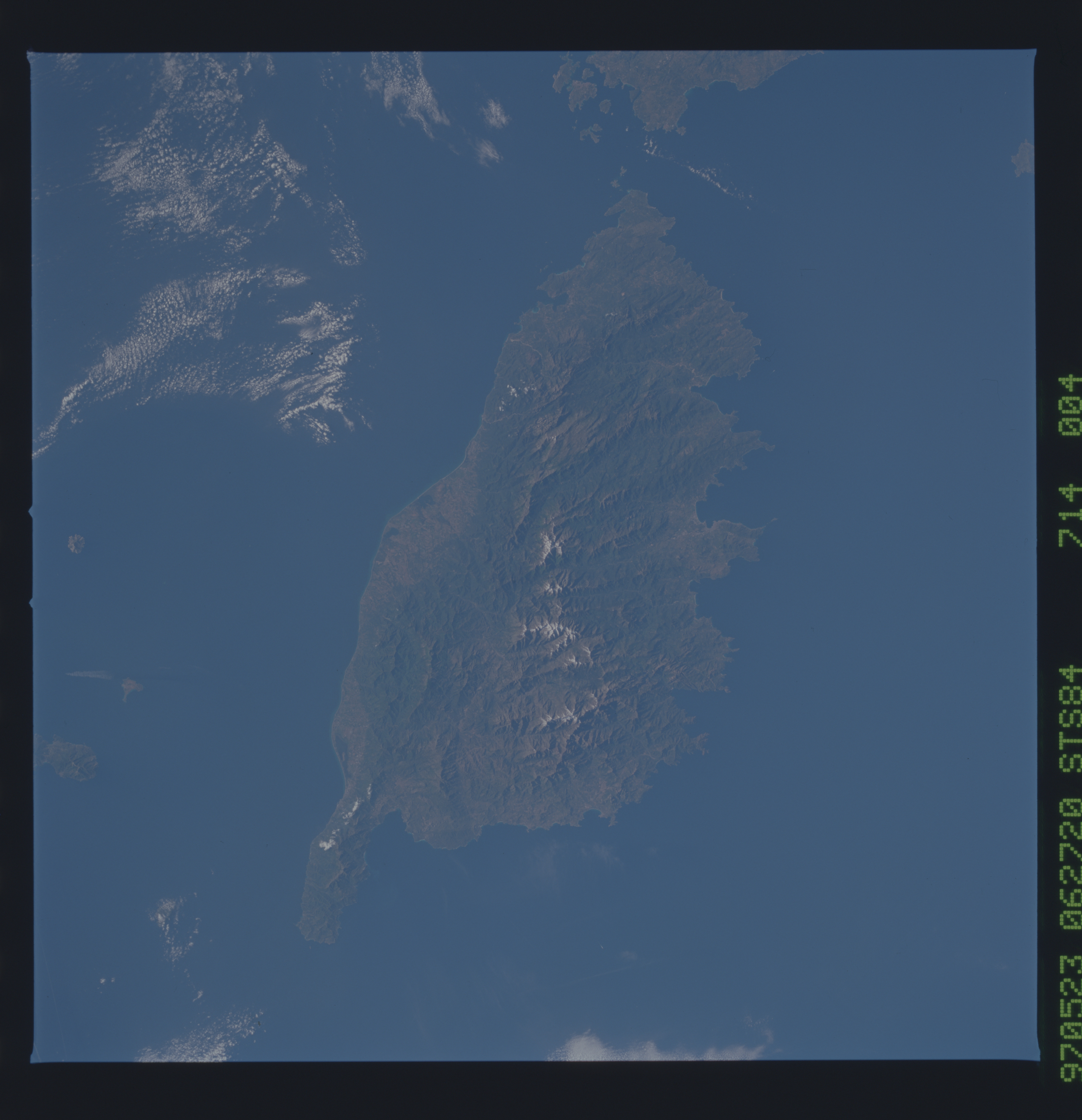
Image Caption: STS084-714-004 Corsica, France May 1997
Corsica, annexed by France in 1768, is a mountainous island with a rocky coastline that is severely indented along the west side of the island. Snow-capped mountain ridges (lighter colored areas), exceeding 7000 feet (2134 meters) in elevation help to identify a north, northwest to south, southeast alignment of the higher elevations that extend almost the entire length (118 miles-190 km) of the island. A narrow coastal plain, including lagoons and swamps, is visible along part of the east coast of the island. Less than 5 percent of the land area is suitable for the commercial cultivation of crops. Tourism has surpassed fishing as the leading economic activity for Corsica. The Strait of Bonifacio separates Corsica from the Italian island of Sardinia to the south (top center).
Corsica, annexed by France in 1768, is a mountainous island with a rocky coastline that is severely indented along the west side of the island. Snow-capped mountain ridges (lighter colored areas), exceeding 7000 feet (2134 meters) in elevation help to identify a north, northwest to south, southeast alignment of the higher elevations that extend almost the entire length (118 miles-190 km) of the island. A narrow coastal plain, including lagoons and swamps, is visible along part of the east coast of the island. Less than 5 percent of the land area is suitable for the commercial cultivation of crops. Tourism has surpassed fishing as the leading economic activity for Corsica. The Strait of Bonifacio separates Corsica from the Italian island of Sardinia to the south (top center).
