STS084-706-14

| NASA Photo ID | STS084-706-14 |
| Focal Length | 250mm |
| Date taken | 1997.05.22 |
| Time taken | 15:05:34 GMT |
Resolutions offered for this image:
4061 x 4061 pixels 639 x 639 pixels 5700 x 5900 pixels 483 x 500 pixels 509 x 514 pixels 478 x 479 pixels
4061 x 4061 pixels 639 x 639 pixels 5700 x 5900 pixels 483 x 500 pixels 509 x 514 pixels 478 x 479 pixels


Cloud masks available for this image:
Spacecraft nadir point: 40.5° N, 114.6° W
Photo center point: 41.0° N, 112.0° W
Photo center point by machine learning:
Photo center point: 41.0° N, 112.0° W
Photo center point by machine learning:
Nadir to Photo Center: East
Spacecraft Altitude: 202 nautical miles (374km)
Country or Geographic Name: | USA-UTAH |
Features: | SOUTHERN GREAT SALT LAKE |
| Features Found Using Machine Learning: | |
Cloud Cover Percentage: | 0 (no clouds present) |
Sun Elevation Angle: | 30° |
Sun Azimuth: | 88° |
Camera: | Hasselblad |
Focal Length: | 250mm |
Camera Tilt: | 38 degrees |
Format: | 5069: Kodak Elite 100S, E6 Reversal, Replaces Lumiere, Warmer in tone vs. Lumiere |
Film Exposure: | Normal |
| Additional Information | |
| Width | Height | Annotated | Cropped | Purpose | Links |
|---|---|---|---|---|---|
| 4061 pixels | 4061 pixels | No | No | Earth From Space collection | Download Image |
| 639 pixels | 639 pixels | No | No | Earth From Space collection | Download Image |
| 5700 pixels | 5900 pixels | No | No | Download Image | |
| 483 pixels | 500 pixels | No | No | Download Image | |
| 509 pixels | 514 pixels | No | No | Download Image | |
| 478 pixels | 479 pixels | Download Image |
Download Packaged File
Download a Google Earth KML for this Image
View photo footprint information
Download a GeoTIFF for this photo
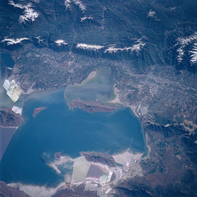
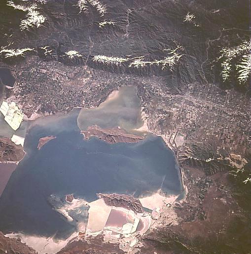
Image Caption: STS084-706-014 Great Salt Lake, Salt Lake City May 1997
The southern half of Great Salt Lake and the cities of Salt Lake and Ogden are visible in this east-looking low-oblique view. Great Salt Lake is the largest natural lake west of the Mississippi River and the largest salt lake in North America with an area of 1000 sq. miles (2590 sq. km). The southern half of the lake is deeper and less salty than the northern half. Near the center of the image is Antelope Island, the largest island within Great Salt Lake. Over 15 miles (24 km) long, the island is a state park, and is home to many forms of wildlife, including a large Buffalo (Bison) herd. The snow-covered peaks of the Wasatch Range, a part of the Rocky Mountains, cover the upper quarter of the image. Salt Lake City, the largest city in Utah, is near the right center of the image. To its north, left center lies the city of Ogden at the base of the Wasatch Mountains. Ogden has many aerospace industries, and is the home of Hill Air Force Base and the Ogden Defense Depot.
The southern half of Great Salt Lake and the cities of Salt Lake and Ogden are visible in this east-looking low-oblique view. Great Salt Lake is the largest natural lake west of the Mississippi River and the largest salt lake in North America with an area of 1000 sq. miles (2590 sq. km). The southern half of the lake is deeper and less salty than the northern half. Near the center of the image is Antelope Island, the largest island within Great Salt Lake. Over 15 miles (24 km) long, the island is a state park, and is home to many forms of wildlife, including a large Buffalo (Bison) herd. The snow-covered peaks of the Wasatch Range, a part of the Rocky Mountains, cover the upper quarter of the image. Salt Lake City, the largest city in Utah, is near the right center of the image. To its north, left center lies the city of Ogden at the base of the Wasatch Mountains. Ogden has many aerospace industries, and is the home of Hill Air Force Base and the Ogden Defense Depot.
